Thanks to the guy at Marathon Sports back home who made the logo! I think it’s going to have to stay here because I cannot for the life of me figure out how the hell to get it next to the title above. Eventually I’d like to have a few things added, like lists (everyone loves lists), hike of the month, and a few more categories, but for now it’s all about learning to hike, climb, and run. Elevation profiles are in the Strava links when provided, and if anyone would like a GPX file of my route, comment and let me know, I usually have one. Comments, blog suggestions, and recommendations for peaks are always welcome! Doesn’t matter whether it’s a hike, run, or climb.
Recent updates: I have started an instagram! have_tent_will_travel (because some bastards took havetent_willtravel and havetentwilltravel). Not much to it right now, but I figure it’ll keep things moving during the dreary winter days where we can all reminisce on that one time it was sunny for a record streak and we were sick of the sun hoping for rain.
Maybe skip the prose and just look at the pics, my writing is rusty and rambly. I have had some other trips this year, like Japan for a week to ski, several backcountry trips in SLC, one in Seattle, but between April and now I was mostly open water swimming with a dash of surfing here and there. But here we are! Summer is over and we are back to landlocked activities.
TL;DR don’t panic, there will be larches every day. For us personas estadounidenses, it’s like the PCT, it’s pretty gradual, you really can’t get lost because everything is very well signed, camp at designated campsites, and you should learn to convert kilometers to miles.
Distance: 33ish miles
Elevation Gain: 6k total? Elevation gain is easier in meters
Weather: Mostly raining but I’ve forgotten about that at this point
Commute from Seattle: 10+hr drive or $$$ flight
Did I Trip: No but I dropped Brad’s hiking poles on the regular because they don’t have straps and apparently I never actually hold my trekking poles
Nearly everything went wrong leading up to this trip. We had permits for four days in September, so that was our only window. Now let’s see:
I had to move back to Seattle for work (don’t get me started) literally that week
Surafel’s now wife got laid off so he bailed
Brad twisted his ankle
I had cold/cough/etc. Miserable.
Flight to Calgary was USD$612 ONE WAY! ONE. WAY. !!!!
Weather called for rain for like 70% of the trip
Westjet had IT issues and couldn’t check anyone in at JFK for over half an hour
Plane was delayed 3hrs on the tarmac. Turns out for international flights you’re allowed 4hrs, with a 45min extension if “there’s a reasonable chance you take off soon,” so we weren’t turned around. But let me tell you I was rooting for them to let us off after 90min in that seat, trip be damned
How Surafel was able to still join us. I don’t know why he decided to wear Ethiopian wedding garb the whole time
But my plane took off, I got to Calgary at 1am, “slept,” and slogged through the worst continental breakfast I’ve ever had (featuring maybe the best breakfast potatoes I’ve ever had?), neglected to consider Banff NP traffic or lines to get into the park, and then illegally parked to finally meet Brad at the hilariously overpriced IGA in Banff where I don’t want to know how much money I spent buying snacks for the four day trip. I forgot that some mountains are touristy, not stop-at-a-gas-station-and-find-a-remote-trailhead-where-your-car-might-be-burgled.
Our itinerary was amusing, booked under duress in January via Facebook Messenger after being let out of the virtual waiting room at 7am Pacific Time to take out shot at getting permits upon opening. I nearly booked the campsites in the wrong order (think A -> C -> B instead of ABC of CBA) but caught my error at the last minute. We couldn’t get the ever popular Floe Lake, so we settled for this:
Most of the trail to Floe Lake
Day 1: 12 miles, Floe Lake trailhead to Numa Creek. 12mi. Partly cloudy in the morning, rain in the evening. Day 2: 4.5mi (hahahahaha) Numa Creek to Tumbling Creek. Rain in the morning, partly cloudy in the afternoon, rain in the evening. Also it did end up being just over 5mi somehow which felt more legit. Day 3: 8.5mi, the money day, Tumbling Creek to Helmet Falls. Rain in the morning, partly cloudy rest of day. Day 4: ~9mi, cry and leave and car shuttle from Paint Pot(s) to Floe Lake and cry more and get on a plane to Seattle forevermore. Weather doesn’t matter.
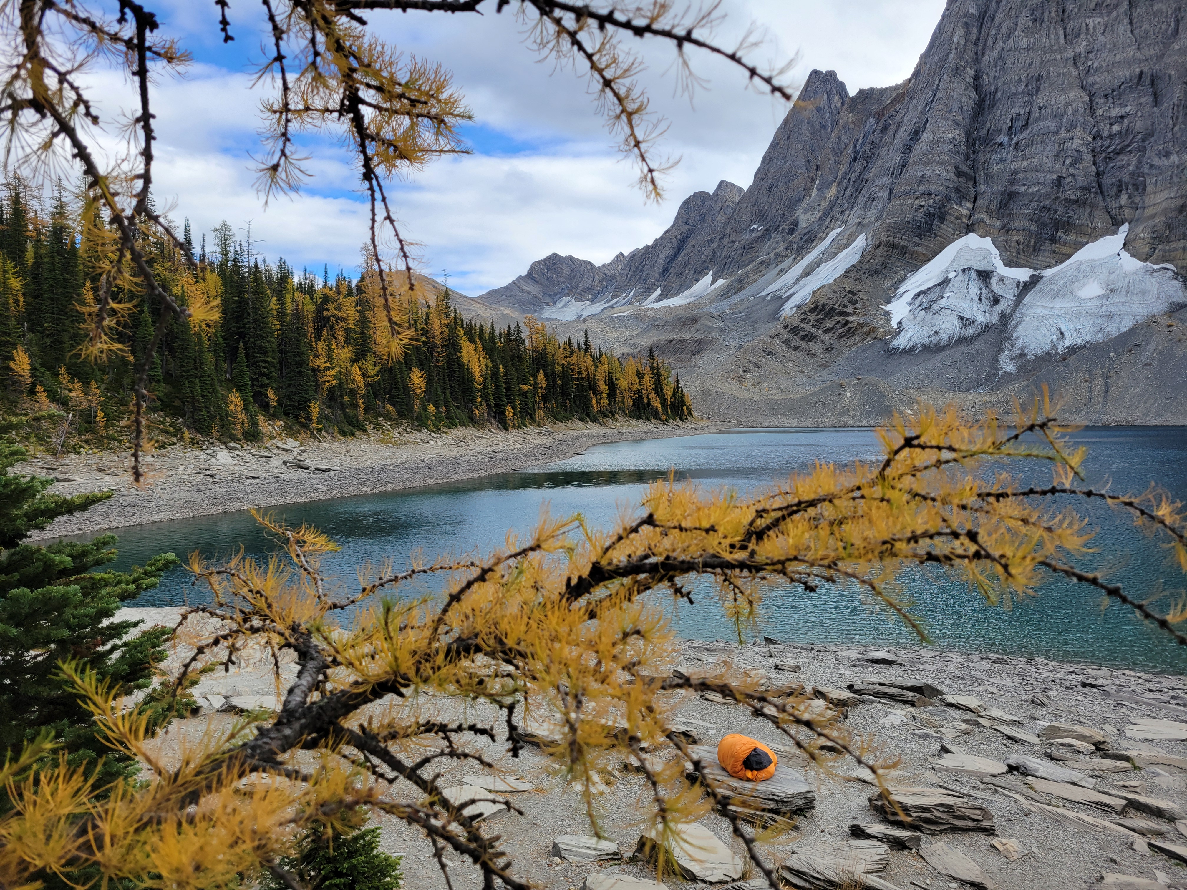
The only way to enjoy the views was to make your sleeping bag burrito portable
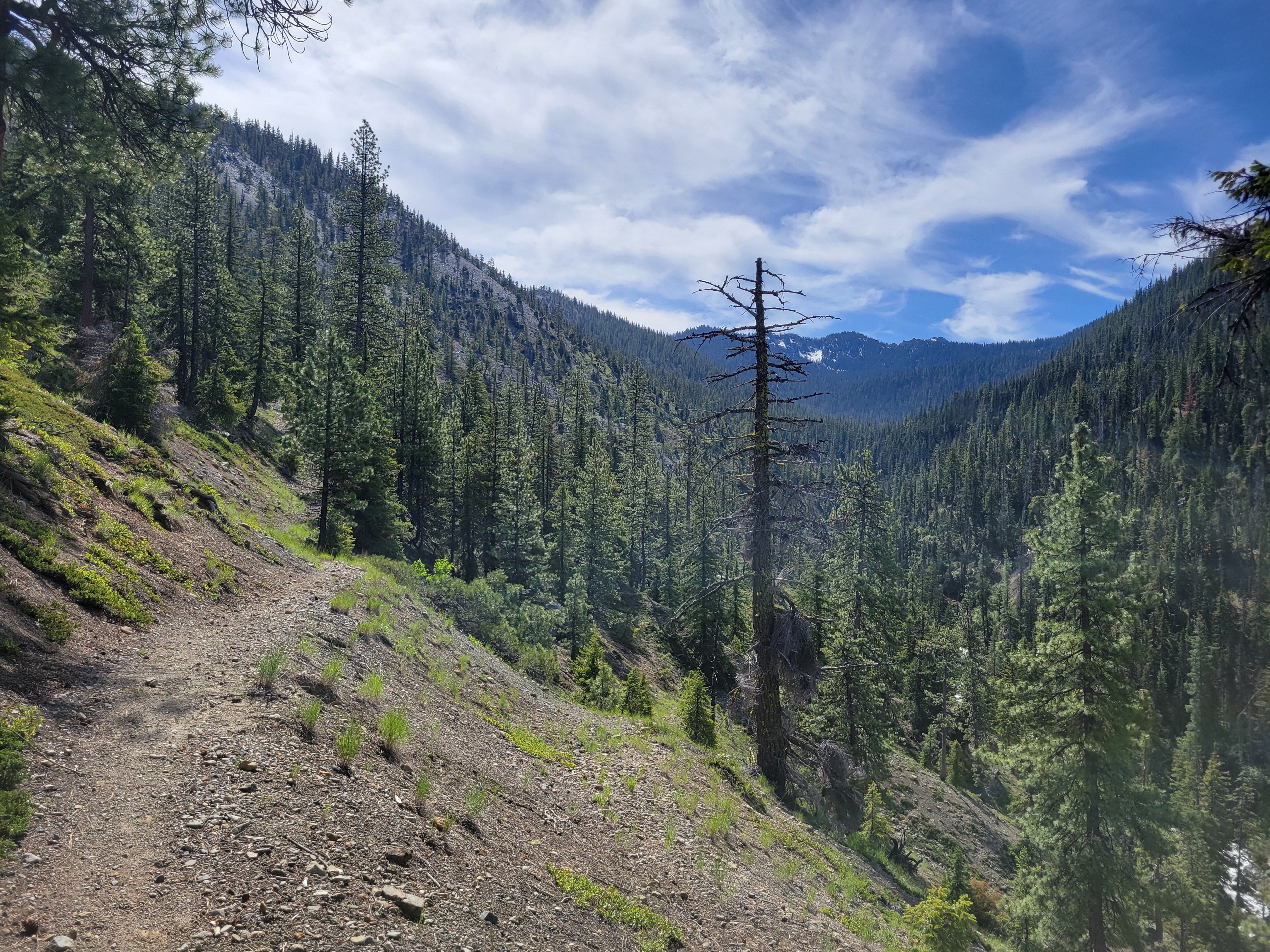
The hike up to Floe Lake was pleasant, a gradual gain for 6 miles through a wide open old burn zone. Most of the elevation gain was close to the lake. I looked up and said “that’s gotta be only like, 300ft” and Brad goes “yeah.. actually it’s like 300m, you’re only off by a factor of 3x.” Ah yes my uncalibrated city eyes complementing my tired city legs. Let’s just skip to the larches.
The lake itself was a mix of larches and evergreens, and by the time we got there it was cold, cloudy, and windy. There’s a warden’s cabin there (jealous). Unclear status of fish. We didn’t break for very long since it was cold and it was already 5pm and we wanted to get to the next camp 6mi away before dark. My legs were burning and I wanted to get the rest of the elevation out of the way. On to the larches! Larches, Legs, Lac Floe.
The larches got denser and denser as we climbed and suddenly we were on top of a wide open plateau with baby larches all around us and Floe Lake laid out below us beneath insane towering rock walls. This is where we started to realize maybe we were hiking the trail backwards because the views were always behind us. But anxious about getting to camp, and cold, we didn’t take much time to enjoy the views. Crazily enough, the elevation gain was pretty minimal, I think under 3kft for the whole day despite 12mi. But my city legs were tired.
Ridiculous color even with moody skiesFloe Lake below the first larch grove. You can HIKE (not climb!) those peaks from the other side. Insane
Bonus larches after the pass!
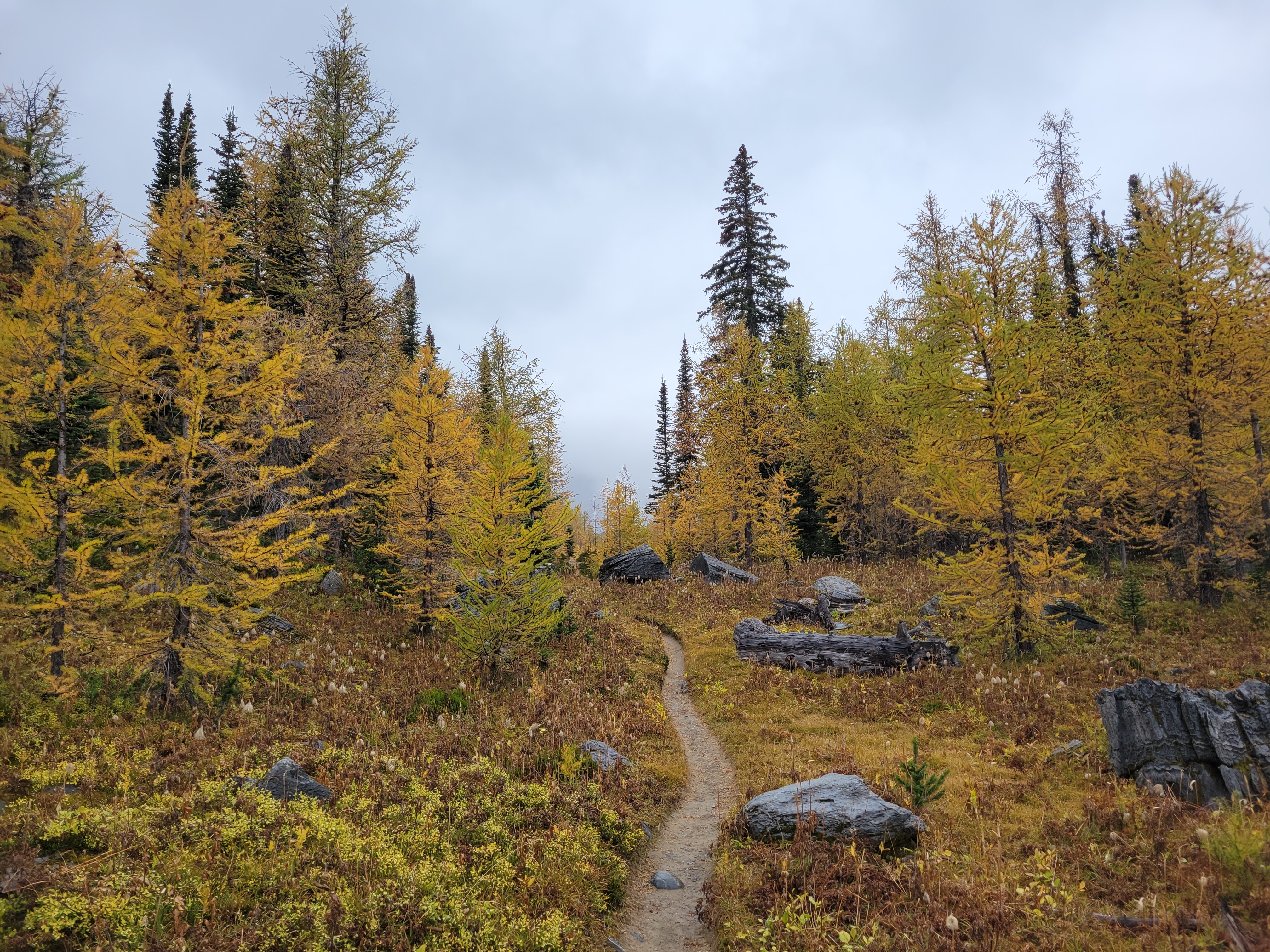
And we crested the pass and what did we see?! Was it more larches?? You bet your ass it was more larches. The trail snaked along the gravelly hillside (tease!) before turning straight into the next grove of larches. Trail optimized for larches.
Tease of blue sky but no sun. Doesn’t matter, found larch carpet
Once the larch grove was past us, losing that 3k elevation gain was kind of brutal. Switchbacks forever, and steep, and I had done a pretty good job of keeping my cardio up but nothing had prepared my legs for jarring downhill. But we saw a porcupine booty bobbing through the trees, I’ve only seen a porcupine once before. As it got darker outside I started bugging out about bears. Every switchback, every bend in the trail, every tree out of the corner of my eye, bears everywhere. Everybody had me psyched out. I felt like a dork carrying bear spray but everyone kept telling me ohhhh no the bears are the real deal there. I was guaranteed to run into a bear. But soon enough it finally flattened out, my legs relaxed, my brain relaxed, and we stumbled into camp. Far below treeline right next to a river. With no larches. And no views. Just trees and darkness and probably bears.
Uninspiring start to second day. This photo doesn’t even deserve to be here except to convey my disappointment
We set up camp pretty quickly and ate, finishing just before it got fully dark outside. Turns out every campsite has a designated camping spot and separate eating spot, complete with bear lockers. I just left my whole pack in there and crawled into my tent where I burrito-down in my sleeping bag and lay freezing and congested for the next 9 hours. At one point I stuck my head outside to blow my nose and was greeted with the first time I’ve seen the Milky Way in over a year. I lay with my head hanging out the door for a solid half hour marveling at every shooting star that passed. Crazy to go from counting planes in the sky to counting not just stars, but shooting stars in a span of 24hrs.
Ah yes if heaven were rainy this would be it
At 6am, it hadn’t started raining yet. I was optimistic. I started to get ready for the day. Contacts, change of clothes, oh you’ve gotta be kidding me is that rain? The rain had started. I went back to sleep. I finally got up around 8ish and had breakfast, paced around restlessly, gave up and sat beneath a tree that was thick enough to cast a dry spot for a few hours. Didn’t have a book or anything because luxuries aren’t part of my trip planning. I remarked to Brad that the pit toilet was phenomenal, could barely even smell it. “Or maybe you’re still sick.” Oh, yeah. Or that. Around noon we figured it wasn’t going to really clear up, we might as well move.
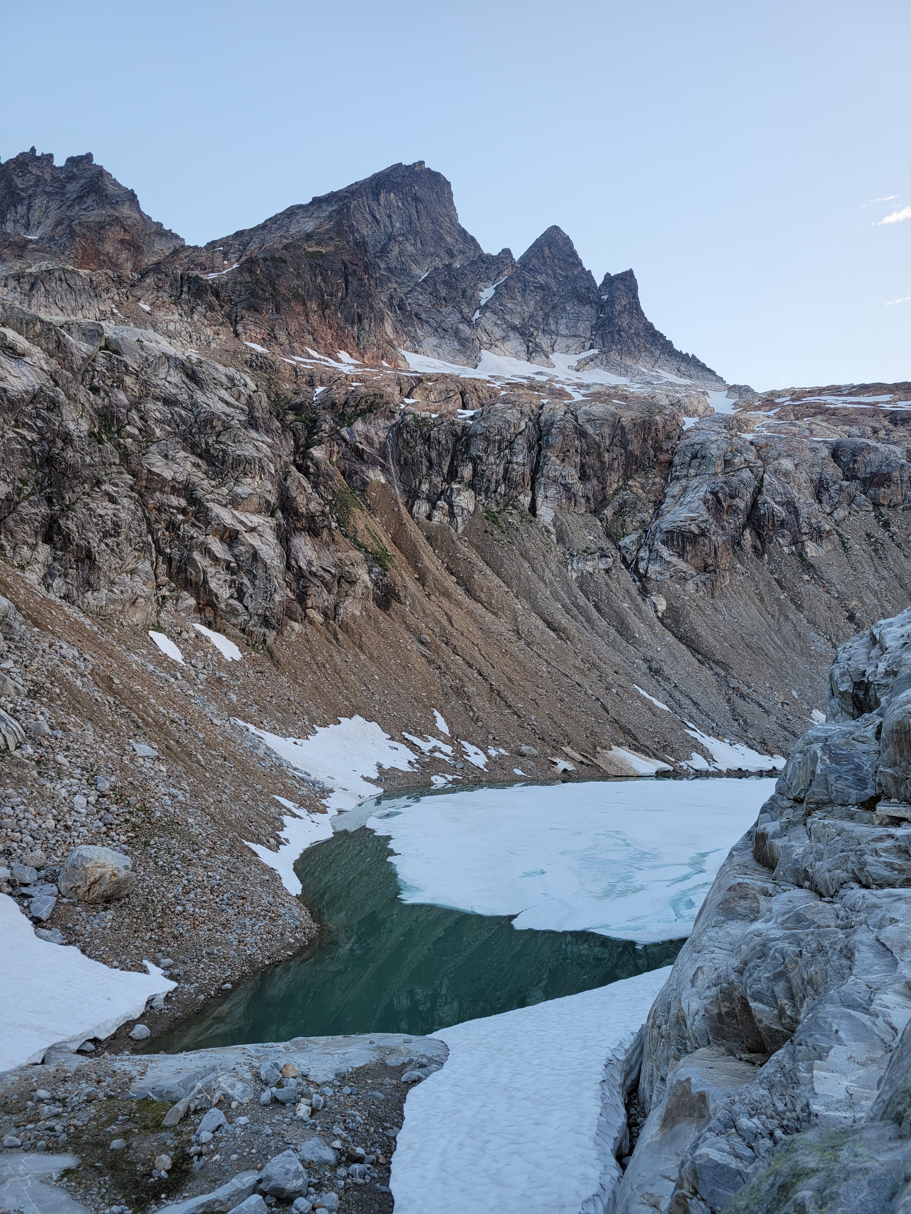
Crazy glacial moraine, lake out of frame
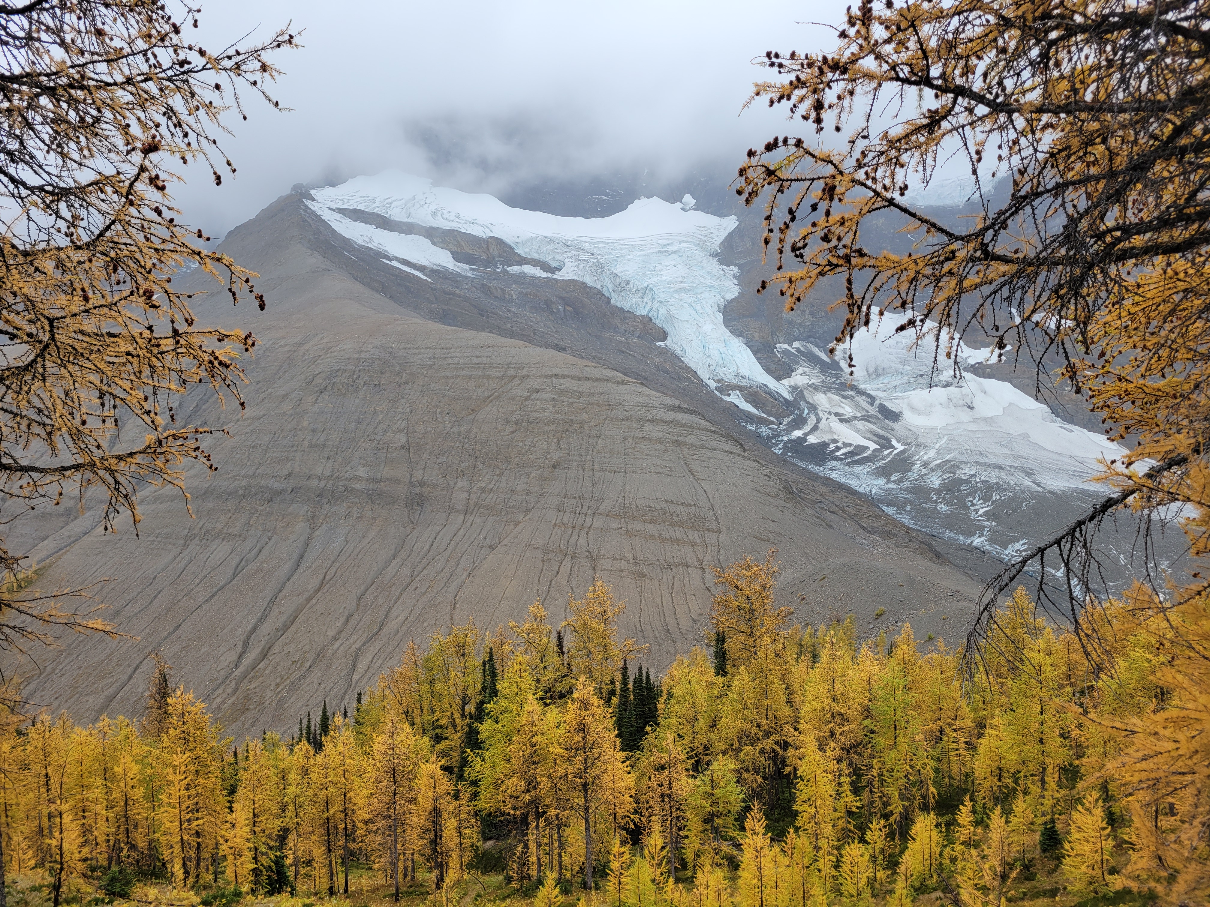
It had backed off to a drizzle. I strapped my soaking wet tent to the outside of my pack to spare everything on the inside and we took off. The first mile or two was stupid, generic slopes in the mist. And then we crested the next pass and hit larches and holy crap the glimpses we got were such teases. Toes of glaciers hanging down rock walls between larches! A huge moraine, with a lake I’d have demanded we hike to if it hadn’t been raining. The rolling slope to the east that we could have hiked up easily for better views, if we hadn’t been socked in by clouds. Oh man. But at least we only had to go four miles. Four miles of +2000ft and then -2000ft. Because of these below-treeline-only-campsites.
The Prince and his Throne
We got to camp around 3pm and did basically what we had done that morning, set up tents and sat in dry spots for as long as we could tolerate. 5pm was dinnertime, we huddled in a dry grove between trees. Nobody was using the official picnic tables, which were in clearings fully exposed to rain. I think I was in my sleeping bag by 6:30pm where I slept for 12 hours because there was nothing else to do in the rain and the cold and this was another campsite below tree line with no larches and no views and only trees and probably bears. I peeked my head out occasionally to see if clouds were moving. The one pro of camping below tree line is some of the trees are dense enough that they maintain dry spots so you can at least sit outside briefly. I barely survived the pit toilet. It smelled horrible. My head cold must finally be passing.
I woke up at 6am, truly believing in my deepest of hearts that it would. be. sunny. Narrator: it was not sunny. It’s amazing that you can believe so hard in something and have it not be true. Whatever. I guess free will doesn’t exist. Love isn’t real. Karma doesn’t actually come around. We’re helpless. Nothing matters. It started to dawn on me that the next day I’d be getting on a plane in soggy clothes with a pack full of soaking wet gear after four days in soaking wet weather that I busted my ASS to make happen. What can you do but laugh? We dined on stroop waffles heated over the steam from the water we boiled to drink, to various name-that-tunes: stroop, there it is. stroop, stroop ba doop, stroop ba doop. Like everything else, my existential crisis also doesn’t matter, not when faced with Costco snacks. We packed up once again and started off.
Great Jesus ray. That’s the father, the son, and the holy spirit telling me personally hey, we got some sun headed your way
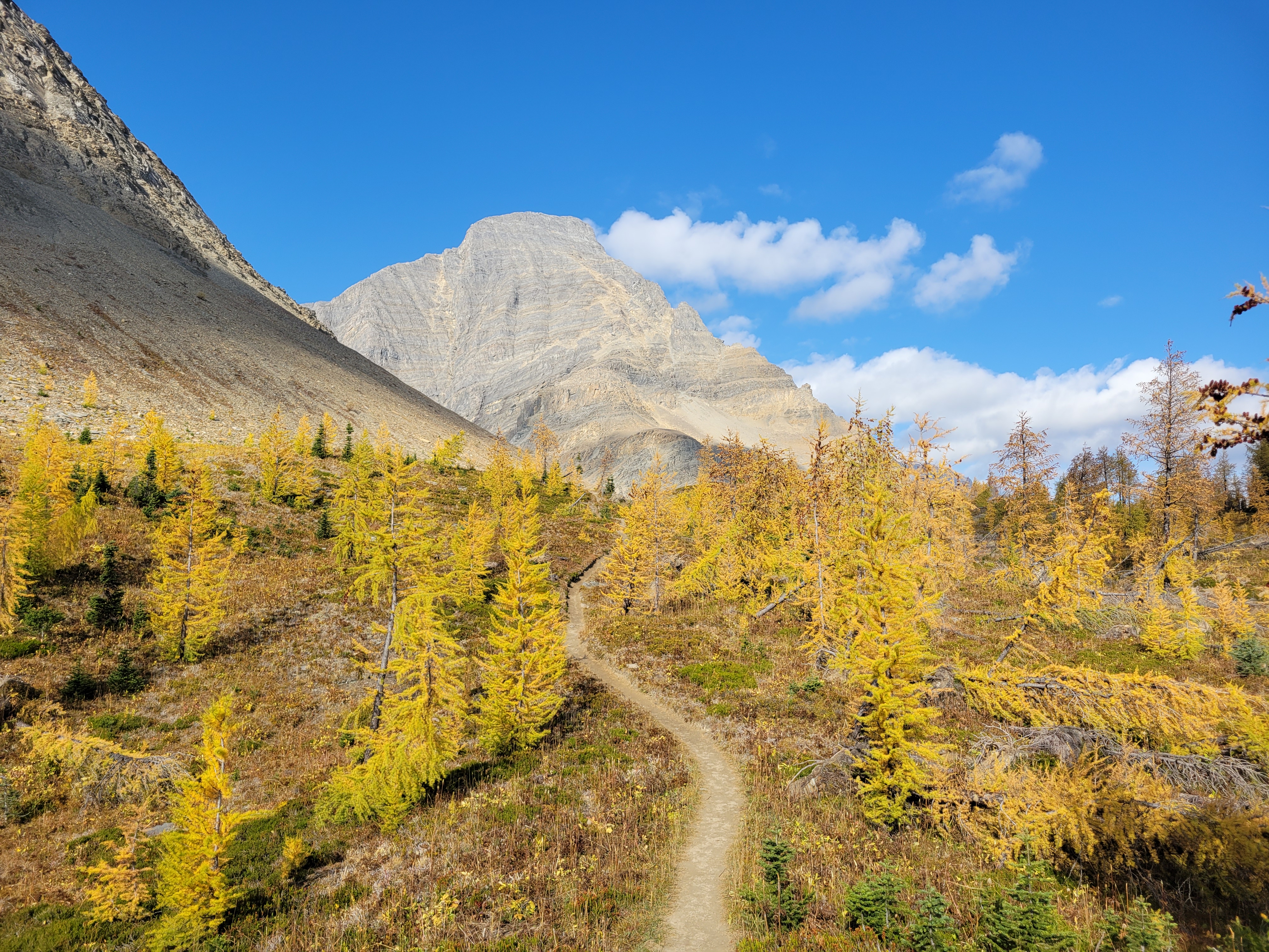
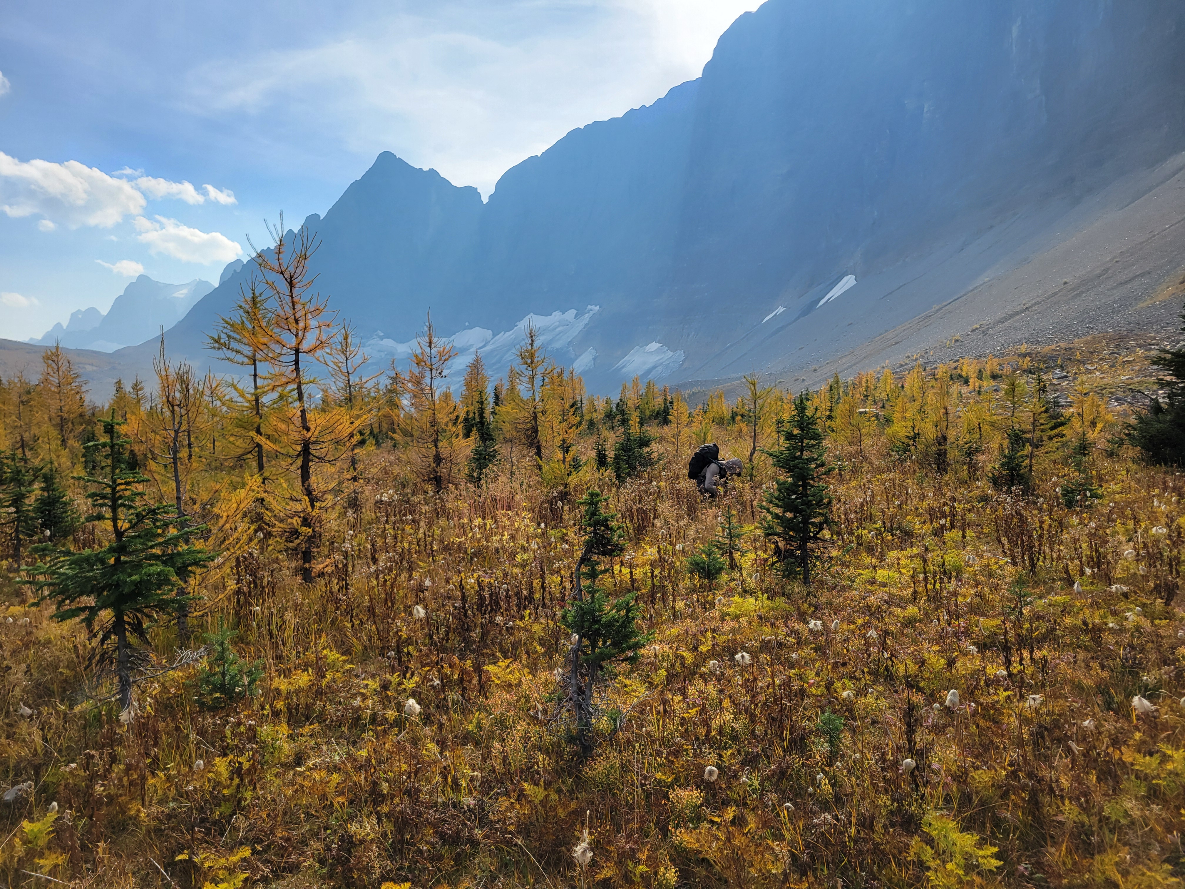
When we were close to the first pass, which was only a couple hundred feet of elevation gain from camp (phew) the sun started making moves. Suddenly the larches were backlit and we were in a cocoon of yellow and IT WAS FINALLY HAPPENING our pace slowed to like 1/10th of a mile per hour and we started basking. This was what we had been hoping for. A trail above 6000ft that just clung to the side of a valley covered in larches, maintained elevation rather than going up 2,000ft and then down 2,000ft, just a beautiful traverse on a warm sunny yellow day. There was another warden’s cabin up there too, which isn’t even fair. I always joked I wanted to retire and be a park ranger but maybe now I want to specifically be a Canadian park ranger if that’s where they’re patrolling.
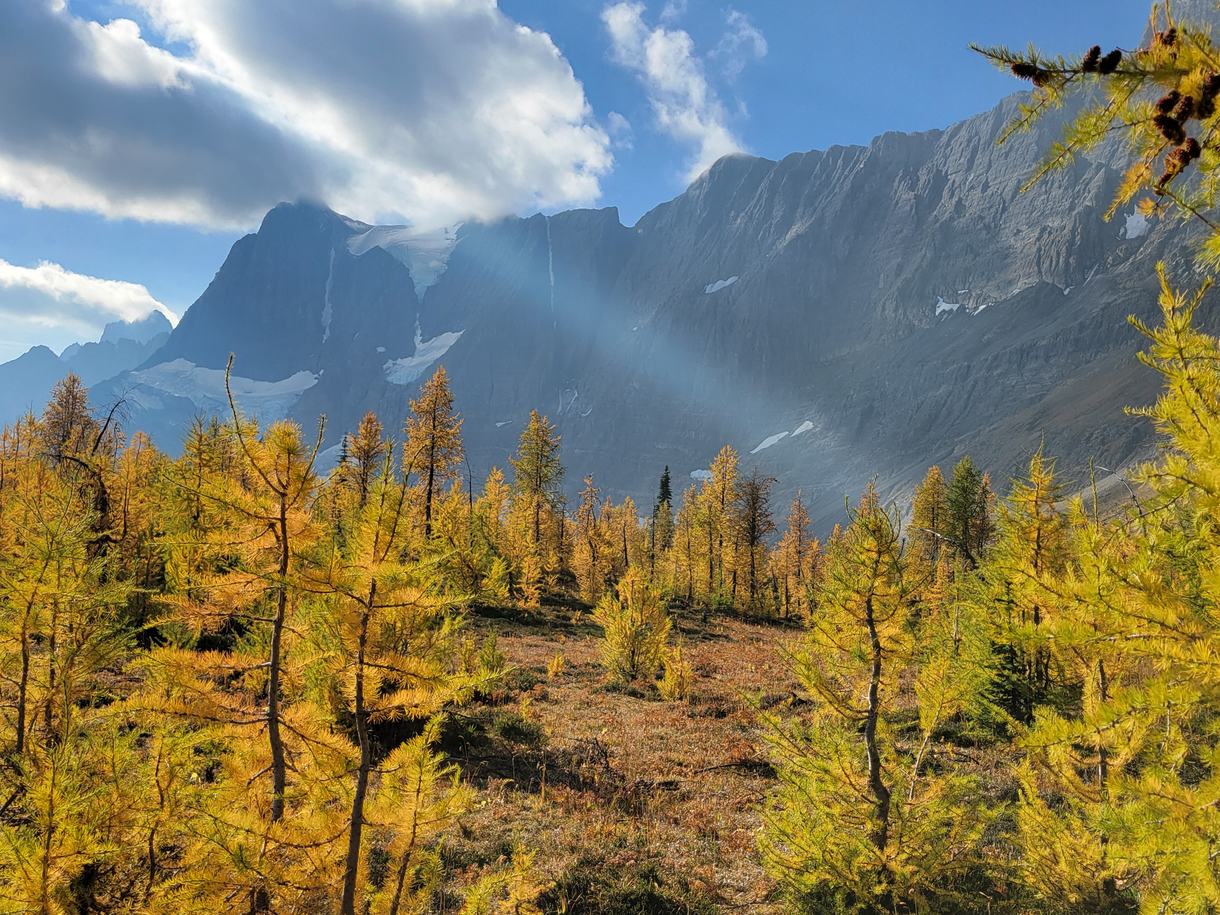
Smokey giants
These peaks are absolutely giant. Totally different feel from the Cascades. We saw another moraine with a bright green lake behind it and looked at each other. Uhhh we need to go to this right? We need to go directly to this lake? We trotted off giggling through dense larches. Thank you, larches, for being so soft and not stubborn stiff evergreens that clothesline you when you try to rush through them. After some rambling we were able to get to the toe of the (very dirty) glacier and took a great lunch break in what felt like a foreign land. It’s truly like the rock walls of Moab meets North Cascades rock, with yellow aspen traded for yellow larches and the bonus of glaciers right next to you. Pictures will never do it justice, and I have to winder what this will look like in another 20 years of glacial recession and brush growth. It’s absolutely spectacular, will it be surrounded by trees in 50 years?
Straight from the toe of the glacier to feed future larches. Our cross country trail rejoined the real train in the largest to the left.
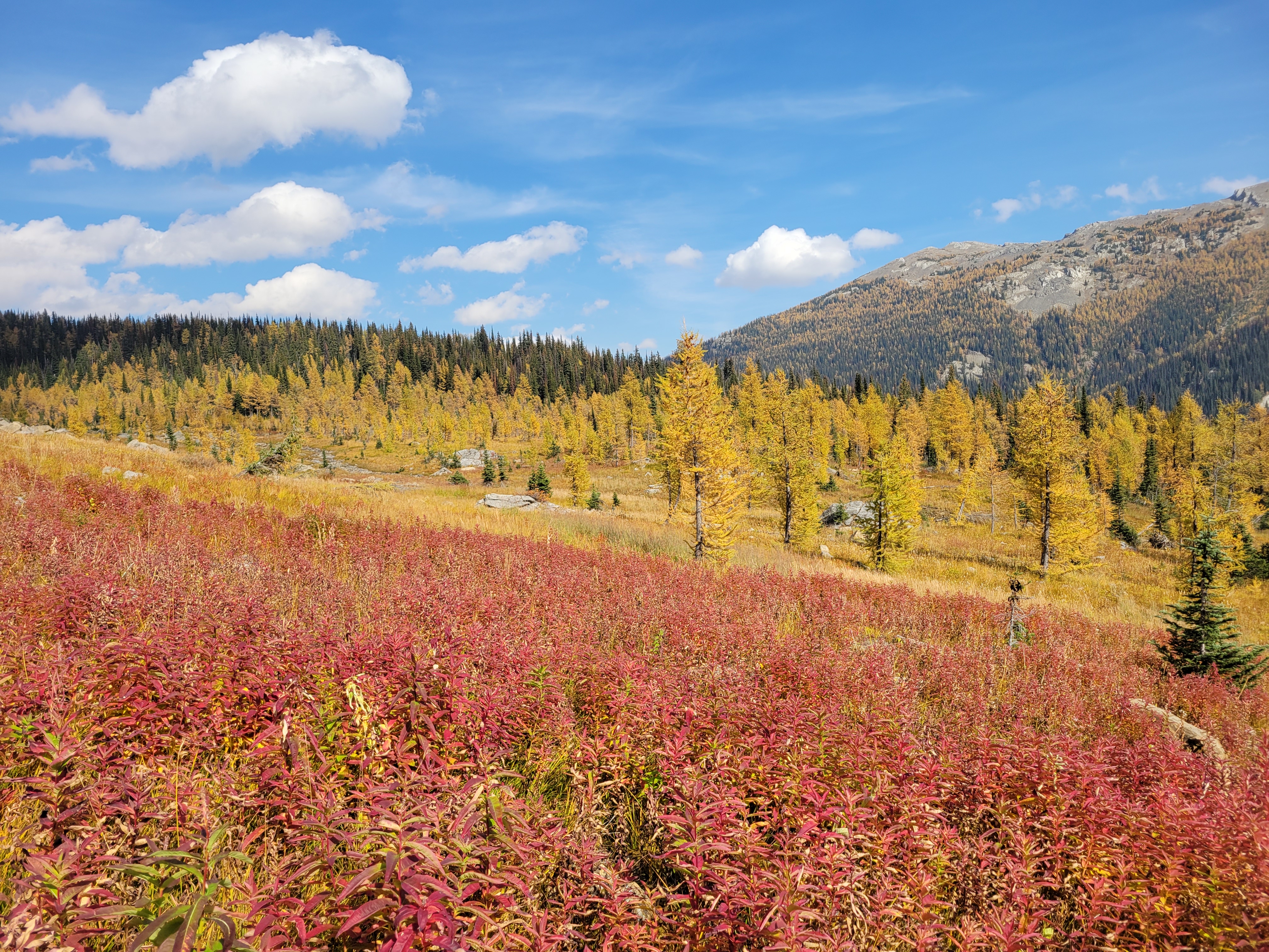
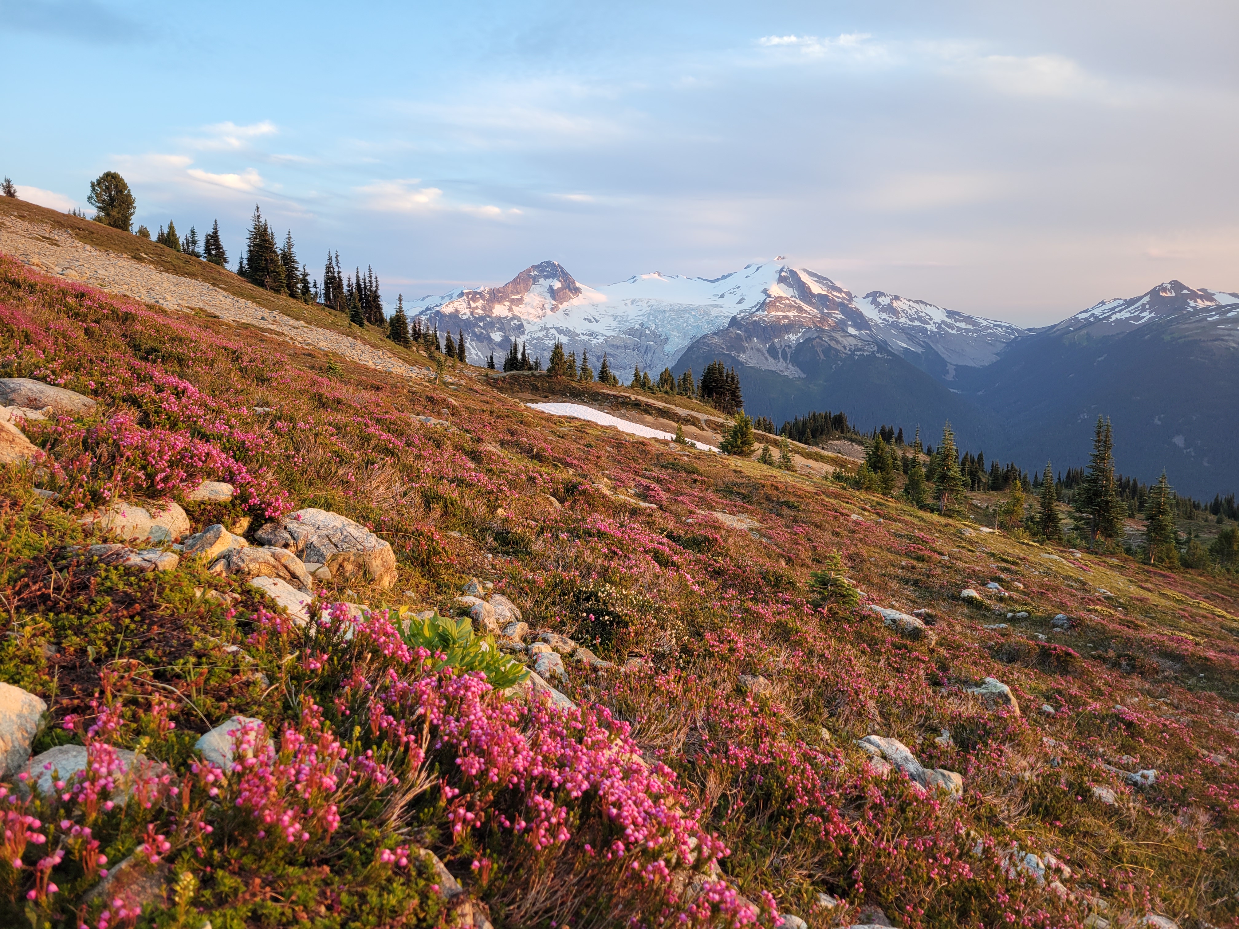
We took our sweet time from the lake up to the final pass. The land transitioned abruptly from glacial moraine to grassy meadow as if the moraine had been pushed onto the meadow just yesterday. The meadow travel was easy, small springs and bright red fireweed and yellow larches and blue skies. Brad has also developed a rare talent: the ability to sniff blueberries from miles away. I’d be walking a trail with seemingly no vegetation and I’d hear “wait. I smell them. blueberries.” and two minutes later “found them!!” and we’d have a small feast. Alpine super sniffer. I couldn’t believe there even were still blueberries.
I have never been so in love with fireweed
Brad working the super sniffer
It is insane to me that you can’t camp here. I get it, it impacts a fragile environment, and I would hate to see this place get overrun like some places in Washington, but oof the individualist and explorer in me is tortured knowing I can’t just do what I want up there (I mean… who’s there to find me?). This was easily one of the most beautiful places I’ve ever been and I want it to stay pristine, but I also want to see every inch, and doing that with a base camp several miles away and thousands of feet lower is tough. But in the meantime… kudos to you, Canada. OOOOO Caaaaa na daaaaa. If ooonly iii knnneeeeww moooore wooooords
The gradual hill to the pass was hell on my trashed city legs, it went forever gaining one foot per minute or something stupid like that. It was smoky, you could smell it, but the views were still elite. I’m used to cramped steep valleys in the Cascades, not these huge broad ridges and wide open valleys with massive mountains on either side. I was almost depressed rolling into camp knowing that was our one day of glory. Helmet falls took me by surprise – it’s hundreds of feet long. Not just a cute little thing in the forest. But yes, the campsite was yet another campsite well below treeline next to a river with no views. Only bears.
1ft per minute to the pass I was dying in the most beautiful land
Naturally, the last day was perfectly sunny, but we were just hiking 9mi out gradually in the woods. Paint Pots was really only one pot and it wasn’t very painted but everything pales in comparison to brilliant yellow larches. Brad beta sprayed me with all of the nearby community centers I could shower at before getting on the plane, I made the mistake of checking email and slack while still being on PTO thinking I’d feel better if it did, and soon enough I was in dark rainy Seattle as if nothing had changed over the last 12 months.
This larch march powered by Costco Brookies
Bonus pics I couldn’t resist adding
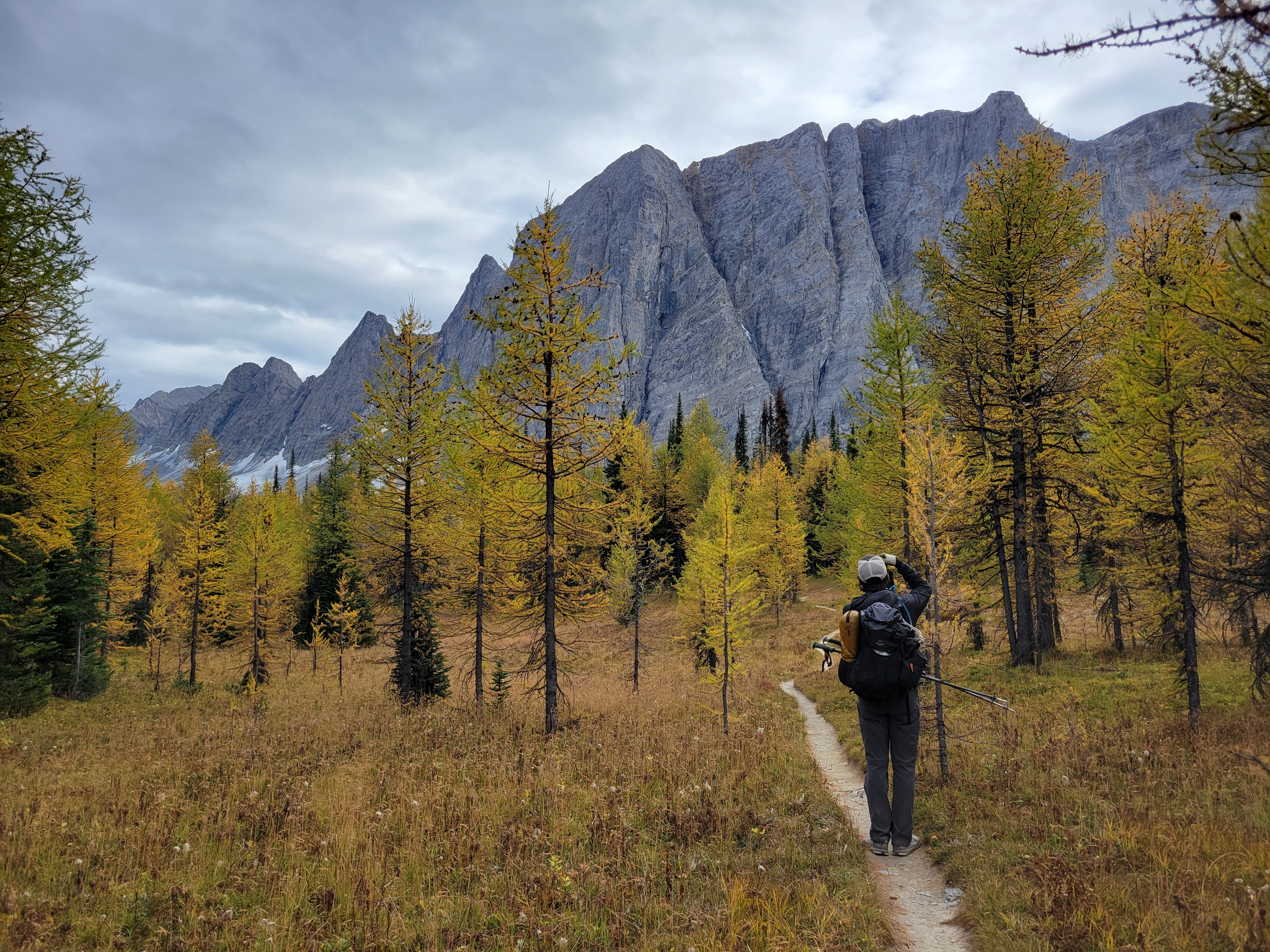
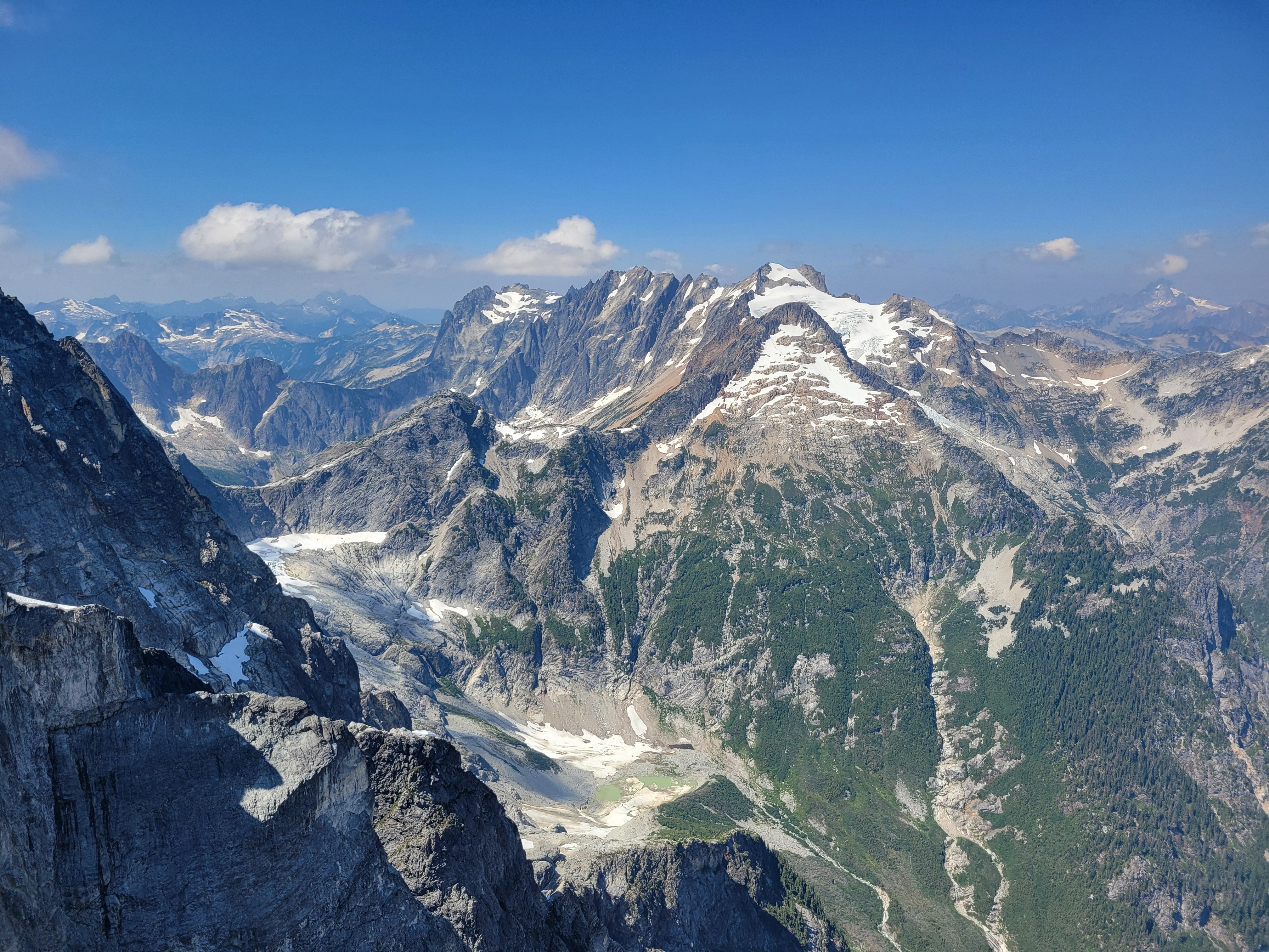
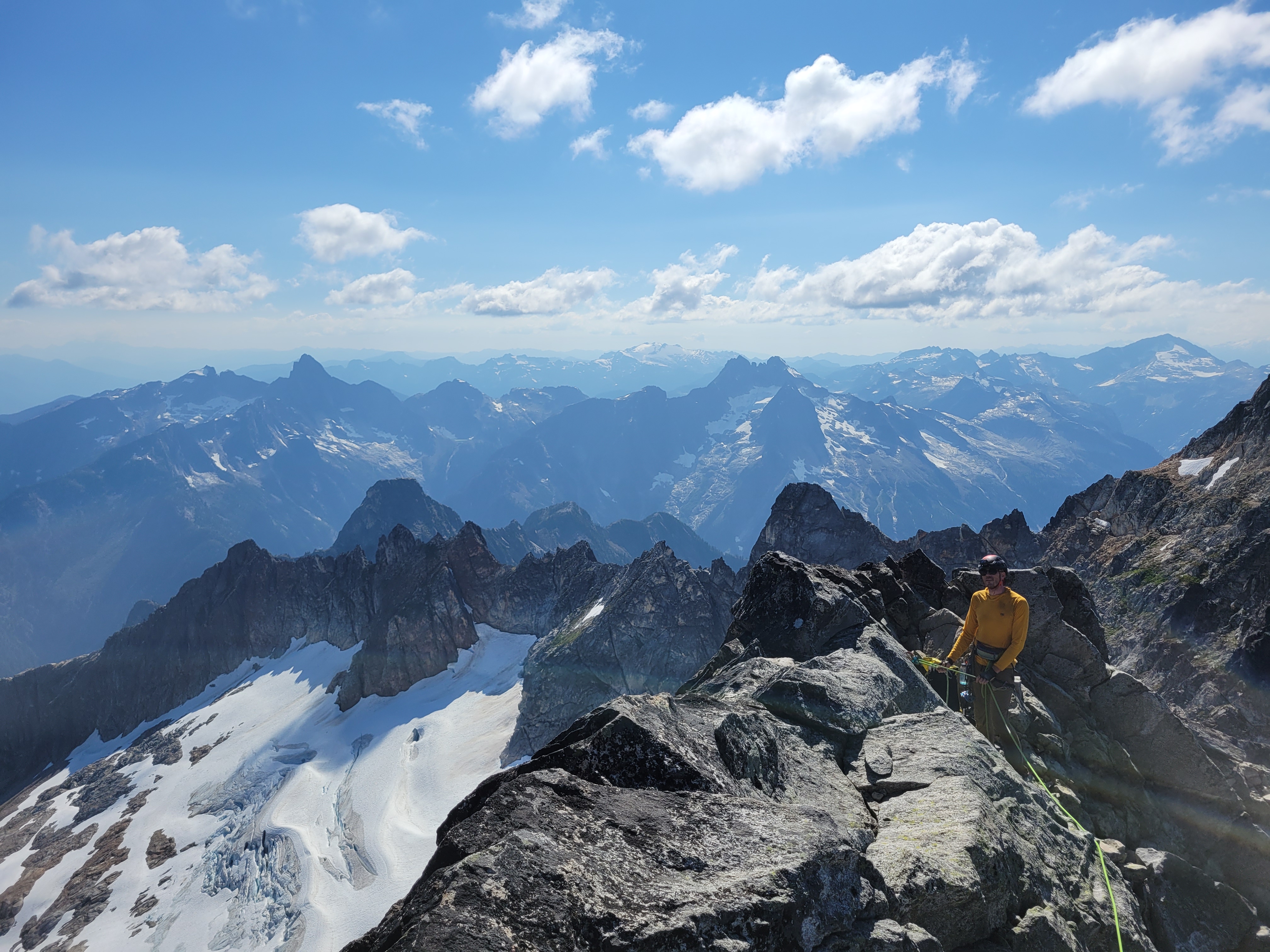
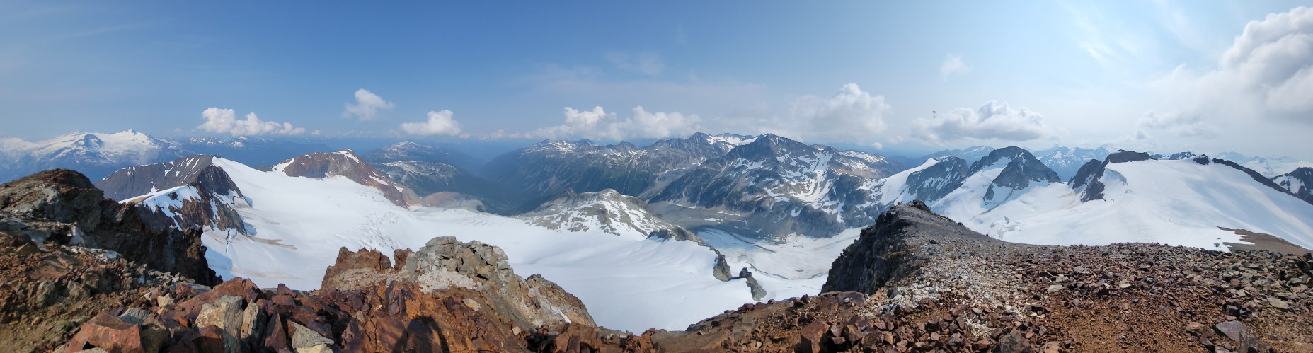
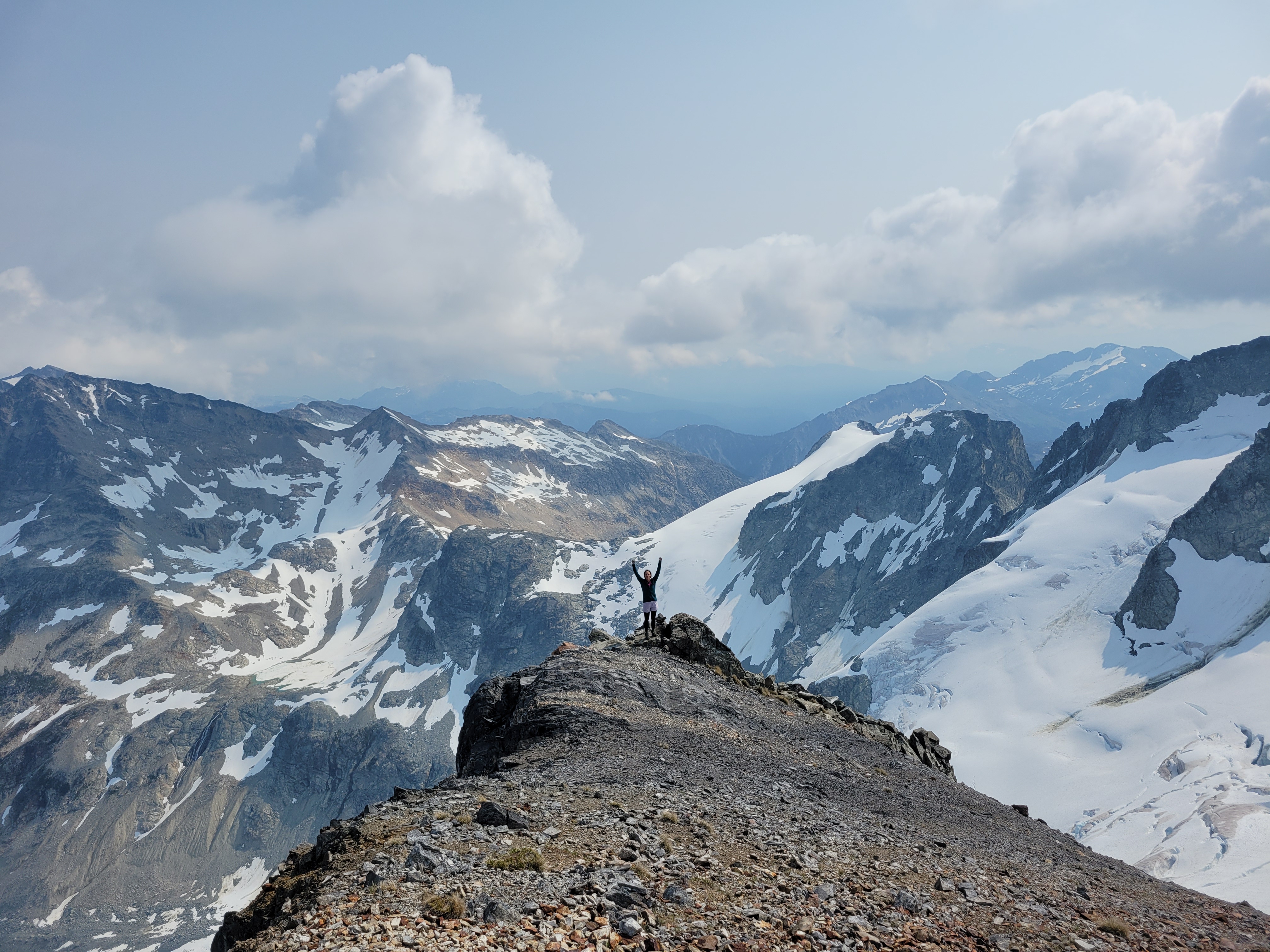
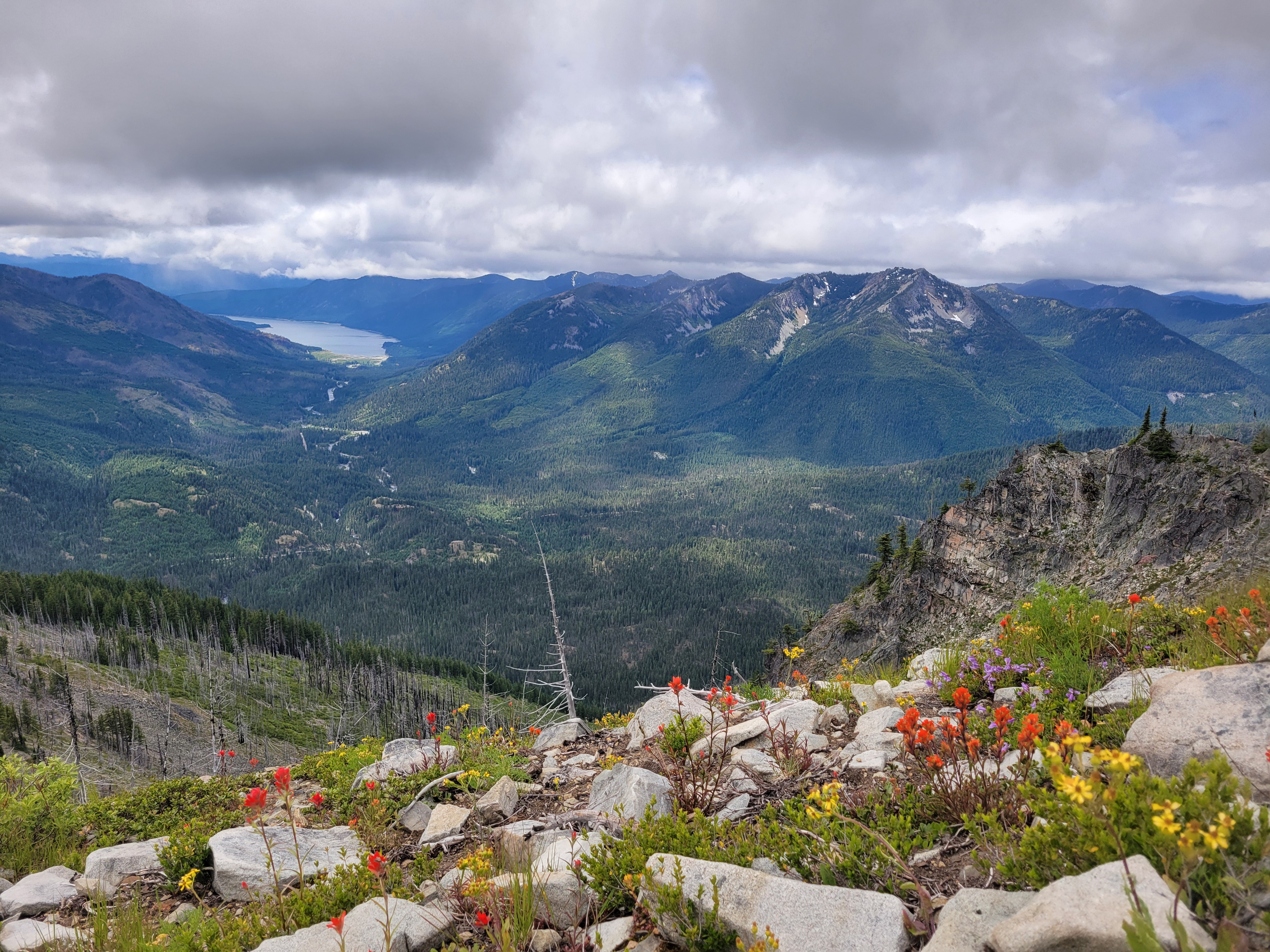
Somehow on top of the world but dwarfed at the same time. Valley 7,200ft~, peaks ~10,000ftGiants. Larch grove slowly moving inJust showing the trail in its absurdityThat awkward moment when you have 75 of the same image
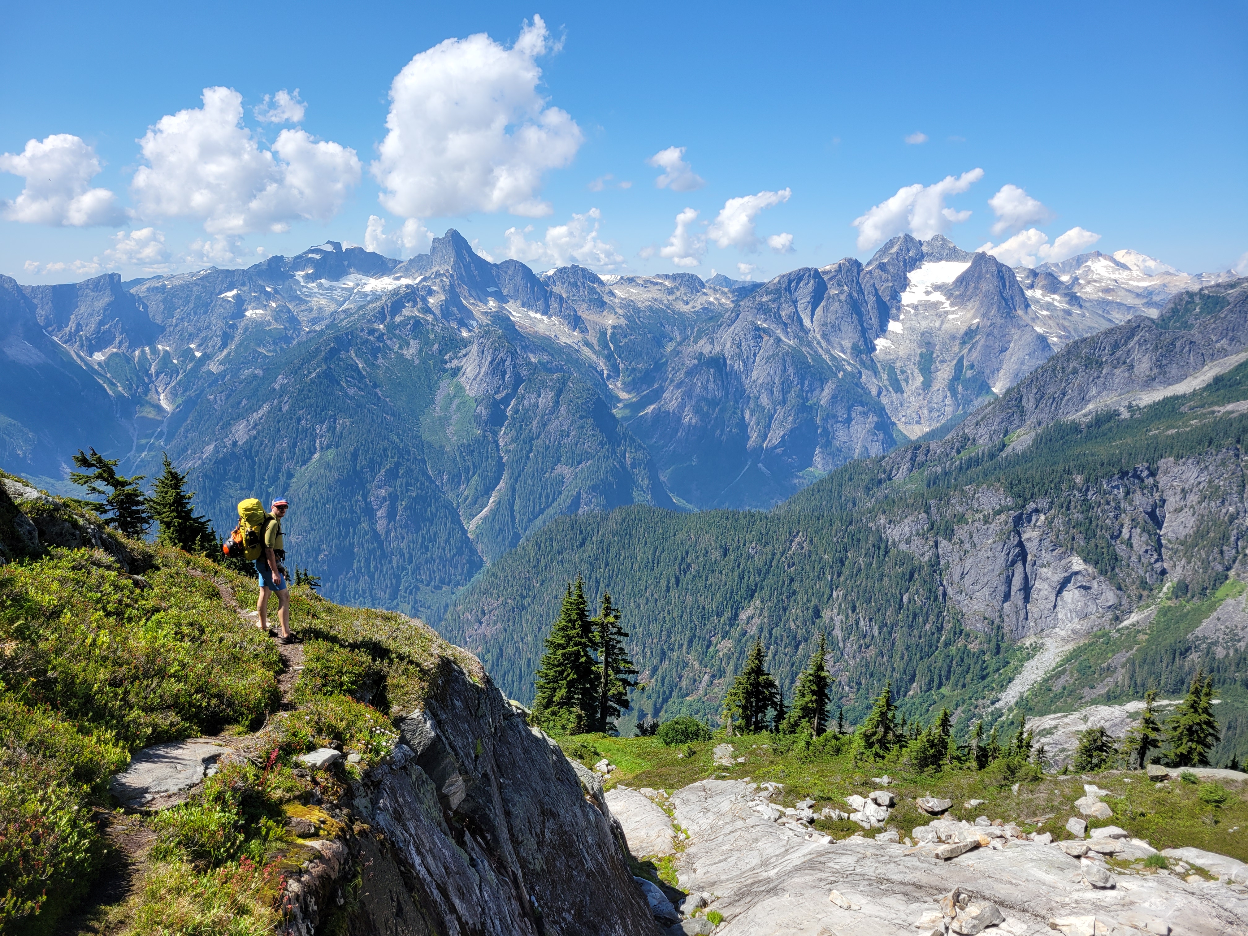
Outrageous. Inspiration is the one with two summits center frame. From left to right it’s Degenhart, Pyramid, Inspiration, some curious gendarmes, McMillan Spires
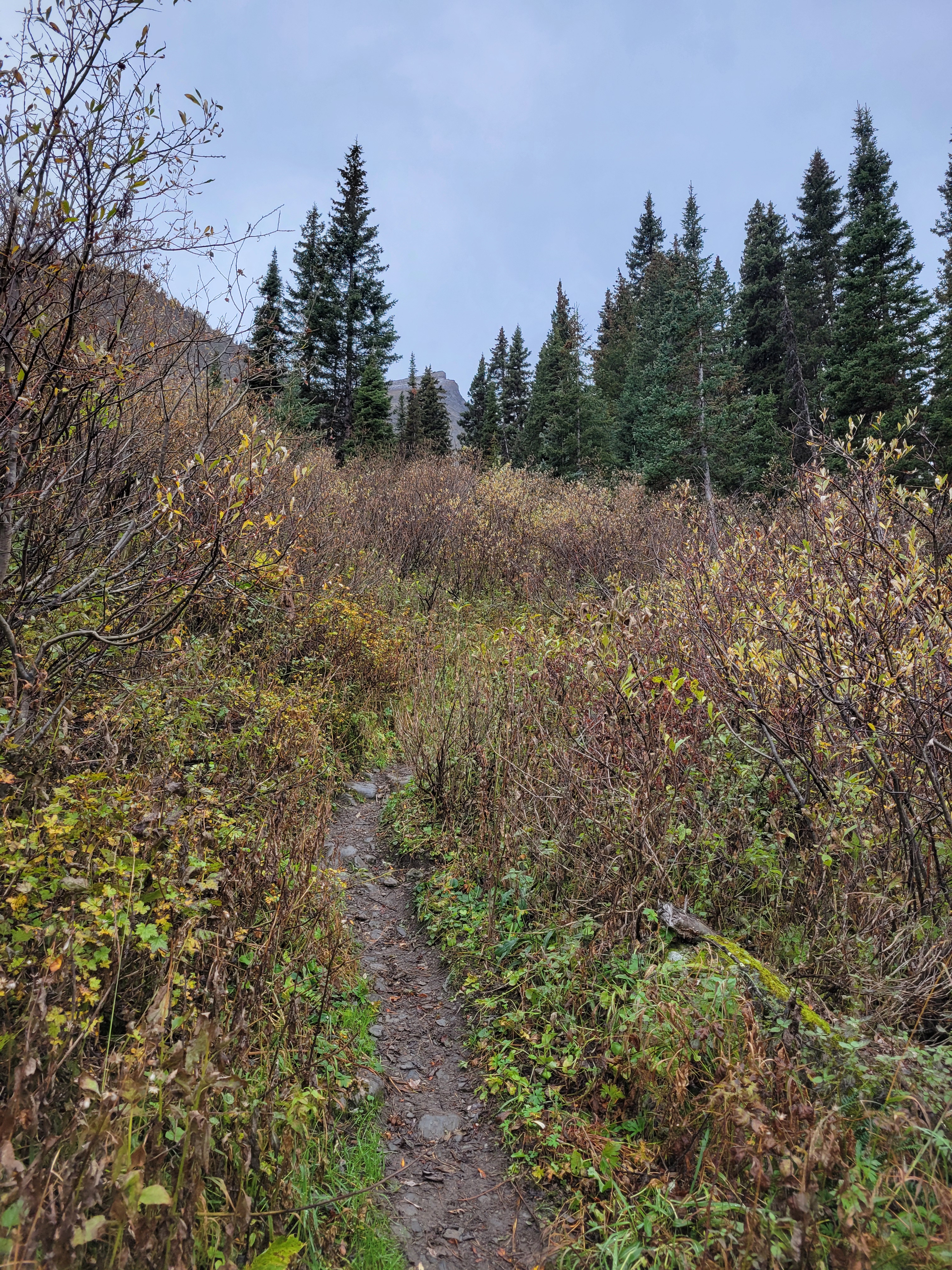
I mean I guess it is overgrown. But open and beautiful
Wow, what a trip. Clint when we got back to the cars said something like “damn, I can’t believe we just did that so smoothly, and i have a full time job AND a kid!” and I laughed and said “and I work at amazon!!” It doesn’t sound like much but to anyone who knows tech, amazon is… not the place to go for any sort of benefit, comfort, or work life balance. I have no idea how my coworkers with kids do it, nevermind young kids. It has been an especially heavy few weeks where I’ve been pulled into meetings at 7am, 9pm, and everything in between. I scarf down food because I don’t know how much time I have. I sit at a desk for far too many hours straight. At the end of the day my legs are stiff and sore and achy and it’s not from working out.
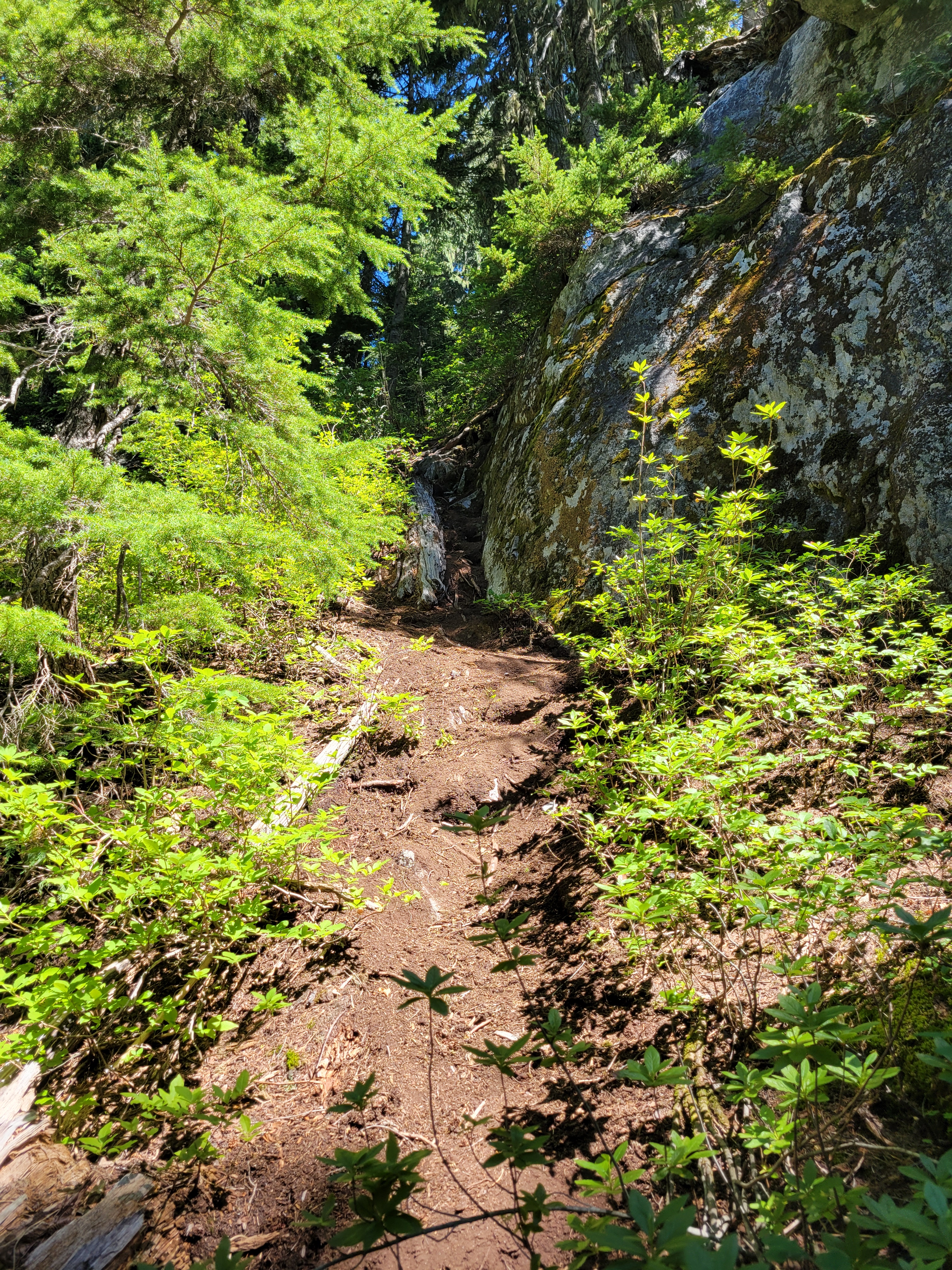
Really angry hornets live here near the dirt steps. Cut through the brush/trees on the left
Well, the past two weeks the unstoppable force that is my job met the immovable object that is my hobbies. Yeah, sure, I’ll work sunup to sundown. But then I’m gonna go climb sunup to sundown. Work hard/play hard is certainly a balance, though it’s one I never expected, and some maintenance pieces of life are taking a hit (cooking, cleaning, yardwork, social life, RIP dating). But it’s working, at least for now. Turns out when work is intense sometimes I just need to push back on it with something else equally intense, and this was that trip.
Distance: ~20mi round trip
elevation: ~7k gain
Weather: hot, then smokey and overcast, then hot
Distance from Seattle: 2hrs
Did I Trip: slip n slide tripped my way down the saddle above camp but no traditional wipeouts
3rd class tree roots
Inspiration has been on what I call my “selfish 10” list going back to around 2015 when I started learning to climb. The selfish 10 is (or was, because it’s fewer than 10 now) a list of climbs that I will bail on anyone and anything for. It’s like 25yo me gave future me permission to bail to get these done. At this point it’s down to six peaks, so progress is being made, albeit slowly. Honestly, last summer I was thinking my climbing career was coming to an end. I hadn’t climbed even in the gym nevermind in the alpine, I was out of shape, I did a single overnight trip, friends weren’t climbing as much anymore, the list goes on. Work was the new priority. I thought maybe someday I’d hire a guide for the trips I really wanted to do and just let go of the rest. Fast forward to this year and here we are, getting after Inspiration as if I had never stopped climbing. And I didn’t have to bail on anyone or anything to do it, though I appreciate my past self setting this amusing boundary.
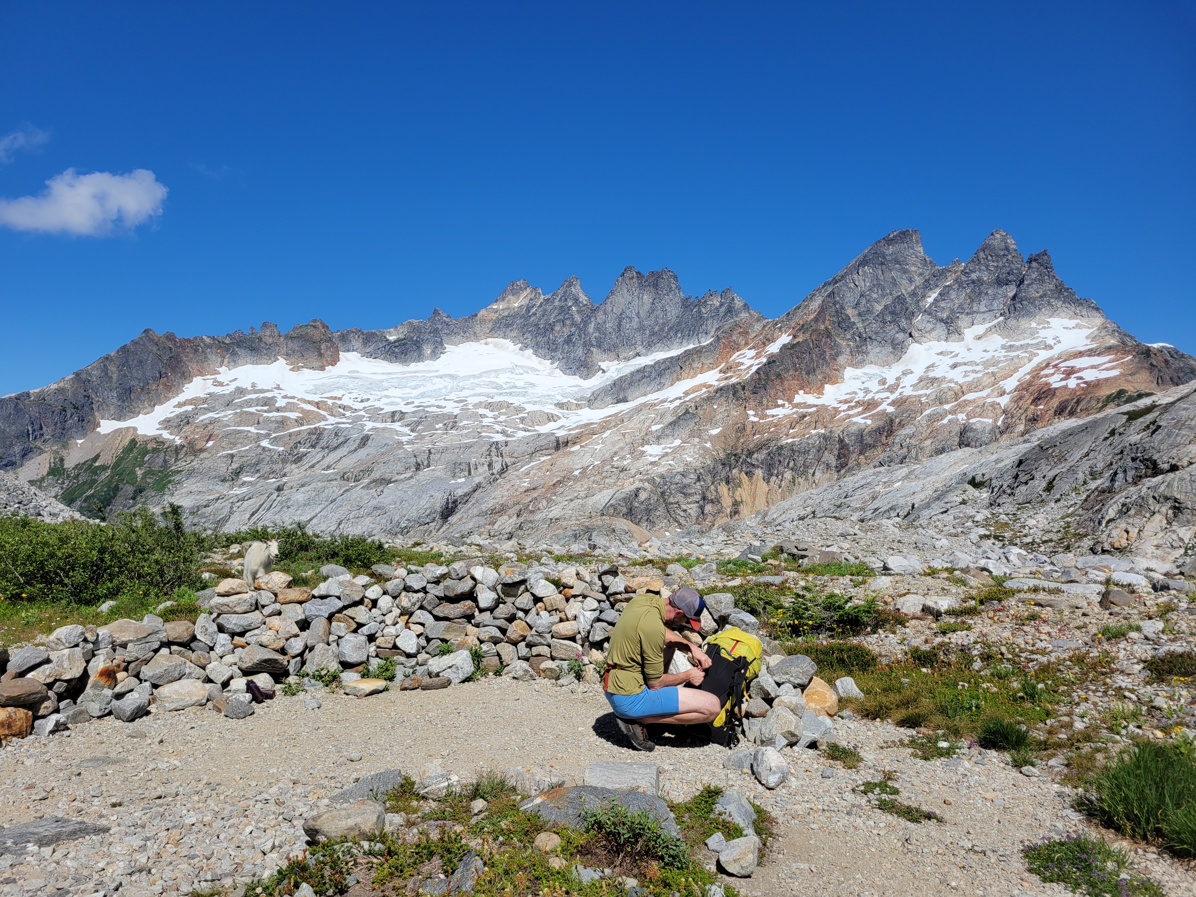
Sparknotes: 1) Don’t carry 6L of water in one pack on summit day, go for two smaller packs 2) Yes carry crampons/ice axe up and over 3) Bears were not a problem but mice and goats were BOLD 4) Glacier is getting broken up but still goes and will for a while if you don’t mind traversing far left 5) Rock is mostly low 5th class besides the two crux pitches, both of which are a blast on great rock. The 5.9 crux had an airy friction move exiting the crack I would not have even remotely enjoyed on lead. Simul from false to true summit, could also simul everything from glacier to ridge but pro was scarce in spots and rope drag is annoying 6) Spectacular position 7) the approach sucks. “7/10 cascades bushwhack approach but at least there’s a trail” as my friend Eric put it 8) I like poles, especially for the shitty slope down to Terror Basin on the approach, and to save my knees on the de-proach. I like to think it’ll buy me an extra few months/years before eventual knee replacement. 9) half liter water bottles on your harness for quick access = ultimate hydration
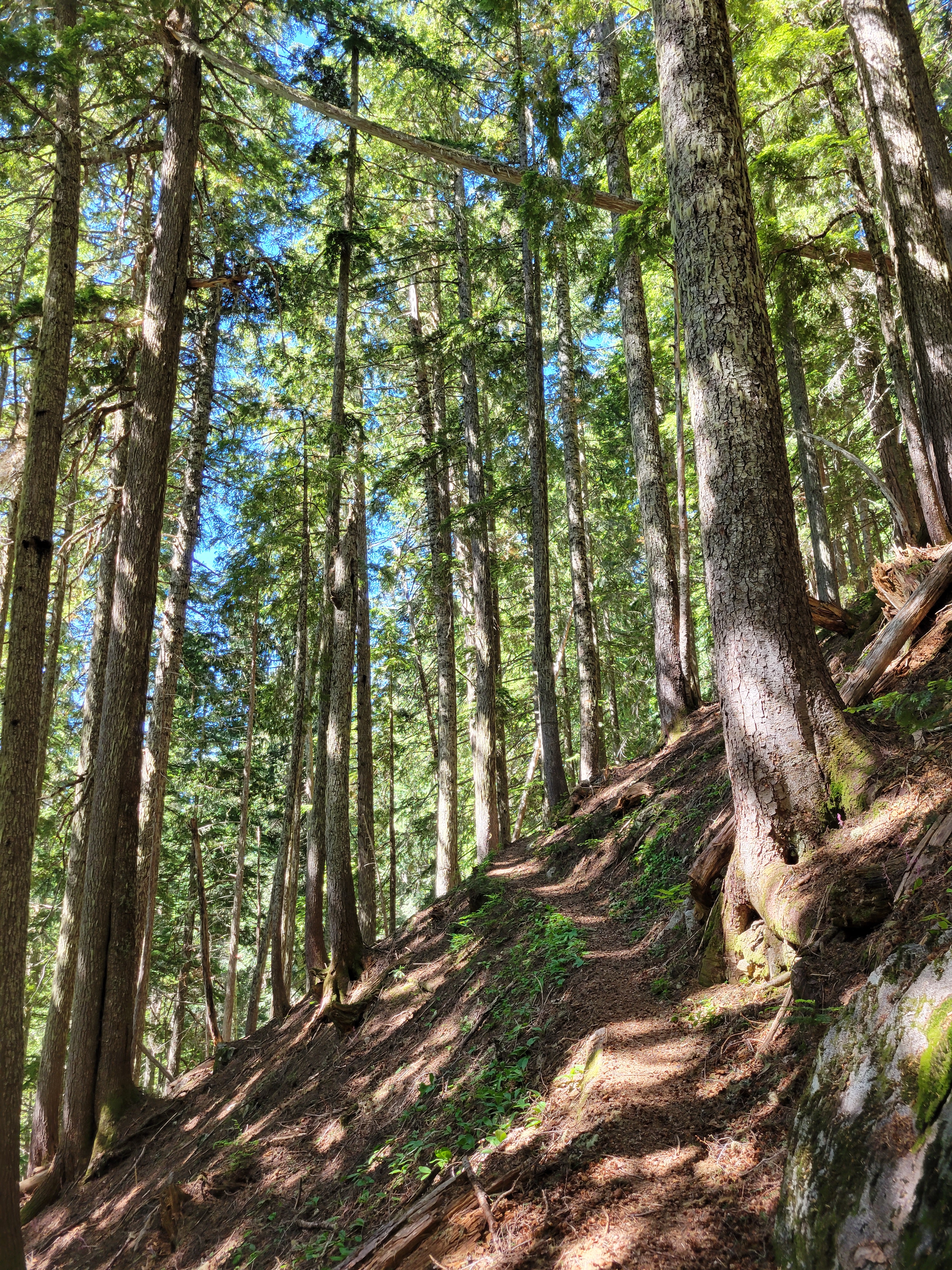
We met at the Marblemount ranger station around 7am and got permits hassle-free. We rented a mid size bear can that I managed to pack quite elegantly (seriously) and were on the trail by 10am. The “overgrown road” is really not that overgrown. It’s a little brushy in spots, but lots of beautiful mossy open forest. We knocked out the first three miles quickly. The only running water we found on pretty much the entire approach was a stream right before the trail turns off the old road and heads straight uphill. Top off water here because you’re about to be out for hours.
Wildflowers
More flowers. My heart
Long traverse to the glacier (PC: Clint)
Starting uphill my body was going on the fritz. I still don’t know what happened. Probably hydration related. I would be overheated, but when we stopped I’d get chilled quickly. It wasn’t enough to make me worried but my body clearly wasn’t compensating normally. I handed the rope over to Clint and resigned myself to this being a slow slog even if it meant meeting him at camp in a few hours. Clint had run 20 miles two days before this, which for many people would mean “I’m kinda too tired to carry a rope” but my interpretation was “fuck yeah he can totally handle the rope.” Fortunately our pace was slowed by the abundance of blueberries and huckleberries (which can also be red??? I thought they were only blue like blueberries?! edit: everyone else already knew they came in red edition). We ran into a few other groups, one of which stepped aside to let us pass and I (still 20ft behind) shouted “no i’ll take the break!!” and heard them laughing through the brush. We continued the slog upwards. Everybody warned us about the hornets “near the dirt staircase with a rock wall to your right.” One guy’s arm was swollen like a squash or something, he laughed and said “yeah they got me” and rolled up his sleeve. We managed to dodge them, though we basically analyzed every single stretch of steep dirt with any rock on the right to the point where I couldn’t help but remember “Blind has predicted 112 of the last 5 tech layoffs” or in our scenario, “we’ve predicted 7 locations for the 1 hornet’s nest.”
Lake below McMillan Spires
The trail eventually turns north and starts to traverse, except the traverse isn’t much of a traverse. I was picturing like nice rolling hills through heathery subalpine meadows but no, it was short trees and bouldery gullies and waist high brush. The very last mile, if that, has views, but it’s still up and down on your already shattered legs. And the final 300ft drop into terror basin? OOF. You climb a nice talus gully to a saddle, and look down the other side… kitty litter and loose rock on hard packed dirt. The hillside is crumbling. We hugged the right wall where there’s a rock band you can at least hold onto, and since it trends right you (mostly) won’t knock rocks down onto your friends. I took zero pictures of this section because I was too busy being sweaty and trying to avoid falling to a silly and untimely death.
Nearing the top of the glacier
In all it took us around 5-6hrs to get to camp. For a 7 mile trail if that puts the trail into perspective. On good trails I average 20min miles, on steeps usually still under 30min, this was a different beast with overnight climbing packs. We grabbed pretty much the first campsite we saw, which was enormous and flat and amazing and right next to running water. We yard-saled our food everywhere (“look at you bringing real food” Clint said when I whipped out a 12″ Bahn mi “yeah really food I can’t carry”) and laughed at the thought we’d have been able to fit it all in the bear can. Clint needed his own like 5 gallon bear can. I ran around taking wildflower pics as usual. We sorted gear for the morning, watched a helicopter search for someone on Degenhart (so maybe my death would have been timely, because a helicopter was already en route for other reasons), watched another party struggle back up the stupid dirt slope above camp, and I fell asleep before sunset, swearing I’d catch it from camp Sunday night after the climb (narrator: she did not, in fact, catch sunset from camp). Clint had lined up a bunch of episodes of National Parks After Dark to fit the mood in Terror Basin, and while the stories were good, none were truly spooky, and apparently podcasts are a good way to put me to sleep. I love sleeping in the alpine. If not for the bugs I’d have bivvied.
Easy transition to rock
We intended to be up at 4 and moving by 4:30, but my alarm went off at 4:30 instead, and we were moving just after 5:30. The traverse to the glacier is straightforward, but longer than it looks. In short, you traverse rolling subalpine hillside (very rolling, and on redundant terrain) losing some elevation to cross the outlet stream below McMillan spires, then gain a bunch of elevation on various ribs of slabs to the toe of the glacier. Most of the terrain goes, but there is some surprising microterrain that’s too small to show up on maps, but significant enough to be a chokepoint. Like a small creek that was somehow 20ft down in a huge rock gorge like 8ft across so you couldn’t jump it or downclimb. The outlet to the lake below McMillan spires, which was similar. I had several gpx tracks from different trips that all converged at a few points through those obstacles.
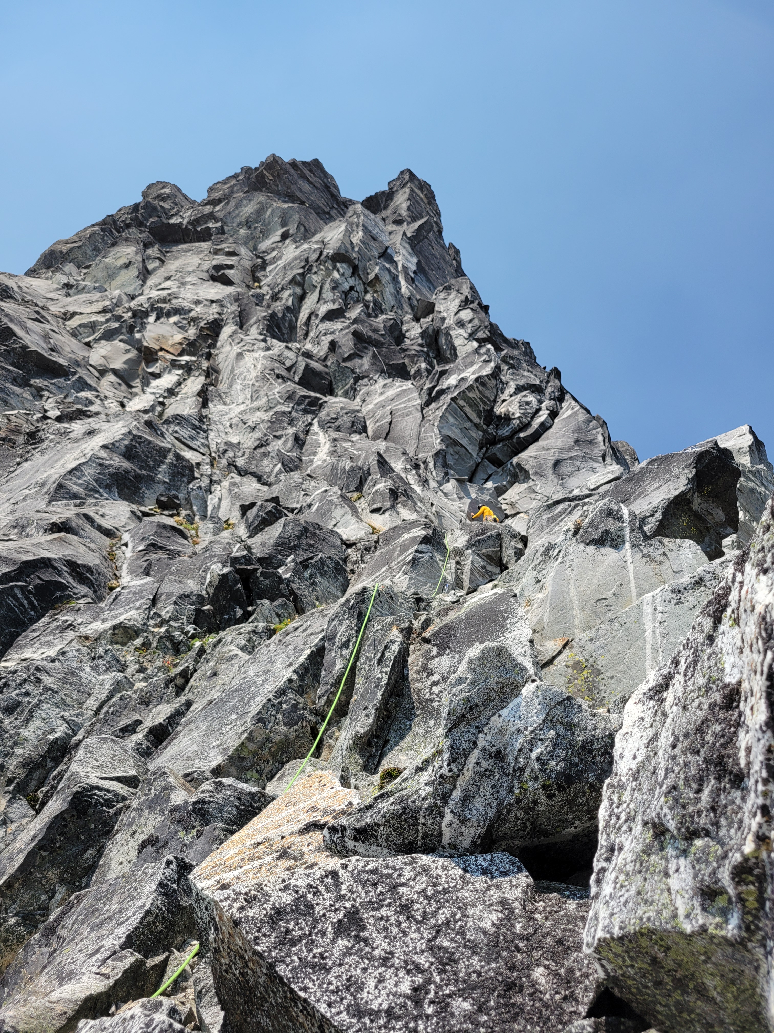
Where we started our climb
From camp, I had spotted a good route up the glacier, but once on the glacier, couldn’t figure it out as easily as it had looked. “Well it can’t be that bad if no prior trip reports mentioned it, right?” We ended up crossing wet slabs in crampons to avoid some broken snow, and then zigzagged up through very open crevasses when it would have been easier to stay on consolidated snow traversing far climber’s left and making one big switchback back right to get to the base of the route. This was actually pretty demoralizing for me, because we lost a fair amount of time and I didn’t want to deal with this sort of hazard late in the day on the way down. Beyond the maze of near-seracs (you could hear them shifting) we had to hop a few small crevasses and cross one legit snow bridge. The crevasses just kept on coming. Finally we reached the rock. We immediately found an easy place to transition from snow to rock and started the climb. Moat was not a problem.
You can see the headwall above us
The climb is super mellow at first. We scrambled until we hit the base of a chimney, where we took out the rope and climbing shoes. There are few things worse than crampons scraping on rock. One of those things is carrying a pack with crampons and ice axes strapped to the outside, that can now scrape and snag on vertical rock because you’re trying to worm your way up a chimney. I threw chimney technique to the wind and just trusted some powerful jugs. Beyond the chimney we were back on easy 3rd-5th class terrain. We traversed up and climber’s right for four pitches, following a heather ledge for a bit and then climbing up steeper but fun, blocky rock, entirely avoiding the lower dirty gully that gets you to the low notch in the ridge. Honestly, I preferred our route over how the gully looked. Our route felt like a good, clean warm up.
PACK HAUL it really only added 5-10min
We took 5 pitches total (more like 4.5) to the base of the headwall, which is obvious as soon as you’re close to the ridge. Could have been 4 pitches but I set up a truly spectacular rope drag situation on the 4th pitch to the point I thought I was going to pull myself off the mountain. At the base of the headwall, we chugged water and stuffed our faces with food, because we had one pack that contained SIX LITERS of water and food for probably days, not to mention two pairs of crampons, two ice axes, and several jackets. There was no way I was going to climb the cruxes with that much weight, even following.
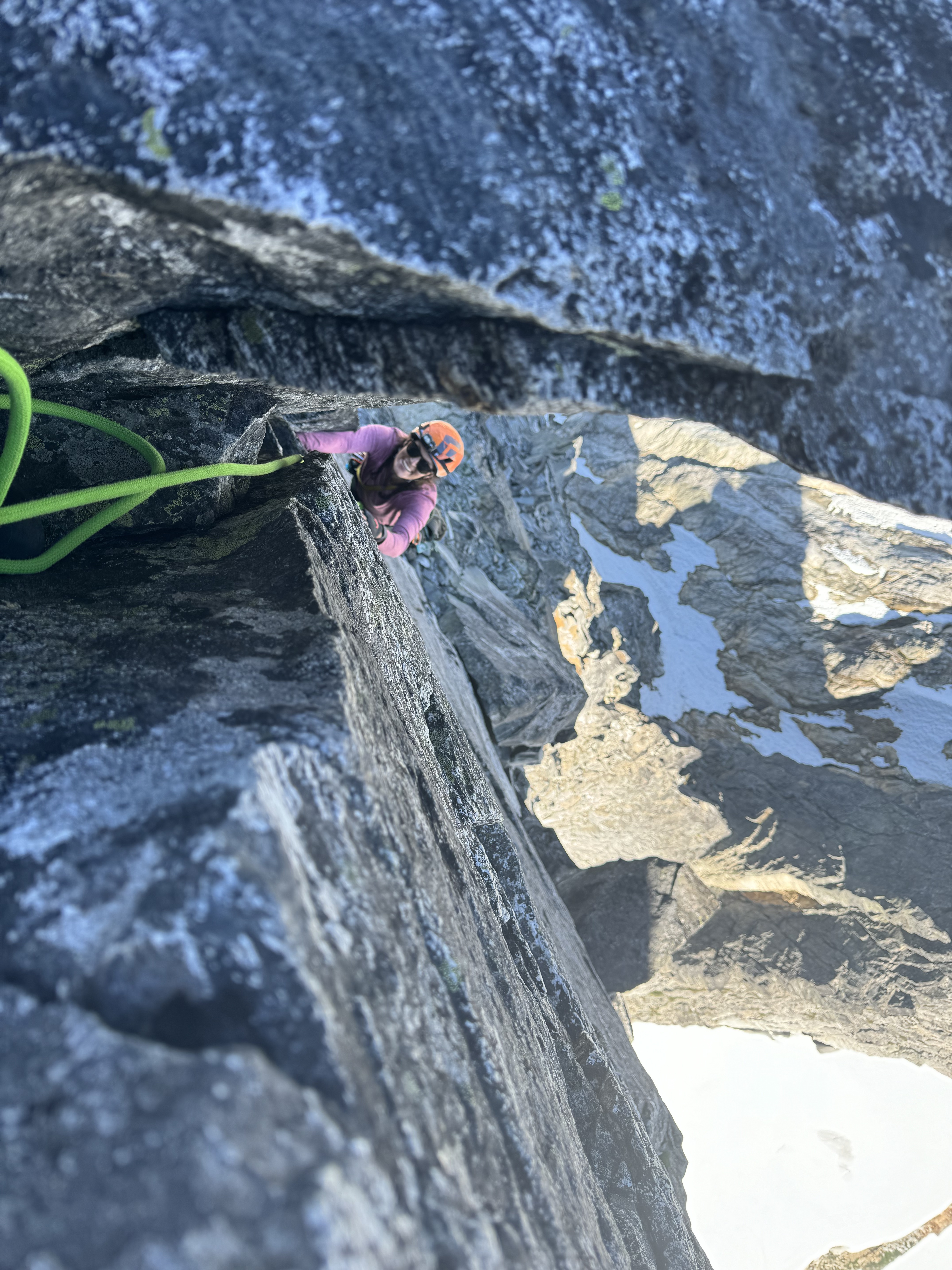
Wish I had better pics. I cannot put into words how mind boggling this crack is (it really starts like 15ft above the belay)
Just past the 5.8 layback (which is one very fun layback move and I found myself wishing it was longer) Clint threw me a loop of rope to clip the pack into, hauled it up, and clipped it into a piece of gear so I could climb without it and grab it above the layback. I think I liked the 5.8 pitch more than the 5.9 pitch but probably just because it was more within my comfort zone. Just very fun climbing.
Stoke = high despite struggles
The 5.9 pitch though, holy cow, how does that crack even exist?! I wish I had a better picture! It’s truly a splitter crack. I can’t wrap my head around how such a crack exists in the middle of this crumbling ridge. Unbelievably clean. Perfect size for my feet. A little big for my fists at most points but I can stuff an arm in there. Clint bumped a #3 up it for a while, then you get to play with two smaller cracks for a few moves, then an airy friction move to traverse right, and a gymnastic exit to a great belay station (no concerns, contrary to prior trip reports) where he could still see and easily shout to me. The helicopter from the prior day was back and circling Degenhart again, still no idea what it was up to but the sound of the chopper blades added some spice to the ambiance. Reminiscent of the thunderstorm rolling in when I was following a similar challenging (for me) crack on Cathedral Peak.
Looking into the heart of the Pickets. Cub Scout is the low peak in the foreground to the left, Outrigger in front of Fury which is the glaciated one in the back
Looking back at Clint as I led to the false summit
I figured I could do this 5.9 pitch with the pack since it was more vertical and the 5.8 had been a piece of cake. A few moves up I had to take (as in, hang from Clint’s belay). Holy shit. Crack climbing hurts, and I’m tired and weak. How can something be so fun but so hard. We hauled the pack again. I felt 1000x lighter. Didn’t matter, took again a few moves later. At the traverse friction move I was thinking I’m just going to have to swing for it (hooray following) but right as I was about to commit to the pseudo-fall my right hand connected with a great jug and I made it across into the new crack and scurried the rest of the way up. Super strong lead by Clint, he made it look so easy it boosted my confidence.
“Wow Pyramid has a cool summit maybe we should do that too” “wait… that’s still Inspiration”
Beyond this, we didn’t know what to expect. Like the glacier section, we figured “well no one talks about the ridge from the crux to the summit so it can’t be that bad right?” Correct. We swung leads again and ended up simuling the entire ridge from false to true summit. Felt like Forbidden Peak, in fact, blocky climbing with big holds and great feet. and some spots with very fun exposure, including an au cheval opportunity and another “sidewalk in the sky,” neither of which I have pics of because simul climbing requires focus and consistency since you’re coordinating pace and rope slack (ideally) with your climbing partner. And soon enough we were on the summit and I was staring at the heart of the Pickets crushing cheez its and jelly beans and just basking in the alpine. How freaking lucky are we.
Clint belaying me to the summit
Alpine cheezits
The helicopter returned yet again, this time hovering over Degenhart, then landing below us on the glacier, then dropping two people off on Degenhart. Still no idea what was going on. We started rapping down the west ridge (truly the ridge, do not drop onto the face yet). It was mostly gross kitty litter slabs and low angle rappels, and some STUPID short raps but we were advised to not skip any, and that advice was correct. A few raps had easy downclimbs associated, but overall we always reached a rap station and only two were questionable. I don’t remember what cued us into starting to rap the S face instead of the ridge. One of those two questionable anchors was set up by yours truly, after we decided to skip the last two raps down the south face/arete and rap directly east down to some wet slabs to get back on the snow. Upon seeing the slabs I said fuck no, if you’re comfortable downclimbing this you can belay me as I downclimb, or we can rap off this block and rock horn and I will sacrifice a quad and some webbing and a dash of my pride. Back on the snow, I nailed the glacier route (had plenty of time to map it in my head up high while staring at it from above) and we were off the glacier within like ten minutes, it was actually amazing.
Doing my best to be a wildflower
I summoned some goats with my pee on the slabs (terrifyingly fast) and we chugged more water and had moree snacks before setting off down and left. We tried to stick to slabs over talus and heather for as long as possible. The gpx tracks were maybe helpful, but most of the terrain pushed you towards the right spots anyway, so we were conscious of the tradeoff of paying too much attention to the tracks vs just going. I finally caved and turned my headlamp on.
We found the outlet stream fairly easily since there’s really only one section to cross, and then the traverse from the stream crossing back to camp took approximately forever. We might have taken a detour through the twilight zone. We might be in a different universe than we were the prior day. I can’t be sure. But suddenly we were surrounded by wildflowers, and I knew exactly where we were because I had taken so many pictures the prior day. And then we were at camp eating hot food (bears were not a problem) and then watching the perseid meteor shower and suddenly i woke up to close my tent door and pass out again. It had been a 17hr day, everything went smoothly, and I was perfectly content and completely wiped and far more hydrated than usual thanks to chugging water all day to avoid carrying 6 freaking liters.
Frankly if bugs can set up this horror in Terror Basin I should be allowed to poop here without blue bags
I got up at 6am. Clint muttered from his bivvy “what are you doing awake” idk eating, bathroom, wildflowers, stoke? I went back to sleep around 730 because why not. When the sun hit the campsite we started packing and got moving around maybe 10am? We took the same route back up the shitty dirt col, using the rock cliff as a safety net. Clint found some sturdy sandals that had melted out from under the snowpack and we slapped them on his pack. I appreciated the traverse way more this day, the skies were clearer the views were better and it felt like unexplored alpine. The trail down went faster than the way up, but it didn’t feel fast, it felt more like a knee banger though I was able to eat berries faster going downhill than uphill (more breath? can see them coming? can grab a handful while cruising?). We took a decent break at the major creek crossing back at the old logging road, and were back at the car by 4:30pm. The ranger station closes at 5!! I NEED TO KNOW ABOUT THE HELO! I jumped in the car and drove straight there only to find out that actually, they closed at 4pm. There was no gossip to be had.
We dropped off the bear can, I stopped to crush a burger alone at Burger Barn (tell me not to get the fries next time. I always get them and am never hungry enough for them no matter how hungry i think i am) and I got back home absolutely glowing with alpine accomplishment. Which is great, because it put me in a super resilient place going into the work week, which was about to kick my ass. But I was cruising on alpine and corporate accomplishment, and a tickle of the old hunger I used to have for the alpine. Those pickets, man. There’s something special about that area. I have a few more trips in mind, but only one is reasonable in a 3-4d span and the rest are more like week long objectives. Gotta be ready to lug 50lb packs again. No more couch-to-pickets training plan.
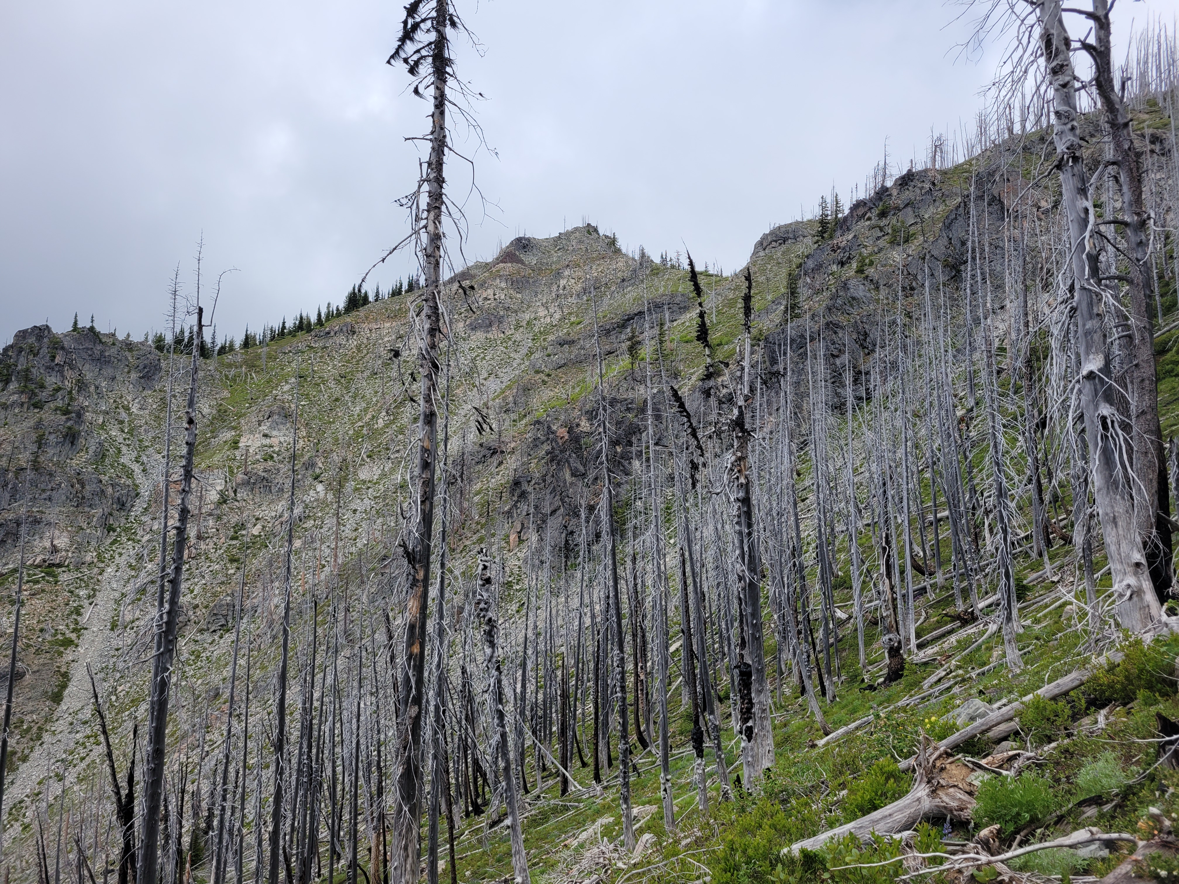
In stark contrast to flowers, this is where we started our journey
Yep, you heard me. I finally left the country. I had done Watersprite Lake as a ski trip years ago (never wrote about it) and entered North Cascades National Park from BC years ago too, but this was my first summer endeavor, and let’s just say I can’t believe it took me 10 years being out here in the PNW to go venture across the border in the summer.
Bonus loo on the Singing Pass trail
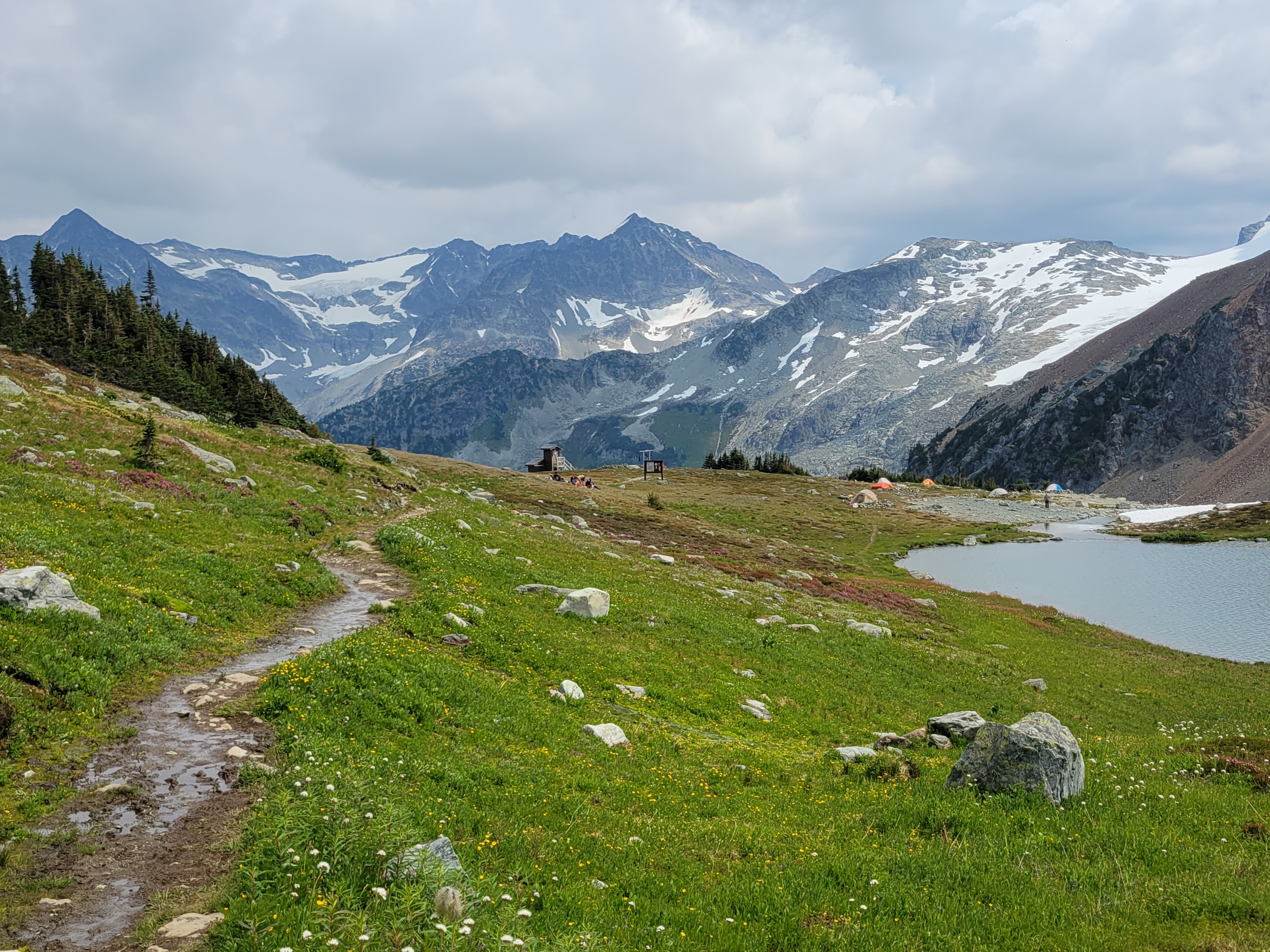
Let me set the scene. Sarah and I were wild-fired out of our original plan. We were driving back from a sunset hike the weekend prior, it was like 2 in the morning, every trip she proposes is something I’ve already done, I’m looking for novelty, and suddenly she says “well what about BC?” I’ve done practically nothing in BC. BC might as well stand for [I] Barely Care [because there’s so much to do in Washington] [and also the idea of an entire country of peaks is overwhelming so I avoid it because it causes anxiety]. She pulled up their national park website to see what camping permits existed. “Well, there’s…. one permit for Friday, and that’s the only permit in any park in BC until…. September.” “What’s it for?” “Russet Lake? Do you know it?” “Nope. Take it.” And then and there, she grabbed us the last remaining permit for campsites in BC all summer, and I guess we had plans. i5 was a dark desolate corridor save for two women cheering in a bright yellow SUV.
One of the few variations in the approach trail
I looked up Russet Lake on caltopo, and saw the dotted trail to Overlord Mountain. If a trail is on Caltopo that usually means it’s decently popular and well traveled. Trip reports for both Russet Lake and Overlord were underwhelming. Russet lake looked like it was just in a barren rocky basin, there was a hut right next to it which bothers me even though I know it’s amazing, and Overlord looked like a choss pile of a walk up, and there were no wildflowers to be seen. And the hike started at a ski resort. Whistler. Yuck. Spoiler: I was oh, so, so, so wrong.
Distance: 21mi including Overlord (something like that)
Elevation gain: 8500ft including overlord. 5500 for Russet lake if you do it backwards. Like 3500 if you do it as recommended.
Weather: 60’s and sunny
Commute from seattle: 5.5hrs? Oof.
Did I Trip: NO SIR
Attempting to capture layers of green
We rolled up to Whistler after one of the most casual starts I’ve ever had to any trip ever. Sarah was extremely patient with me during my hellacious work week when my socialization window was like 8:54-9:02pm, but I was 100% committed to taking Friday off and made it happen. Whistler was PACKED. Thumping music, mountain bikes everywhere, full face helmets on everyone, turns out it was CrankFest. We parked in a day lot and I paid for what I thought was 24hrs. I was jealous of anyone and everyone and felt like a dork with a backpack in the middle of the cool kids. We got in line for the gondola thinking we’d save ourselves mileage and elevation. $104??? For one trip up the gondola?! We laughed and started walking, looking for the Singing Pass trail. Yes, up through the mtb festival. It was signed, but I still felt SO out of place. Finally we were in the trees and not walking on an exposed road, though the “trail” was definitely still mostly a road. But that was nice because we could walk and talk easily. The trail gradually narrowed into a trail. We found a surprise outhouse maybe 3 miles in. We were perplexed by the zipline, thinking it was bikers, no, drones, no, zipline?! We walked below the peak-to-peak gondola. We admired the shades of green in the forest, and how perfectly graded the trail was, and how badly I wanted to be above treelike, and how boring this would be on the way out. At one point I realized why parking had been so cheap. It was free from 5pm to 8am. AKA I only paid for an hour, and would have to re-up in the morning, because it was a day lot, not an overnight lot. Well, shit. Worst case we pay the ticket I guess.
10/10 would be a bear here
Finally we hit wildflowers. And then more wildflowers. Heaven. Two hikers came down from the upper route (called Musical Bumps) that the gondola takes you to. “Are there more wildflowers that way?” we asked. “Eh, more like this” they shrugged. Well… they sound underwhelmed, but we’re stoked, so I guess we’re hiking out that way tomorrow. We carried on into subalpine, wildflowers and heather and massive glaciated peaks in the distance. Does everybody who has hiked this trail just suck at taking photos? Are you trying to keep it a secret? They must be trying to keep it a secret.
I mean come on
A short 2mi from the intersection with Musical Bumps and we stumbled upon one of the most dense paintbrush meadows I have ever seen in my life just before the lake. I mean the prior weekend was dense but I barely had time to frolic, this was just insane with bright yellow paintbrush that had yellow streaks and flowers of every color sprinkled in between. We dropped down to the lake knowing it was almost dark, and struggled to find a decent campsite. There’s a great one near the toilet but we missed it (and didn’t want to listen to people pooping all night). There’s a rack to hang bear bags, but we just buried our food in rocks in the boulder patch instead. Sarah asked “did you think we’d get here in daylight?” I laughed. “NOPE.” “Me neither. Funny we were both thinking that but neither of us said it out loud.” I was so happy with our timing. I had a scone for dinner and fell asleep pretty quickly, though I wouldn’t say I slept well.
Castle Towers over heather near sunset
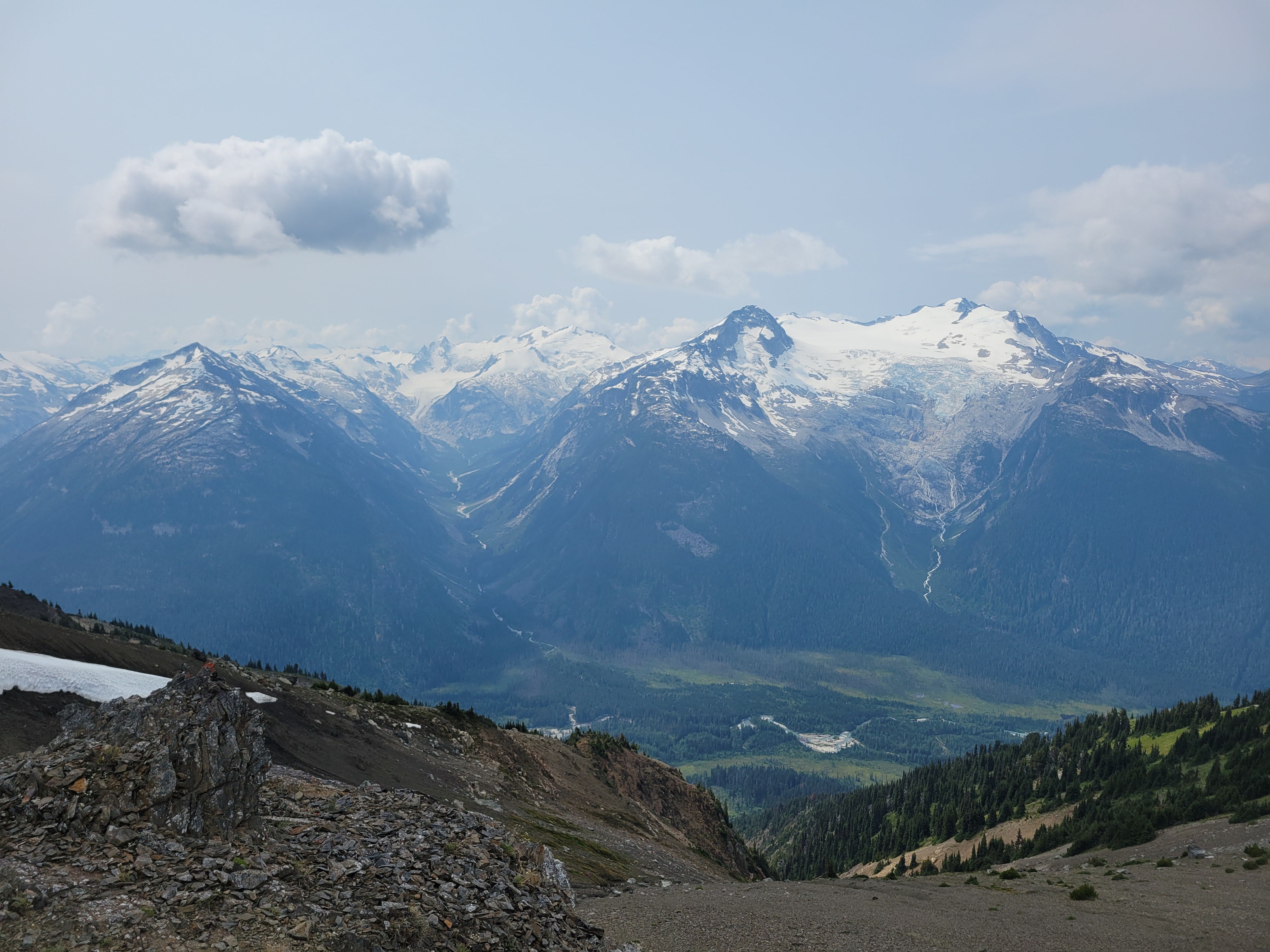
We were up around 7 the next morning, which is LATE for me (and even later for Sarah). Sarah had a leisurely breakfast and set up painting, I decided to “zip” up Overlord Mountain. Which I sorely underestimated. Prior trip reports said to expect 6-7hrs round trip from Russet Lake, but my famous last words were “it’s like 3.5k gain and 3mi, how long could it possibly take?” as I pranced off into the distance leaving Sarah to her art. I wasted time trying to traverse high rather than drop down to mellower terrain on the traverse from camp to Whirlwind’s ridge. I paid for the full day of parking with the shockingly strong cell service I had. When I saw the ridge to Whirlwind across a small valley I had an “oh shit, that’s where I’m going?” moment, but it comes up quickly and it’s not as steep as it looks. There’s also a trail nearly the entire way starting at the base of this ridge, which expedited things after my cross-country bumbling for the prior mile. There was a little tarn that I bet is beautiful when it’s melted out, and crystal clear streams gushing through the rocks off of the base of the glacier.
Woke up in (smokey) heaven
Castle Towers over the Cheakamus valley
On top of the first ridge, peaks started growing in the distance as I gained elevation. I nearly broke out into the Canadian national anthem I was so astounded by the beauty. I was making slow but steady progress, less than 2mi to Overlord but I knew the last mile would be the trickiest terrain. Whirlwind was really just a long slog, I snapped a few pics at the top before dropping down to the first of two saddles between Whirlwind and Overlord. I was waiting for the 3rd class scramble sections. After the first saddle, I hiked up and over another knoll, knowing that Refuse peak (something like that) was between me and Overlord. Refuse pinnacle? I can’t be bothered to look it up. Either way, it was almost entirely class 2, I maybe had to use a hand to balance once. But the ridge is fun, with huge views in every direction. After Refuse Pinnacle, it’s a walk on this really cool shale that sounds like walking on glass, like tinkling music (tinkling sounds like pee but you know the sound I mean), and then a long slog of a talus field with some snow patches to the top. O Canada kept morphing into the US national anthem in my head, and honestly I can’t think of worse songs to have stuck in your head. There is a climber’s trail the entire way from Whirlwind to Overlord. It’s sparse in parts but if you are used to boot paths you’ll find it.
Looking up at Overlord (left) from Refuse Pinnacle
The summit was broad and welcoming, I had some quick snacks and chatted with two other climber who were ahead of me before quickly turning around to head back down knowing Sarah was waiting for me. I had taken just over 2hrs to the summit, and was hoping to be back in 3.5hrs total. The way down went quickly at first, until I was just past Refuse Pinnacle and saw all of the other parties on the way up. I stopped to chat with each one (uphill has right of way so… yeah) and reassure some folks who were worried about the scrambley part. Finally past the people, I realized how much of a delay that had been and texted Sarah that I wasn’t going to be back until 12:40 despite an ETA of 12. I desperately hoped I was underpromising/could overdeliver and be back way before that.
Looking down on the Overlord glacier from the top
Yours Truly for scale
If you zoom in there is a blue dot, that’s another party headed up (Overlord summit behind the knoll)
Halfway up the saddle I turned around and saw the other parties. One woman waved to me and whooped which made me so goofy happy. I was DRAGGING. Coming over the knoll and realizing there was another 300ft of gain to the top of Whirlwind was crushing. But once on top of Whirlwind it was soft enough I could start jogging, and I knocked out the remaining 2mi in around 30min, getting back to camp at 12:15ish right as Sarah texted something politely conveying “I’m bored, hurry up, I’m ready to leave.” I packed up my stuff as quickly as possible and we were off to the paintbrush meadow. 6-7hrs round trip from camp my ass. Good to know I can still knock that out. I question my fitness constantly these days (which most people who know me are probably rolling their eyes at).
I cannot in good faith recommend going up Cowboy Ridge above Russet Lake where the meadow is because it is impossible to do without stepping on wildflowers. They are EVERYWHERE. There is no trail up there but the flowers are absolutely astounding, and I hear the lakes on the other end of the ridge are great for swimming, and the end of the ridge has a good view of the Overlord glacier. We did not have enough time to hike the full right, which is okay with me given the impact it’d have had on flowers 😦 Guilt quickly kicked in for me and we zipped back to the trail after just a few photos.
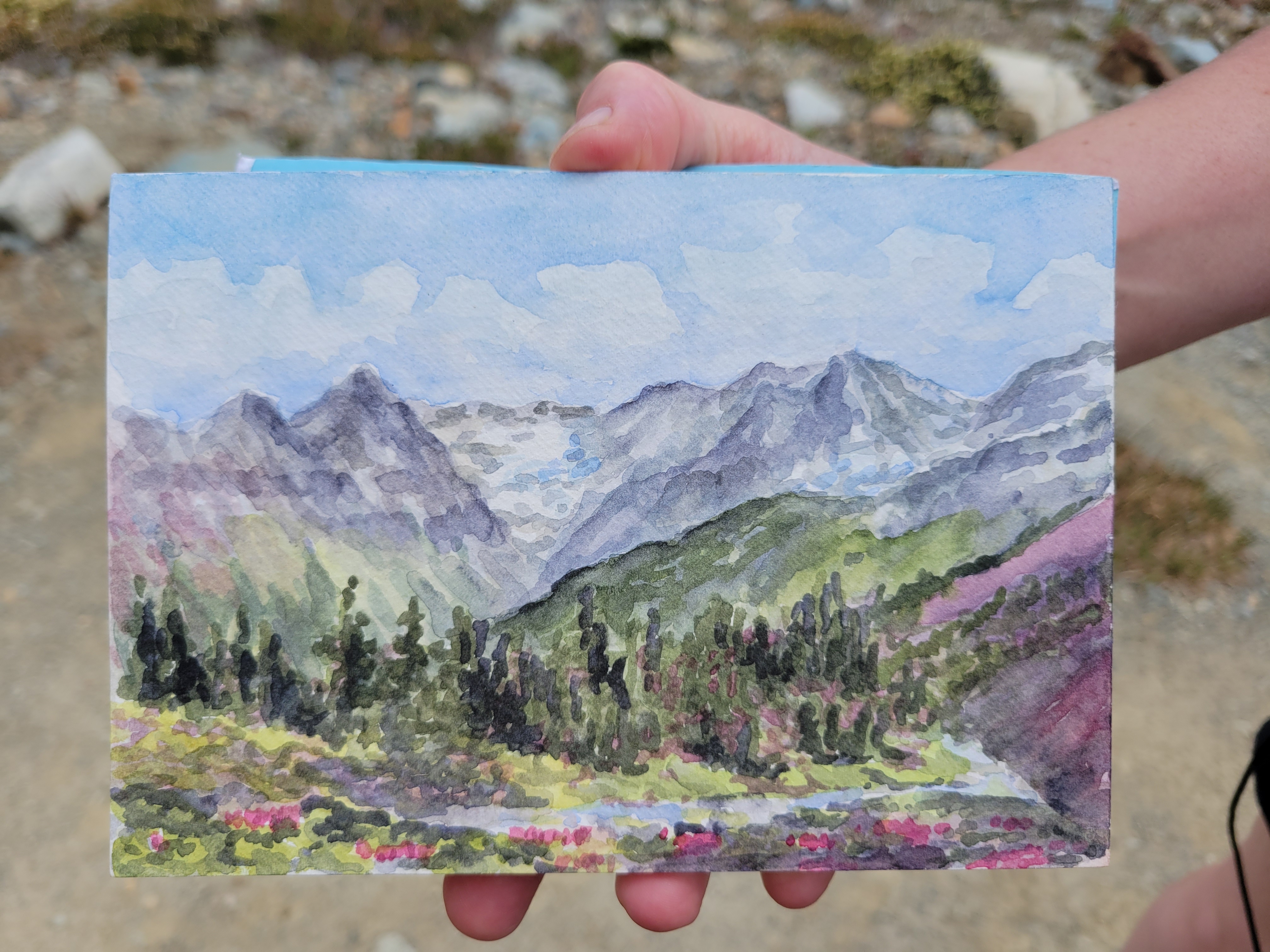
SARAH’S PAINTING omfg I freaked out when I Saw it. Will link to her site once it’s up. She did that at camp!!
Russet Lake camp
We retraced yesterday’s steps to the junction between Musical Bumps and the Singing Pass trail, and started up Musical Bumps. Let me be clear: we were doing this whole trip backwards. You’re supposed to take the gondola up to the top, then hike DOWN musical bumps to the lake, then hike DOWN the trail from Singing Pass back to Whistler. But we were banking on nobody checking for gondola passes because we’re cheap. And we were also banking on the gondola being open until 5.
The wildflowers continued to be absolutely phenomenal going though Musical Bumps. We are NOT fast hikers when flowers are involved. We probably looked like two off kilter toddlers chasing butterflies. I started collecting beta from passing hikers because we didn’t entirely know the way to the gondola, and my phone was dying, which meant no navigation soon. My legs were also DYING after knocking out Overlord and now this. Flat was fine, downhill was fine, uphill was tough. Getting the gondola was going to be tough at our speed. I made a joke to a passing hiker. “Yeah we’re trying to catch the last gondola out of here, gotta go!!” They lit up. “The gondola’s running until 8! There’s dinner at the restaurant so they’re keeping it open late!” Sarah and I burst out laughing. YEs!!!!! How was this working out so well in our favor? Spirits newly lifted knowing we could take our time, we plodded on through all of the gondola-carried tourists hiking with tiny day packs, envying their light loads (maybe that was just me).
It truly just kept going. Insane numbers of meadows.
Something something frosted tips
Even within ski resort boundaries the terrain is gorgeous. I wasn’t as annoyed by the lifts as I expected. That last mile to the gondola though was one of the slowest of my life. It just. Kept. Going. Every time I thought we had to have gone a half mile we hadn’t. I was soooo happy to finally get to the lodge. We popped into the bathroom, sought out concessions (specifically Diet Coke, which we did not succeed in finding), and got in line for the gondola. 5min later, we were in a gondola, high fiving because nobody had checked for a pass.
Three colors of heather in this one pic
Nearly back at the car, I said out loud “this HAS to result in a ticket right? I mean everything else has gone so perfectly… there’s definitely going to be a ticket on the windshield.” NO TICKET. We dropped our packs, chugged some diet cokes from the village, and headed back to Squamish to get ready for a day of dragging.
I cannot recommend Russet Lake enough, or Overlord behind it. Two extremely beautiful objectives, well maintained trails, incredibly accommodating campsites (the hut I think is $50 per night?). I am truly shocked I had never looked into any of this. I got exactly the novelty and adventure that I had been missing, with great company, and a trip that way surpassed expectations. Definitely hope to be spending more time in BC in the future.
Has anyone seen the movie Nope because that weird cloud is in like a dozen of my pictures from Overlord
Looking at Huckleberry from South Huckleberry. No more trail from here sorry!
Fireweed
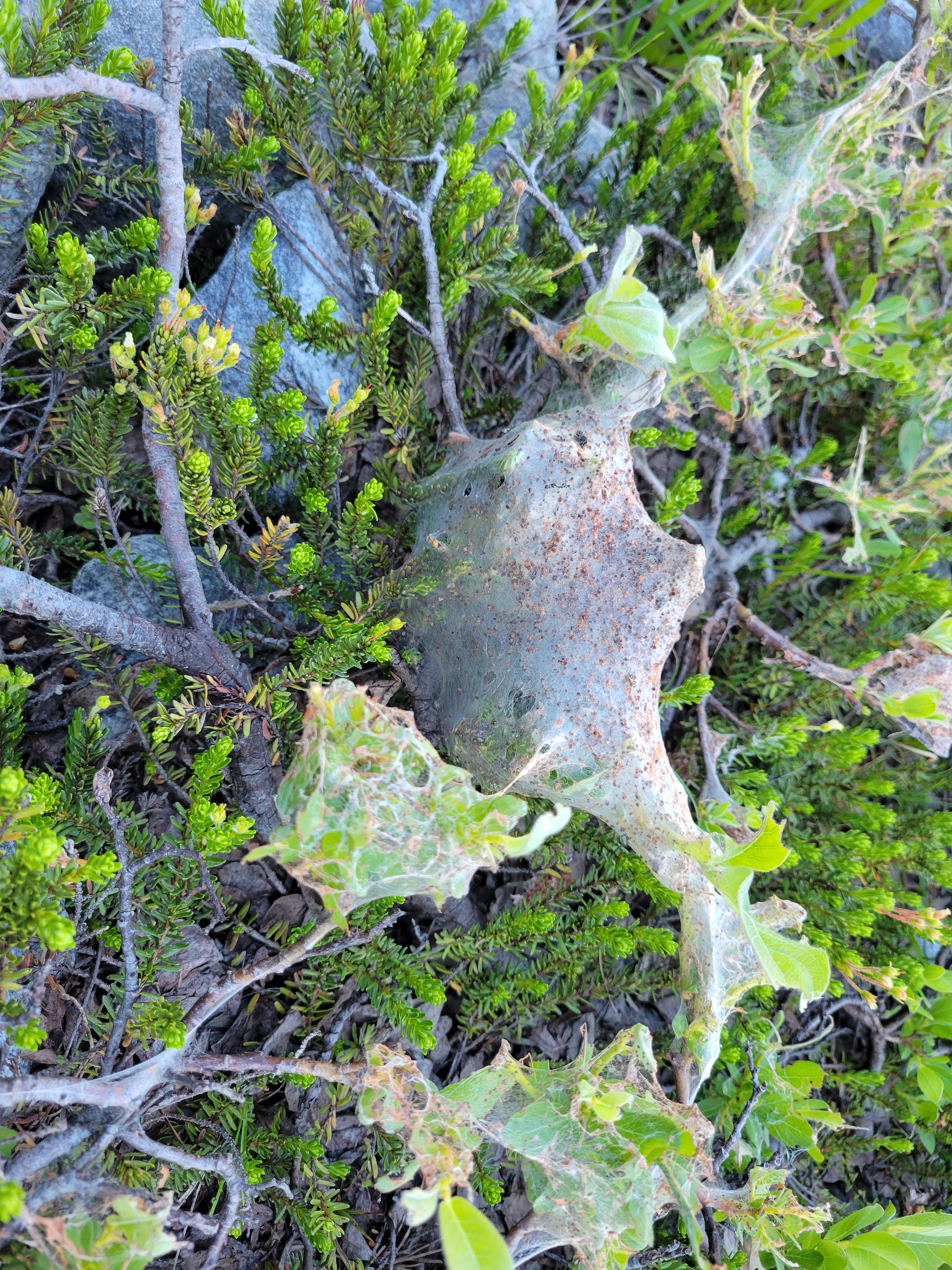
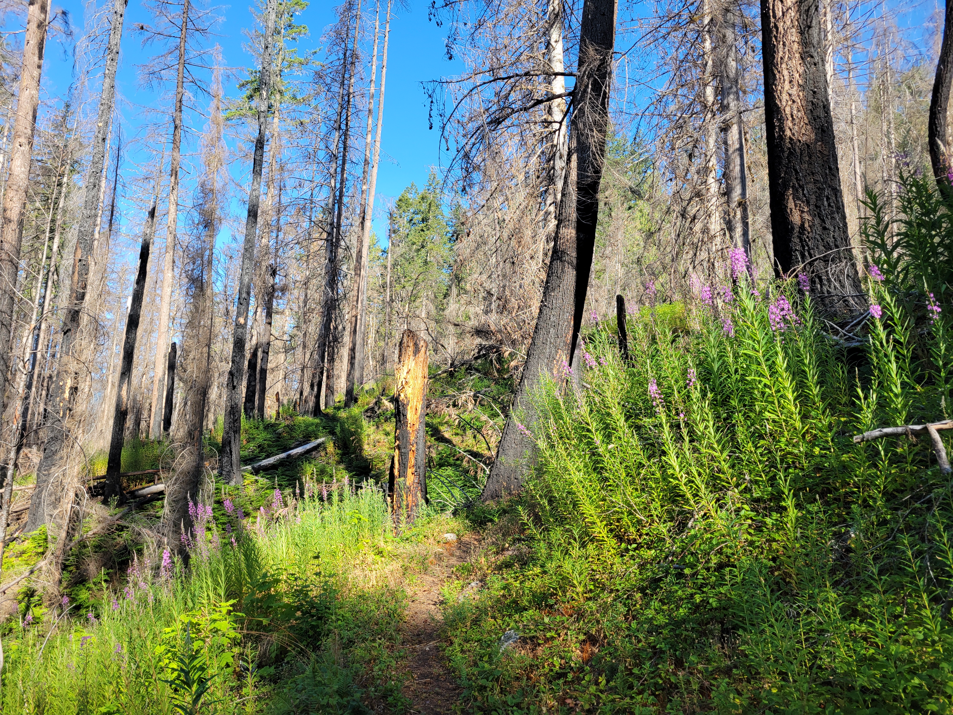
I mean this was the worst hike I’ve done in years. I realize I barely hiked last year so that doesn’t say much, and most of the years prior to that at least had good views, but oh man this was WAY more of a grind than I expected. I was overdue for a crappy hike, something had to cancel out with how surprisingly awesome Davis was two weeks ago. Seriously I should have bailed like 2mi in to save myself the trouble but you know how far stubbornness can take you. And to boot, I had bailed on this trail way back in maybe 2016, with one of my weakest bail reasons: spiderwebs. I never should have come back.
Distance: 13mi ALLEGEDLY. you can increase this by losing the trail 43598 times.
Elevation gain: 5200ft, highest point 5860ft. you can increase this too if you are clever
Weather: 70’s and sunny
Commute from Seattle: 2hrs
Did I Trip: no but like everything else went wrong
HOW IS IT ONLY 5,680FT TALL I don’T UNDERSTAND how it can take THAT MUCH EFFORT AND still be SO LOW. Ok so to get to the point.
Green regrowth along a creek
The things I hated:
1) I forgot about the fire. Ok that’s my own fault. The first ~5mi through burn zone have had a LOT of impressive work done though and are actually not that bad in terms of burn fallout. 2) Swampy sections 3) Stinging nettle 4) No open views until like the last half mile 5) Minimal flowers 6) Past the burn zone, the trail is disconnected at best and nonexistent at worst. And the bushwhacking isn’t great. All waist high brush ready to shred your legs 7) I wore shorts (see points 3 and 6) 8) The longest switchbacks I have ever seen. I’m not on a bike just get me to the top come ON 9) Spiderwebs. The fire did not destroy their real estate, those fuckers 10) oh also i forgot maps of any kind
The good things:
Mossy regrowth starting in sections
1) Not kidding about the work done on the trail up to a point. The lower few miles were actually brushed (as in someone trimmed the brush on either side nice and short) I should have counted recently sawn logs (hewn?). Someone’s putting in some serious effort and I hope they continue to the top. I am convinced no trail ever existed between South Huckleberry and Actual Huckleberry. (edit: I’M NOT CRAZY) 2) Blackberries? The non invasive kind? They were small, but utterly delicious. 3) Burn zones are cool, and this one had a TON of variety and fascinating boundaries between severe burn and fresh green growth 4) The few views up there are pretty good 5) Great workout 6) No people (WONDER WHY) 7) Alki bakery makes great scones and I had one (I almost put this on the bad list bc I ONLY had one, but let’s practice gratitude over my default state of gluttony) 8) The Suiattle River Road is in great shape and drives REAL nice right now
Old Glacier Peak Wilderness sign
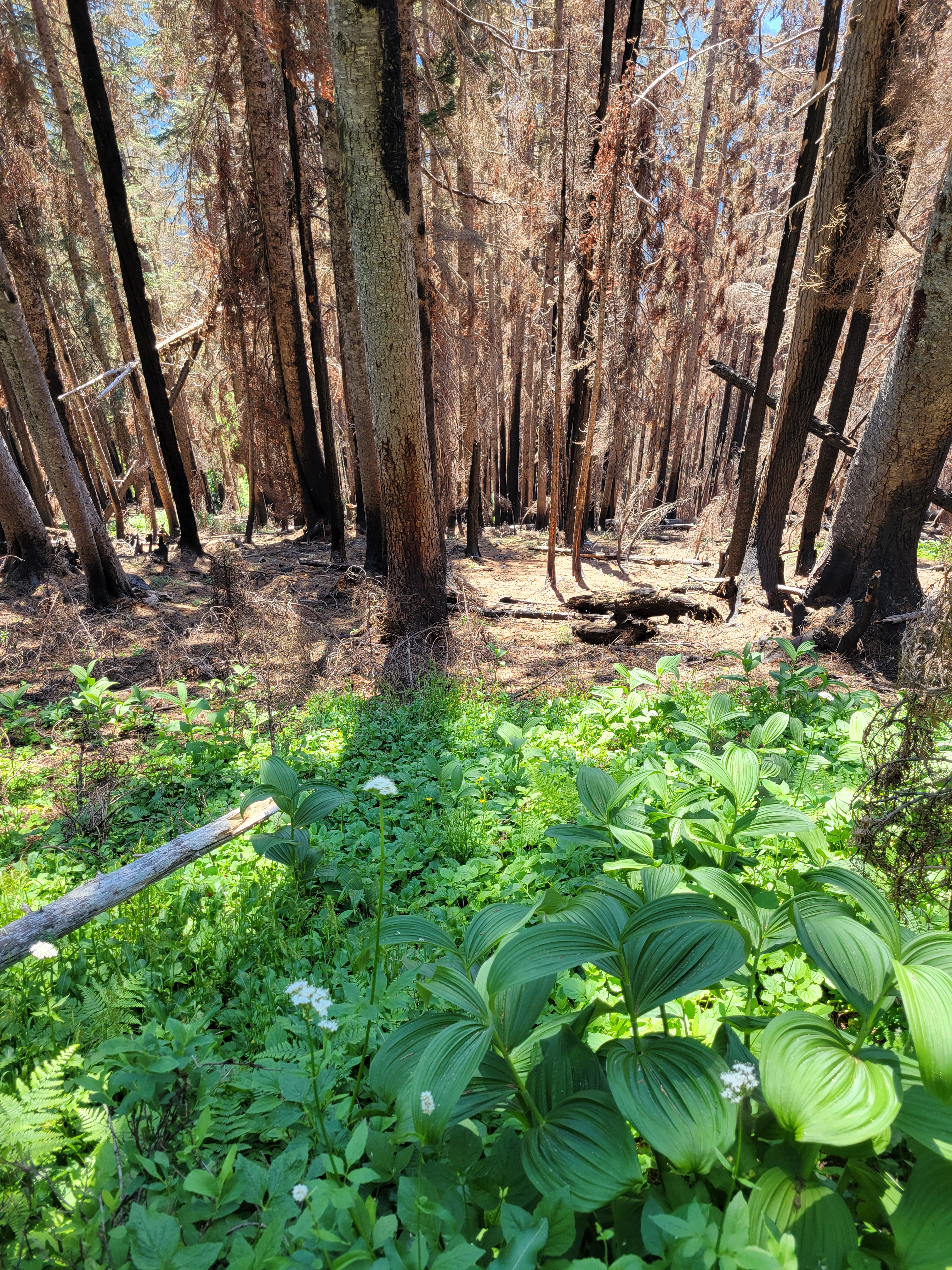
Aaaand now to the actual conditions. You enter the burn almost immediately. Stages of intensity (and how much has regrown) vary widely. I was thrilled to see that the trail had been brushed out and was way wider than the last time I had been (the fire helps with that too). Fewer cross-trail places for spiders to set up shop. OH WAIT. Where there’s a will, there’s a way. I fended the worst ones off with poles and a prior hiker had taken down a few for me. The prior hiker was a steady old guy who said it was great when I ran into him on his way down around 9:30am, which I took as encouraging at the time, before eventually realizing he must not have made it all the way to the top, or he has the gift of human flight.
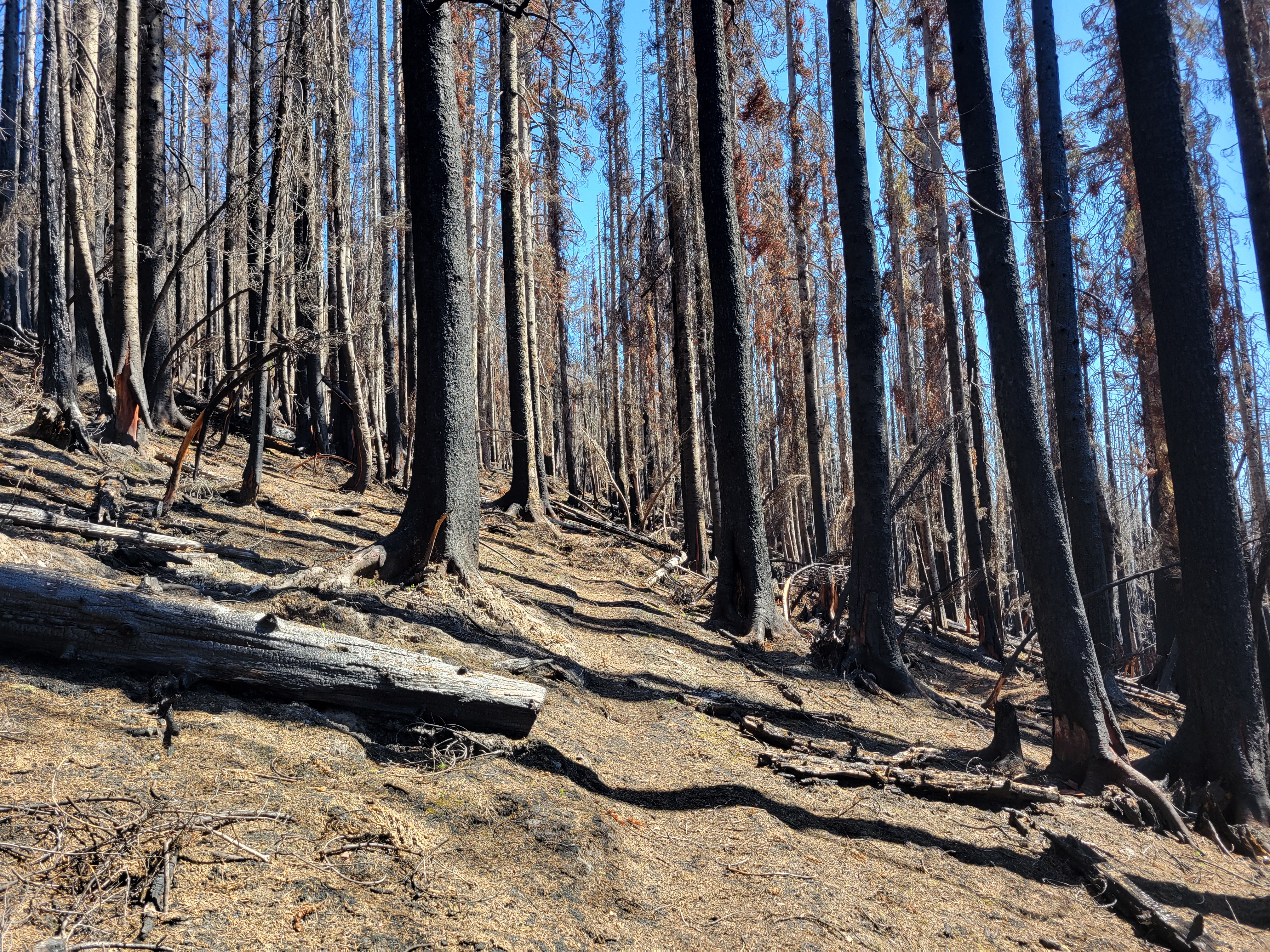
This was in the open forest burn zone. There were patches of fireweed, but most had not bloomed yet and was just green. There was also dark desolate feeling burn in the forest, a stark contrast to the fireweed/nettle/grasses combination. The easy moving was a relief. Every swampy step or brush with nettle or spiderwebs had me cursing GET ME BACK IN THE HARSH BURN ZONE. Since I did not have any maps, I had no idea how far in I was, and assumed I was way further than I actually was, so I persevered. The somewhat burned zones turned into a completely desolate burn zone around 5mi in after entering the GPW (needs a new sign). This is where the trail started to disappear. It survived most of the burn, but can be tricky to follow. Fortunately a tiny glimmer of cell service had come through and I had loaded two maps.
The desolate section
The next half mile is a crazy mix of desolate burn and thick green brush with zero gradient, just a 0-100 type swap within an inch of ground. The contrast is crazy. The trail is on a super steep slope and has been eroding, so you’re walking on some 6″ at BEST tread mostly under brush. I imagine this will be shoveled/widened/rebuilt in time once whoever is crushing the trail building down low gets to it. After this mildly tedious traversing you break into a meadow (with no flowers, add insult to injury) and probably promptly lose the trail. Welcome to the wilderness. The meadow is easy. Walk straight across and up the shoulder and you’ll recatch a section of trail along the edge of the trees above you. In another 100ft you’ll lose it. Drop some elevation to skirt obvious cliff bands. Maybe you’ll hit a flat meadow with a meandering stream, maybe you won’t. It’s a good landmark though. At the meadow start to re-gain elevation, you won’t find a trail anywhere so just look for the path of least resistance, which will be knee-to-thigh-high huckleberries (that don’t have berries yet). They aren’t bad, unless your legs are already covered in stinging nettle burns because your dumb ass wore shorts.
A brief patch of trail in the meadow. Don’t get excited it dies out soon. But hey, views, finally!
Stark line between growth and burn (and yes that is the trail)
You’ll finally break out into another meadow, which you can walk straight up again, scouring for a trail but never finding anything besides short stretches that are probably just game trails and one suspicious short switchback just below the summit after hundreds of feet of nothing. Oh and the summit has trees. Great views to the north and west but the south is blocked. By trees. But there was a lookout tower there from 1935 until 1962, so someone could peer over the trees, maybe. It was burned down in 1962, not for any official reason, just people being mean. You can still see some lookout remains. The usual shattered glass and some metal wires.
At this point I was nearly 90min later than I expected to be, so I snapped pics, contemplated my life choices that I would have to relive again on the way down, and started off. In like 15min I was back just above the meadow with a stream, and I started to regain elevation. Except I gained it trending too far right. And ended up over some cliffs. I tried to scramble down, but it got too mossy and sketchy so I climbed back up. I thought I could go up and over this knoll, but 15min later I found myself cliffed out in three directions. Tucking my tail between my legs I lost the few hundred feet of elevation I had gained fighting through shrubs and dropped back to the meadow, relying on the map to show me the way. I thanked every landmark I remembered. Thank you, downed tree. Thank you, nice flower. Thank you, snow patch I rubbed all over my body. Thank you, stupid meadow with no flowers. Oh hi butterfly fluttering by.
Another stark contrast
I was so happy to get back to the burn zone where the trail was suddenly a miraculous highway I could cruise down, plowing through spiderwebs and nettle and shin deep mud. A deer even followed me for a while, freaking me out. Shouldn’t she be scared of me? I was so done with nature at that point I just yelled at her. JUST LET ME BACK TO MY CAR! I KNOW IT’S A NICE TRAIL I DON’T WANT TO GO OFF IT EITHER BUT YOU’RE NOT GONNA WIN THIS I am glad she seemed too dumb to charge me bc I’m sure I’d have found a way to be the first hiker killed in a deer attack in the history of hiking.
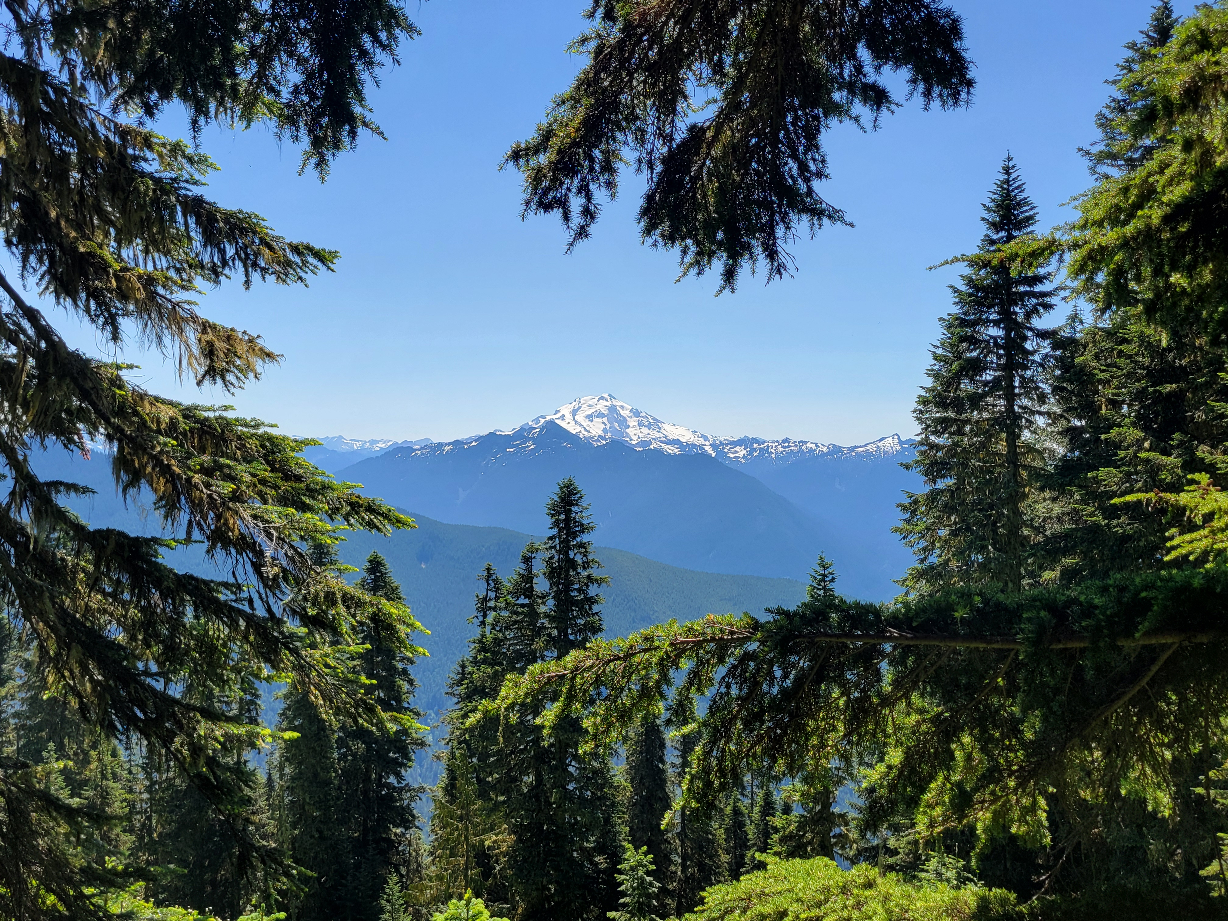
Glacier Peak frame
The last bit of trail to the car was the stupid cherry on top of a stupid day. It like swirls like a MTB trail rather than taking you to the car. I was dying.
I did just find out the trail is intended for horses. At least until the bushwhack? But that explains the absurd switchbacks. Ohhhh my god. Just go if you have a horse or donkey then you’re above the nettle and swamps and the horse will take care of spiderwebs.
That is all.
View of the Buckindy Traverse from the top of Huckleberry
No wait one more thing. From an old drafted post that was never published about my first trip to Huckleberry :
“Well, this day was rock bottom. I was solo. I wanted elevation gain. I decided to go check out Huckleberry off Suiattle River road. I started hiking. I had forgotten poles. I ate a spiderweb. Cool, breakfast. And then another. And then a third. And then they were all over my face. And getting in my hair. And wrapping around my wrists. I started dry heaving with every one that touched me. I battled them with sticks, but you can’t actually hike 8 (did this used to be only 8mi? no way) miles waving sticks around, that’s ridiculous. And feeling the resistance against a 5′ long 1” thick stick means they’re legit webs. And finally, after a particularly thick, yellow, stick face level monstrosity that blew onto my face in the wind despite being wrecked with my branch small tree, I waved the white flag. Fuck you. I hope no bugs frequent this trail. I hope another braver, stronger, fearless hiker comes and ruins all of you. But in the meantime, I guess I’ll go hike Sauk Mountain, where I know the masses have already destroyed every web.
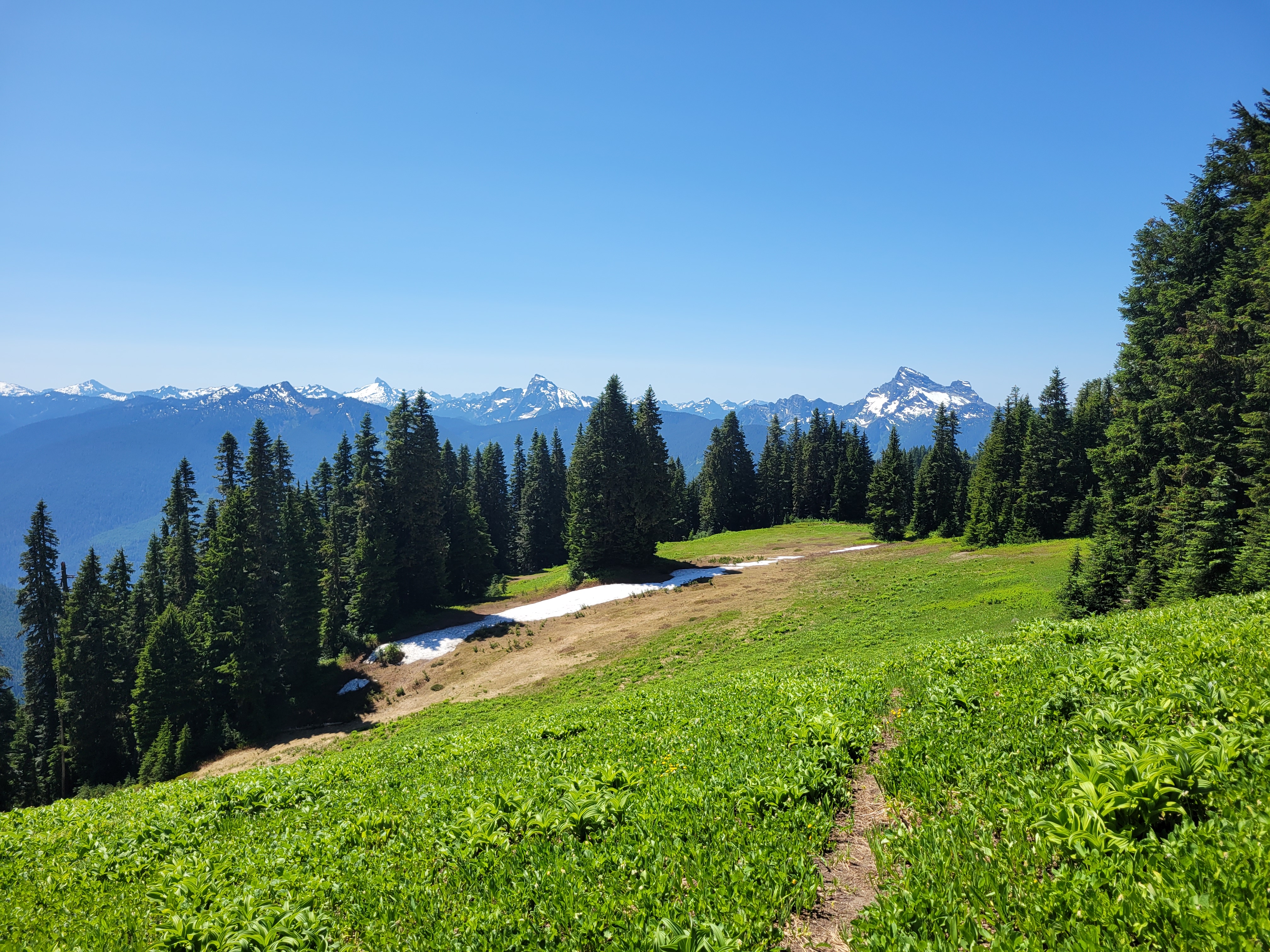
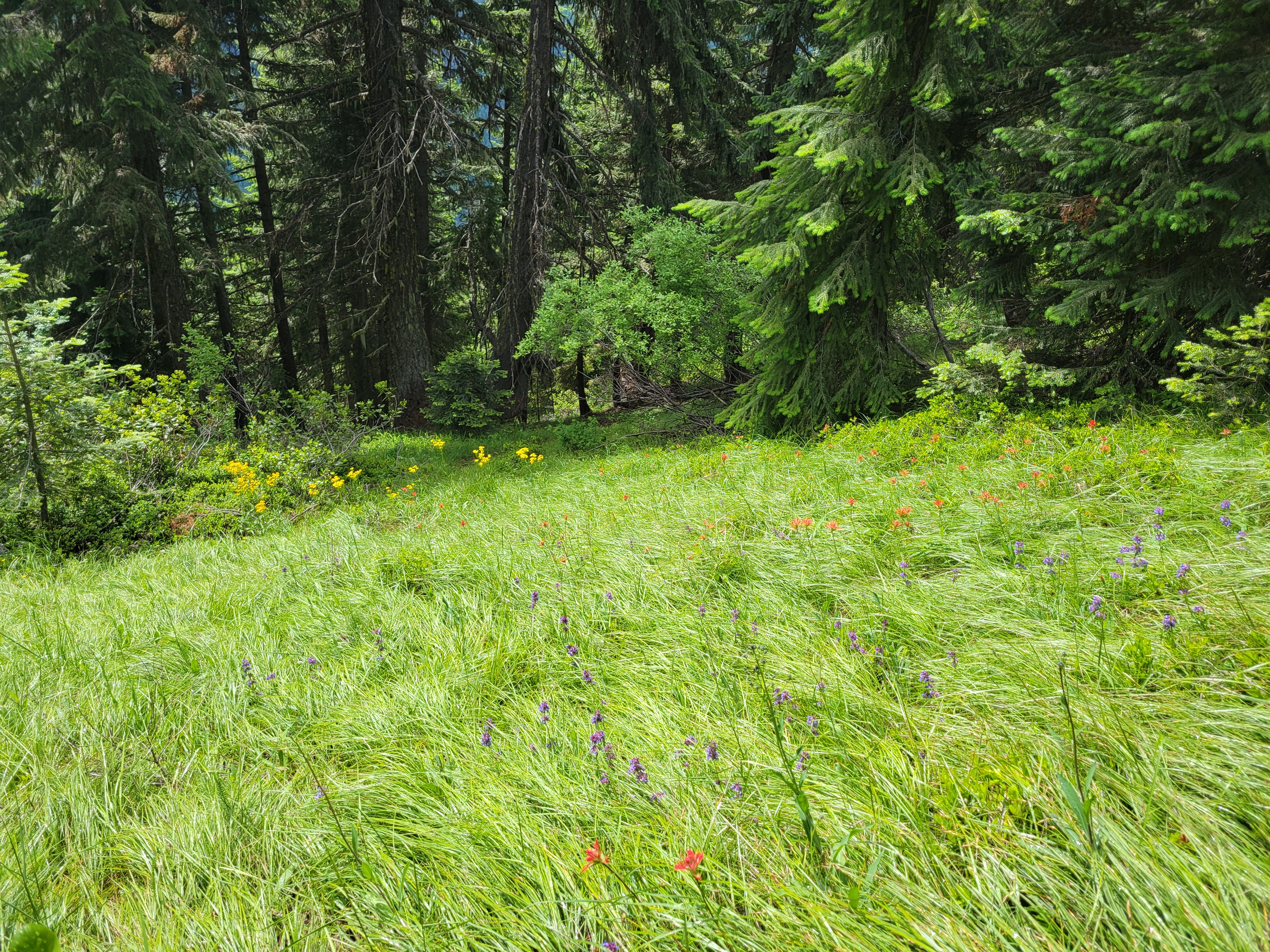
Holy cow what a surprise. Davis had been low on my to do list for years, looked like a good workout but nothing very aspirational. WOW was I wrong. Nobody told me this is a wildflower paradise! I stumbled into a fairytale! And almost entirely by chance.
Distance: 10mi
Elevation gain: a nice clean 4000 (6400ft highest point)
Weather: 60’s and everything
Commute from Seattle: 2hrs eastbound, 3hrs westbound as i90 gets more crowded
Did I Trip: no
Ocean of grasses and wildflowers
I left Seattle very lazily around 7:30, maybe 8am. I stopped in Roslyn for bakery treats and a second earl grey tea. I wondered why I didn’t do more casual weekends staying in a small town and enjoying breakfast and doing day hikes in the area. My objective was Paddy Go Easy Pass, a more casual 6mi jaunt, an excuse to get out of the house. It was raining in Seattle, cloudy and raining all through the pass. Roslyn was sunny, but the mountains north looked socked in. I could see Davis fully, but every other ridge was socked in as I drove north on Salmon La Sac road.
Oh we’re getting serious now
I turned off the paved road onto the dirt road. Oh boy. I was still 30+min from the trailhead, and driving on the one road condition my car cannot handle (barring sheer ice). Washboard. Even in 4WD the tires spin, the car crabs, and I’m left steering into fishtails as if I were on sheer ice, except with shaking and rattling and a general feeling that the car is about to fall apart beneath my legs. Oh, and my fresh earl grey? Yeah that was immediately all over the center console. I nearly threw a fit. The Davis trailhead was the next trailhead I’d pass, and I pulled over and said eff it, I’m doing Davis. Not driving another 30min of this shit just to potentially be socked in anyway.
Ready to start a rampage with no plan (fortunately I did have a map, somehow) I stomped off towards the trailhead. You have to walk down a road more! You turn off the main road, head downhill, pull over in a small lot, then walk down the road further to a campsite where the trail starts. There is a sign so you won’t be completely lost. You cross the big river on a bridge, and then… heads up, you don’t see water again until you’re back at the bridge on your way down. Bring plenty.
Wildflowers haven’t regrown much here yet
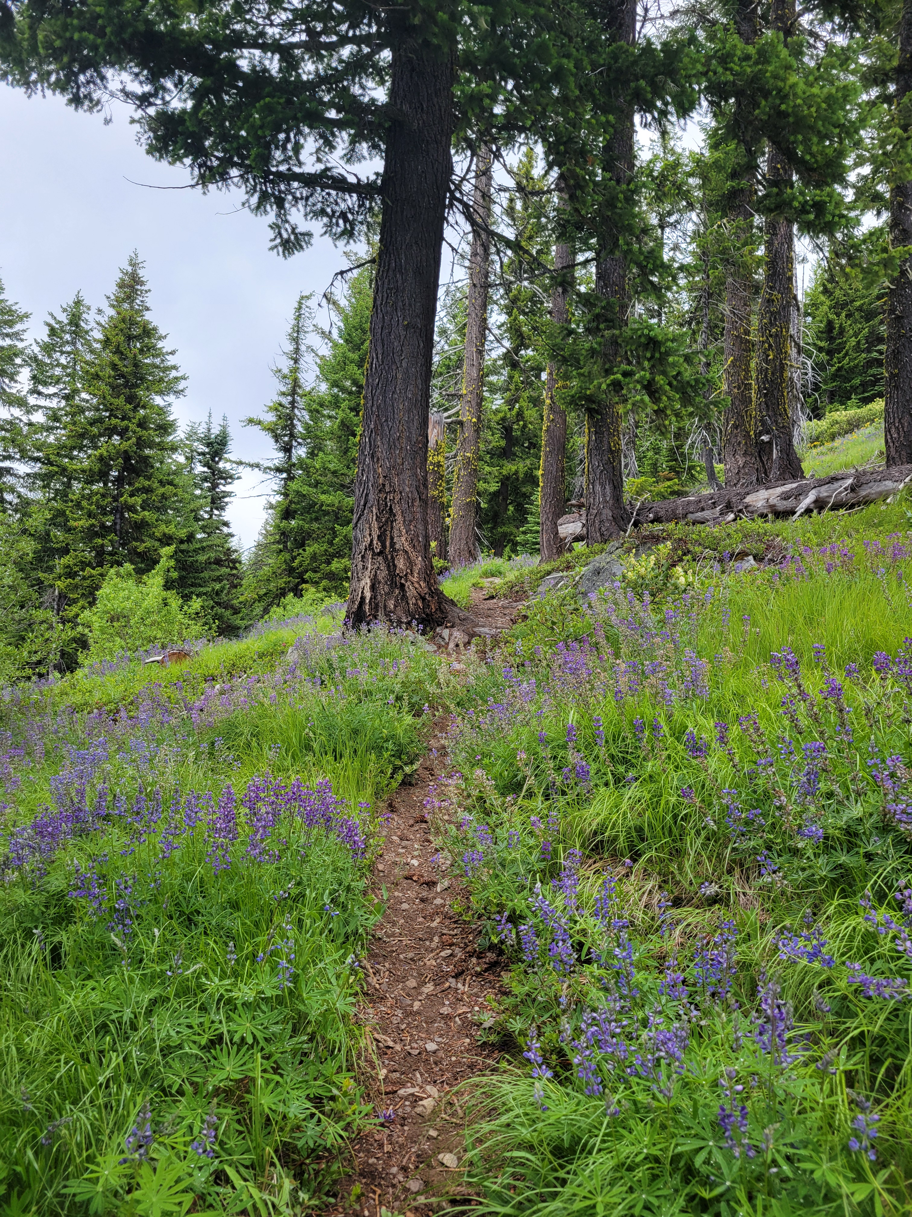
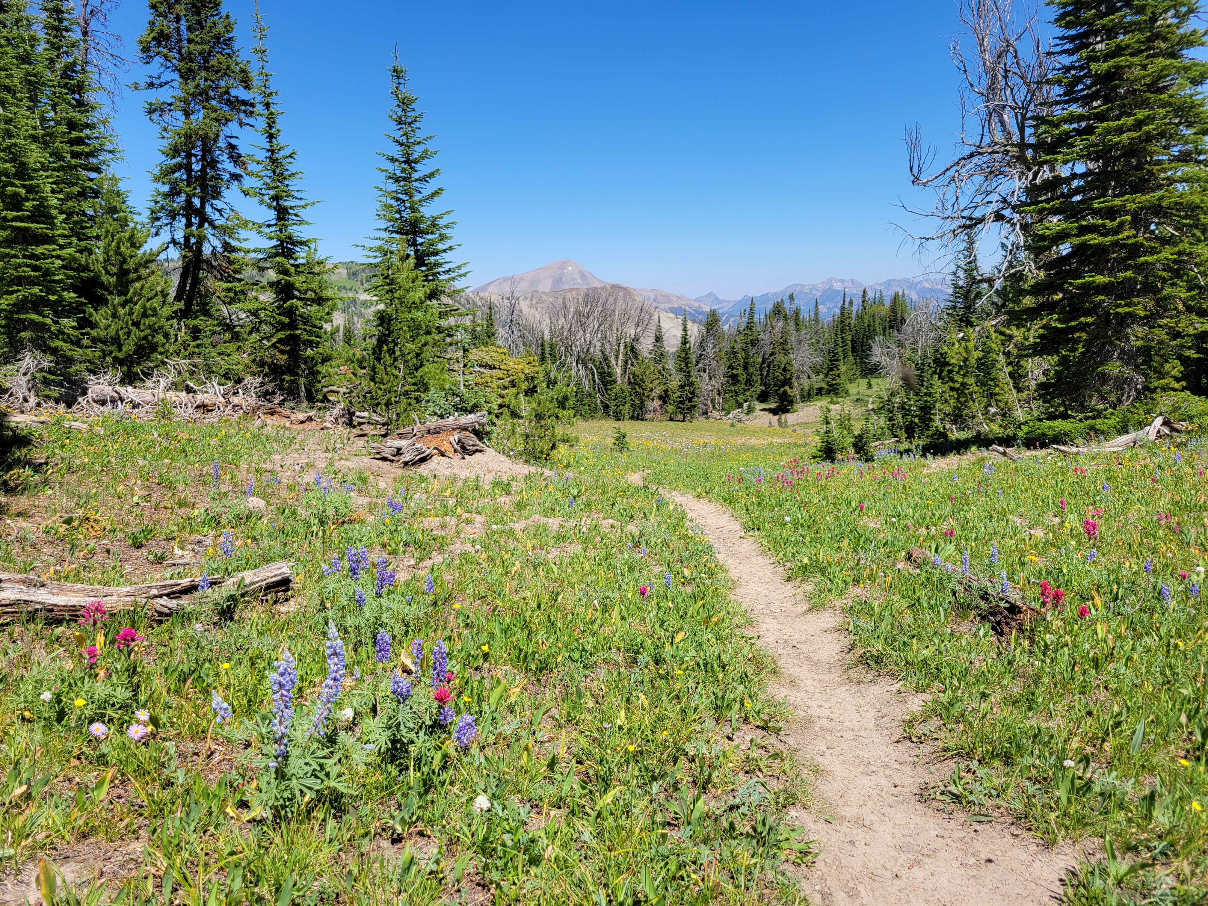
The trail is like 1000 short uphill switchbacks forever. My grouchiness dissipated as I had to focus on trucking uphill. However, the scenery changes every mile or so, keeping you interested. Open forest (I took no pics of that), then burn zone but with tall bushes, then BOOM DISNEY PRINCESS WILDFLOWERS I was bewildered! I had NO idea this was even a wildflower objective. I giggled at one switchback realizing it meant I’d get to go right back through an enormous field of flowers. I was in disbelief. A friend pointed out years ago that part of an awesome hike/climb/anything is being surprised by the scenery, and how that makes a 7/10 trail a 11/10 because you didn’t see it coming. This definitely fell into that.
Burn transitions to flowery rocky ridge
Forest and flowers eventually gave way to a more open recovering burn where not much regrowth has happened yet. A few baby lupines, not much else. But this section was followed by a rocky right with some short grasses and a smattering of more wildflowers!
After a few minutes on the ridge, the trail drops down into the forest to the right. If you start heading up a steep rocky “trail” trying to maintain views you’re probably off route. There are branches blocking this trail, but I thought they might genuinely just be blow downs given it’s early season. Nope, they were intentional. Fortunately I figured this out before wasting too much time, refound the trail, and headed into the forest trying not to be too disappointed I was about to lose views. And I hate to say it – if I had not heard voices below me, I have no idea how long it’d have taken me to realize I was definitely off trail. The WTA descriptions clearly mentions this, I just… didn’t read it thoroughly.
If you get this view, turn around because you missed a turn
The forest basin section goes quickly, and soon enough you’re switchbacking up another knoll, breaking out at a lookout site ALSO ridden with wildflowers! Two women asked if I wanted them to take my picture, I said no thanks and plowed ahead before realizing wait I should offer to take their pic (of course they said yes). I explained I was just so in the zone I was not thinking socially. They laughed. “We’ve all been there.”
More awesome meadows next to the lookout site
You could bivvy at the lookout site
Trail to the true summit follows the left ramp
The last half mile to the true summit crawls along a ridge line with almost a scrambly feel. The actual summit probably has spectacular views on a clear day, but all the big peaks were shrouded in clouds. You finally get a view of some lakes. It is the Alpine Lakes Wilderness but 99.9% of this hike had NO LAKES. I had an amazing lemon jam pot, didn’t even know what that pastry was when I bought it but WOW is it delicious. Shout out to Red Bird Cafe.
Oh theeeere are the lakes. And where the views should be.
The way down was uneventful. The wildflowers blew my mind all over again. I watched rain squalls threaten to come over but only got drizzled on once. It was really like Davis was in a patch of dry and occasionally blue sky, and everything in every direction was getting rain. It couldn’t be perfect though, I sat in dead stopped traffic on i90 for like 35min. WA’s highways can’t handle weekend traffic, i90 and 2 are both shitshows. I swore after this that for the rest of the summer I’d only do hikes north via i5 or highway 20, no more i90/highway 2. We’ll see how long that lasts.
Wildflowers with Hawkins in the background, where I just was earlier this month!
The itch to blog. It’s been rare lately, partially due to a combination of my job involving far more writing than it used to, and partially because content has been scarce. But it actually hasn’t been that scarce, I’m sitting on at least six reports from last year, I’m just so sick of computer screens and writing documents by the end of the day why would I go home and write more? But I forget that writing these is nothing like my work docs. I can swear. I can add pretty pictures. I can make fun of friends. I can reread them later when I am bored or want to pull up a cool photo. I have something like 12,000 photos on my phone and it’s getting bad. Blogging forces me to back them up somewhere and select only the best.
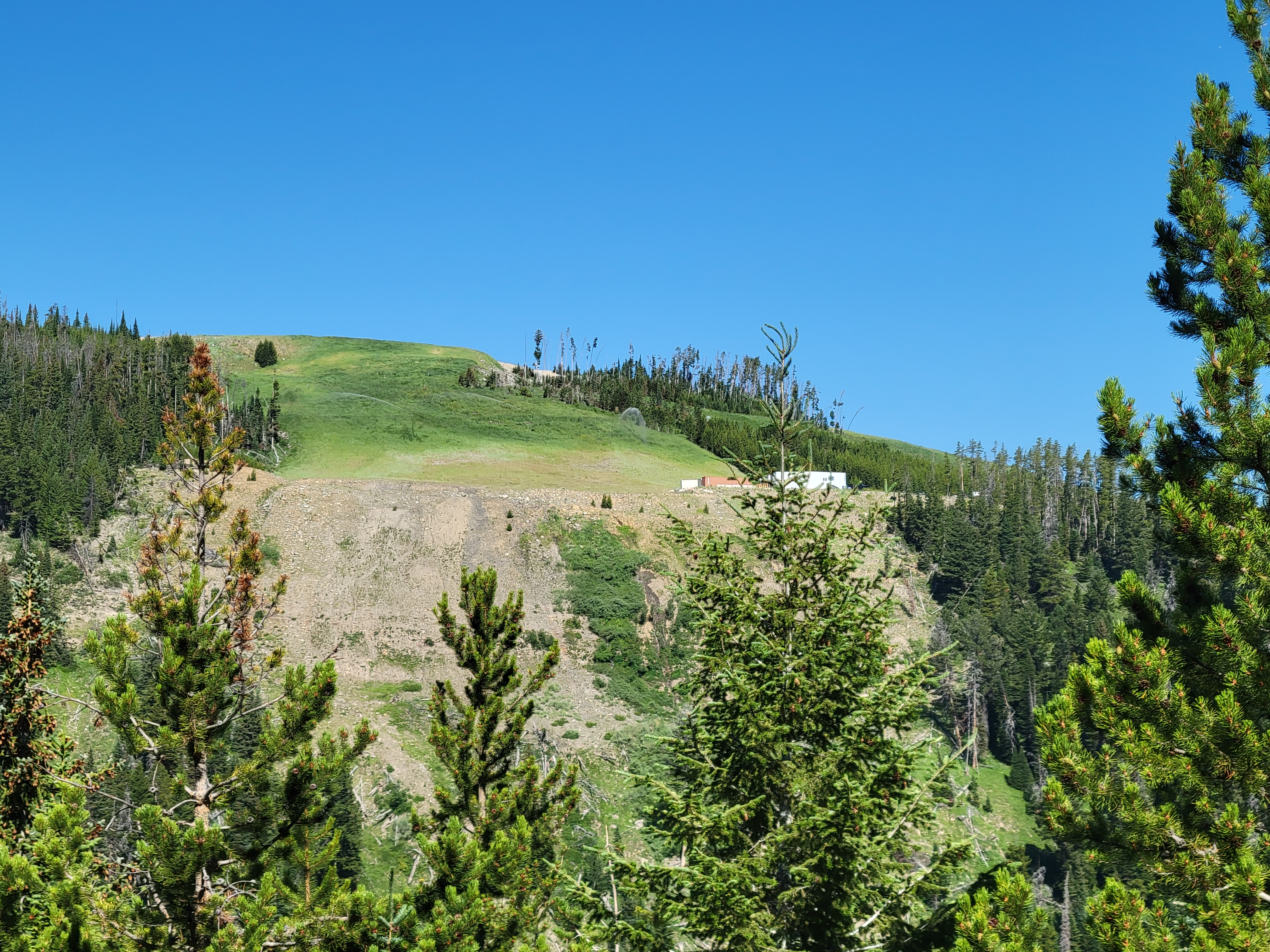
Spot the cabin
AND SO. Here’s a shortie. Today I hiked Hawkins Mountain. I say hiked, but that’s an understatement, there are plenty of places to get off trail, confuse game trails for the trail you want, fall off a cornice, fall down some rocks, or even get sucked into going down the wrong ridge. Or end up with a flat tire on your car, or a 34th dent from backing up into a rock (I did one of those two things). But there was nobody there, the views were spectacular, and the trail/route is interesting the entire time.
Distance: 10mi round trip
Elevation: 3,300ft gain (7,100ft highest point)
Weather: 60’s and sunny
Commute from Seattle: 2 hours
Did I Trip: There were no witnesses…. but no, no I did not
Sneak peek… of a sneaky peak? I’ll show myself out
I started later than I planned because the cat was out overnight. She finally rapped on the window at 7am and went straight to sleep like an unruly teen. I was out of there at 7:30 and at the trailhead by 9:45, moving by 10. The road to the trailhead is sketchy after the last intersection (~1/4 mile from the trailhead). Better to park there if you are in a sedan, or don’t want to deal with a parking area that fits 2 cars with barely enough room to turn with a deadly drop all along one side. I think it could fit 3 if everyone was there to coordinate.
Sparse trees along the ridge
The trail at first is a bike trail that’s nice and clean and well graded. After about a third of a mile, you turn sharply left on a… bootpath at best. It switchbacks (switches back?) up to a ridge, wrapping around downed trees, intermingling with game trails. Some areas are easy to follow but it’s also easy to get off route if you aren’t paying attention, especially on the way down. It’s quite bipolar really, from areas with downed trees or rockslides and you have no idea where exactly it goes but you find it on the other side to stepping over a log only to find someone nicely built rock stairs on the other side to make the step smaller. Fortunately it’s all very open easy terrain, albeit steep. I was surprised at how many off grid (I assume) cabins were back there, including one on a knoll directly across from the trail. No idea how to get there, but wow what a spectacular location.
You eventually gain this rocky outcropping with a great view of Davis and the Goat peaks across the valley before the trail takes you further up to a legit ridge, where you follow the ridge for the remaining few miles. The trail comes and goes, but you’re following a ridge so no biggie. Most of the snow was melted out save for a few patches, but I could see the upper ridge developing massive cornices in winter, though I bet the area would be a phenomenal backcountry ski. I skirted as many snow patches as I could to the right before finally being forced left to gain the last ridge before the summit, where I scrambled mostly on rocks unless forced onto the snow. I didn’t come up here to be that solo hiker who was present for the one freak cornice breaking way far from the edge.
Looking back along the ridge to Davis and Goat Peaks
I was at the top just over 2hrs from the car, eyeing a pile of rocks suspiciously for the last final steps. You look like where I’d hide a summit register, if there were one here. There was! An old school brass one, too. I took a nice 20-30min break, crushed a surprisingly amazing scone from Alki bakery, and decided to pick my way back down.
As usual, going down was way easier and faster than up, except for when I stayed too far left and nearly descended the wrong right. I was plunge stepping down snowfields and soft easy scree thinking to myself wow I don’t remember so many untouched fields on the way up…. wait a minute. And looked to my right. At the ridge I was supposed to be on. Fortunately they hadn’t fully separated yet, so with some quick sidehilling I was back on track, but yikes. Hope the two women I saw an hour later didn’t follow those tracks.
Looking north up the Salmon La Sac Valley
There were 10,000 deer prints. I followed them most of the way to the top, in fact, that’s how consistent they were but didn’t see a single actual deer. The only wildlife I ran into was a ladybug, two grouse, and what appeared to be a weirdly fat lizard with a stumpy tail (still not sure about that one).
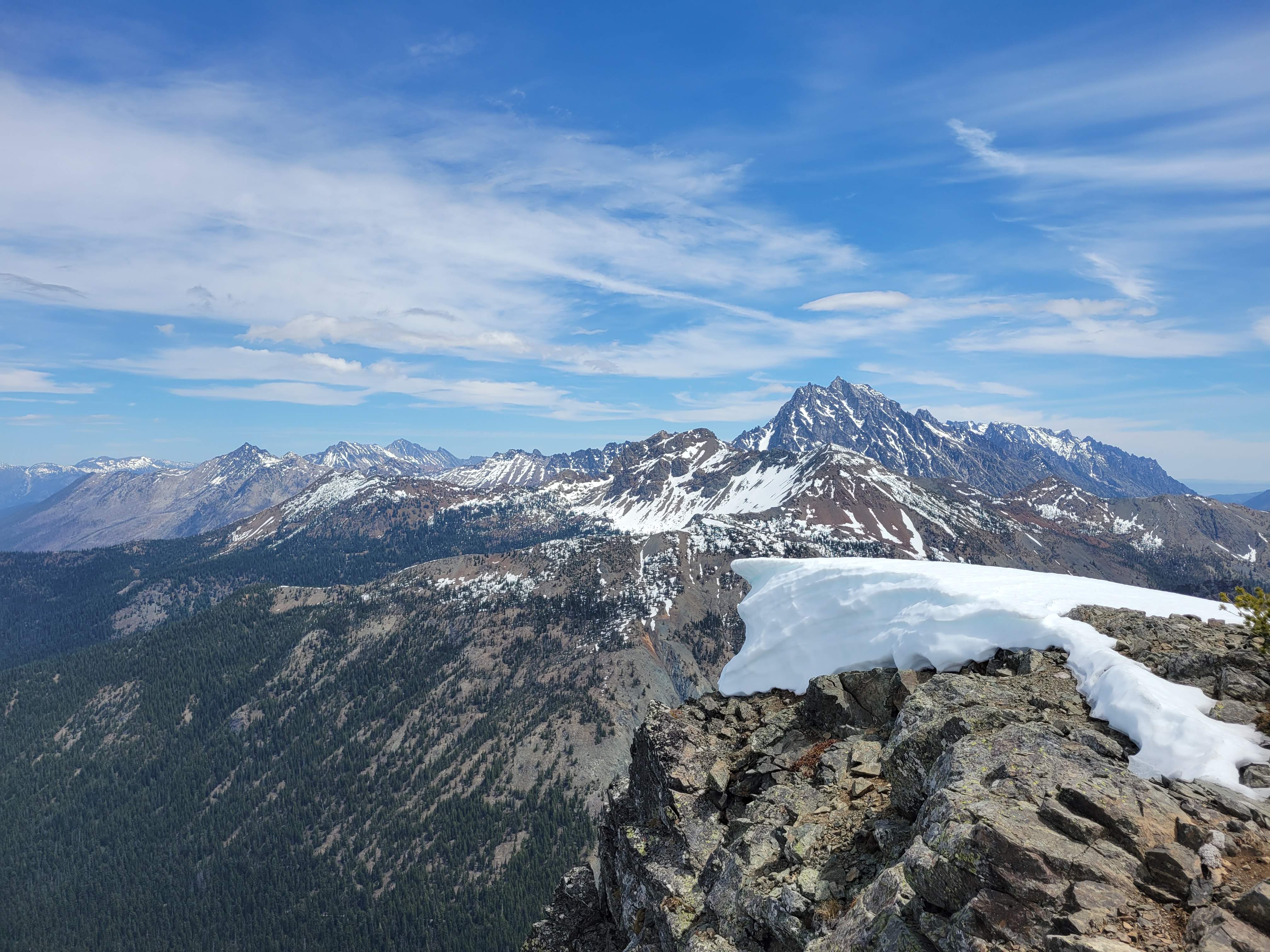
Stuart dominates the horizon to the east over a dying cornice
There were no water sources besides the snow, there was minimal shade, this is the time of year for this peak. Or late fall. It’s going to be reeeal hot and reeeal dry real soon.
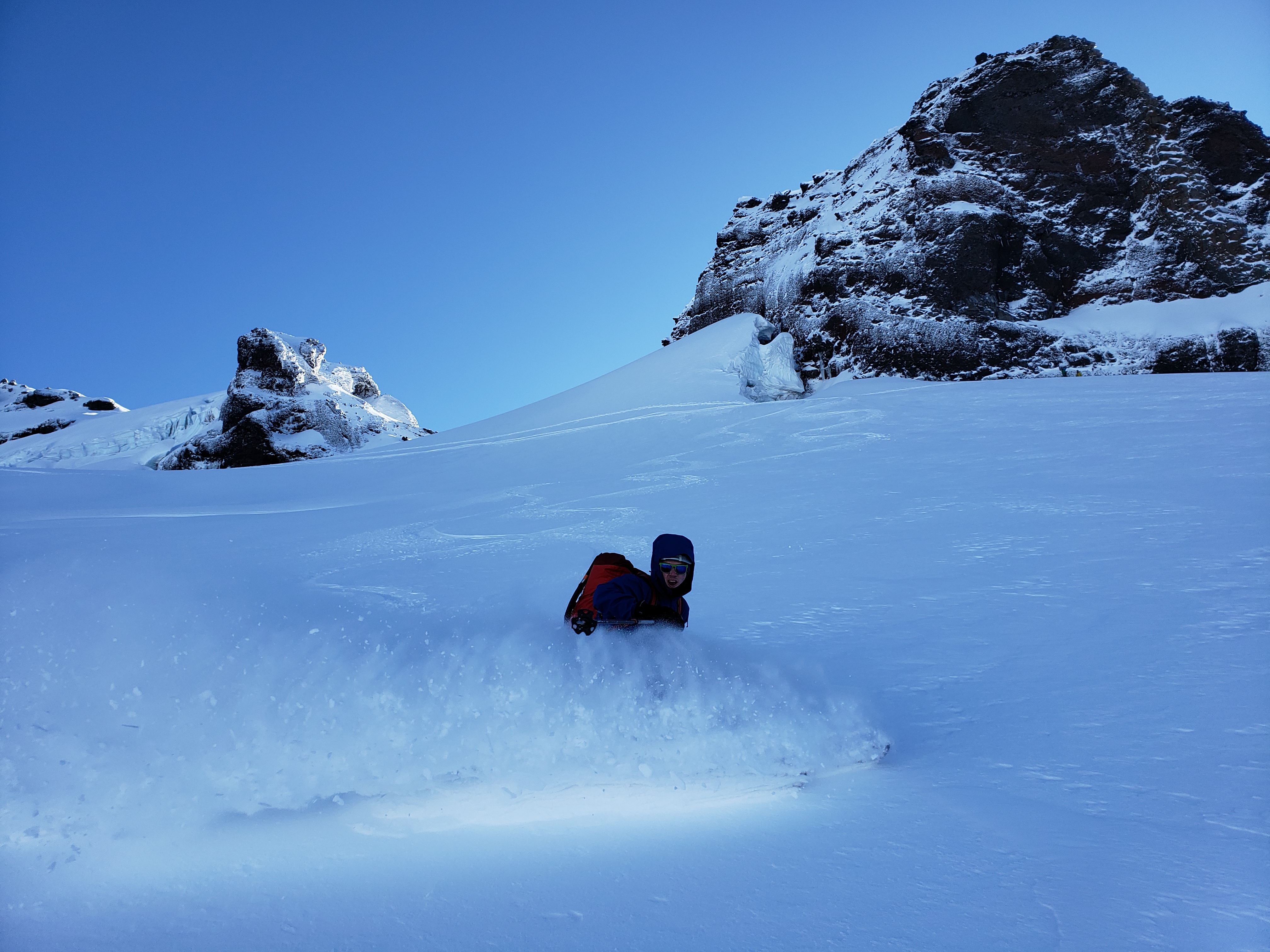
Expectation: Pow on the Coleman Deming (expectation = met) Reality: Two of your friends were left wallowing behind down below, and actually you bailed on climbing ice on Colfax
Reality: yeeting your skis across creeks
You see the drone videos following a skier through a tight couloir. Or maybe it’s a GoPro on one of those sticks that erases itself like how you can’t see your nose. Or maybe it’s a professional skier following them WHILE FILMING because they can. Maybe there’s dubstep or reggae or even classical music in the background. The youtube compilations to music that makes you want to escape and hurt your heart when you’re sitting on the couch on a dreary Tuesday living the best life of a mushroom because that’s what living in Seattle is like, being a mushroom. The images in ads, in outdoor magazines, on the walls of REI and Patagonia and Arc’Teryx stores, and of course, all of the Facebook and Instagram posts that your friends are making with perfect snow conditions and great views and no suffering and no bails ever and it’s never rainy on their trips for some reason. Maybe your coworkers know when you’re stressed because they catch you staring forlornly at your desktop background, a rotating selection of the best shots of your top trips of all time. Maybe they think they’re default backgrounds or lock screens and that’s why they haven’t said anything (that’s what I tell myself).
Well let’s levelset here. Backcountry skiing is like 90% type II fun, 8% variable conditions, and 2% the best skiing and adventure you could possibly find. In fact, let me break that down into a more detailed visual based on the type of snow you can expect.
Note % of time spend in actual pow. Hot n heavy = unskiied mashed potatoes and ice could be further broken down into above/below treeline.
Okay, moving on to gear. Don’t pitch me on a she-wee, there are still many layers of harness/clothing to get through and nonzero risk involved. And if you’re a coffee aficionado, I wish you luck. You all know the feeling when you are finally geared up head to toe and NOW is when your body decides it actually does need to pee.
Pros of bibs: no snow up your back if you wipe out Cons of bibs: Bodily fluids stay in the bibs
Reality: gear malfunctions
Now that you have your gear situated and are (proactively) entirely depleted of bodily fluids, let’s get to the trip.
No, wait. By “having your gear situated” I mean… how confident are you, really? What if your binding breaks? Did you forget skins? Your boot could snap at the top of a couloir leaving you in walk mode for the whole ski down. You could drop a pole in a river. Snow could be sticking to your skins or even your skis if you’re lazy about waxing either and/or both (guilty). Multiply those risks by however many people you’re with.
Ok, I think we’re clear on the gear issues and the fact your downhill ratio will be higher (but not in a good way) if you suck at skiing like I did for years. So what are you going to be thinking about during this trip? What other skills do you need to hone?
On a great trip, you’ll spent about 85% of the time going uphill and 15% of the time going downhill. This is why I’d generally recommend learning to ski at a resort, because if you go straight to the backcountry like some of us, you’ll spent more like 50% of your time going downhill, and not in the enjoyable way you want. But assuming the 85/15 up/down (which honestly might be generous on the down) here’s where you’ll probably expend your mental energy.
I used to be hot headed and gung ho but now I spend more time in the 17% ready for beer
“Good thing it’s not bushwhack related because there’d be a #DIV/0 error” -Brad
Reality: friends are useless except for pics
F-bombs per capita per hour is fascinating because it covers both extreme ends of the success spectrum, the “ah fuck we’re fucking fucked” but also “this is the freshest fucking powder I have ever fucked with fuck yeah and even the satisfied “fuck yeah” with a fist bump at the end. There aren’t many in between, though, so the more calm you are, the fewer f bombs.
Then you have the excuses to take breaks and try to cope. A few ideas, if you need something to say that isn’t “I need to catch my breath” or “I need to scream into a jacket for a sec:”
“I need a snack/water” “I need to take a few pictures” “I need to check the map” “Oh shit I forgot to put my phone in airplane mode” “Wow look at that ice formation, that’s cool” “Wow weird how the snow changes right here” “Did you hear that” “Hear what” “No nothing”
Speaking of map checks, this is a terrible habit I have when I start to drag. Checking the map over and over aka watching my own progress 2 meters at a time because I can’t figure out how to put alpine quest into freedom units.
If I check 10 times a minute you know I’m dying
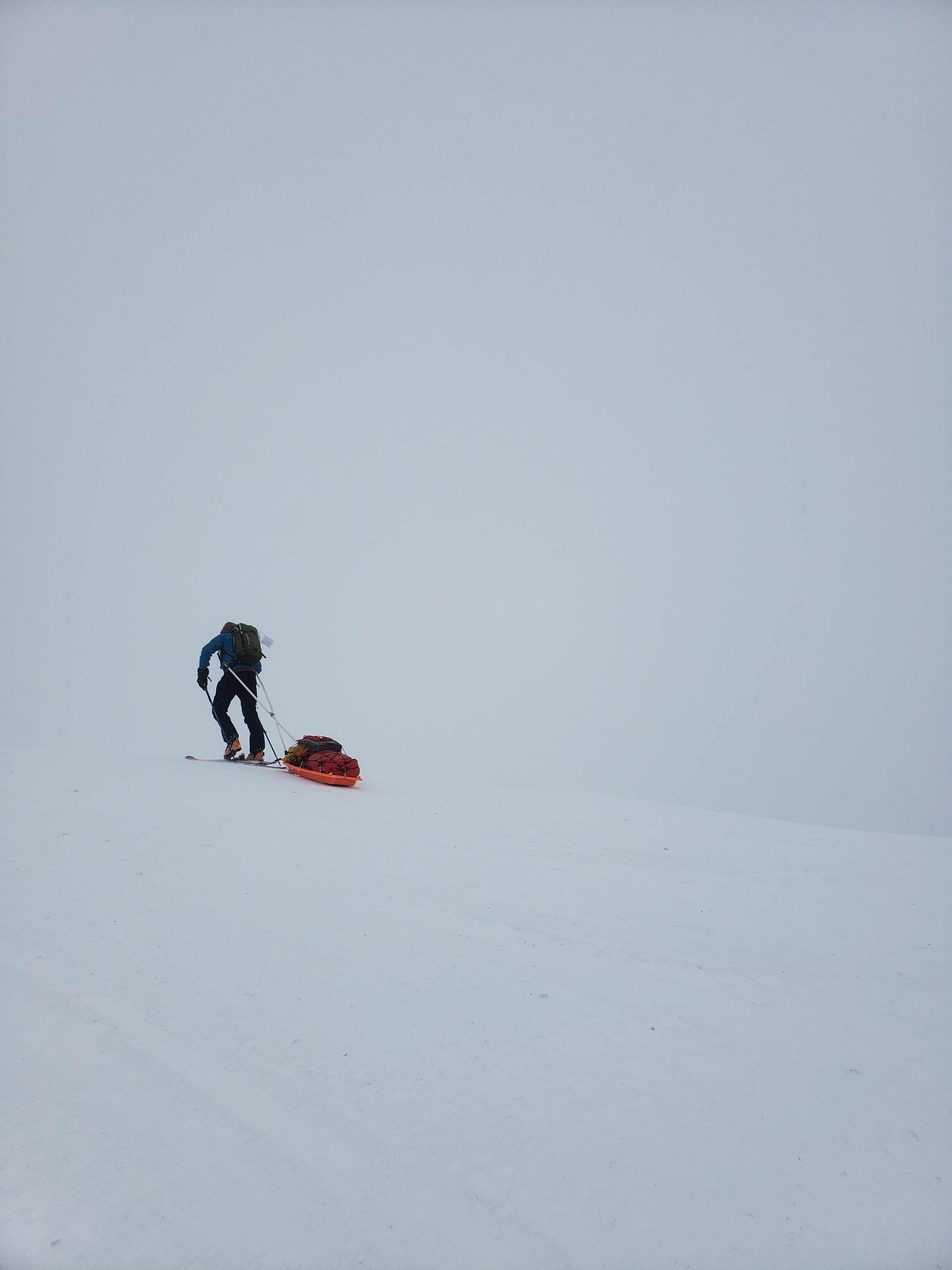
Bad ass pulling a sled.in a whiteout?
Did you see the tumblr a decade ago called “reasons my son is crying”? It’s a stream of photos of some guy’s toddler crying about ridiculous things (ex. “I told him he couldn’t eat the dog treats.”) I thought I should include a list of reasons you might find yourself crying on an adventure.
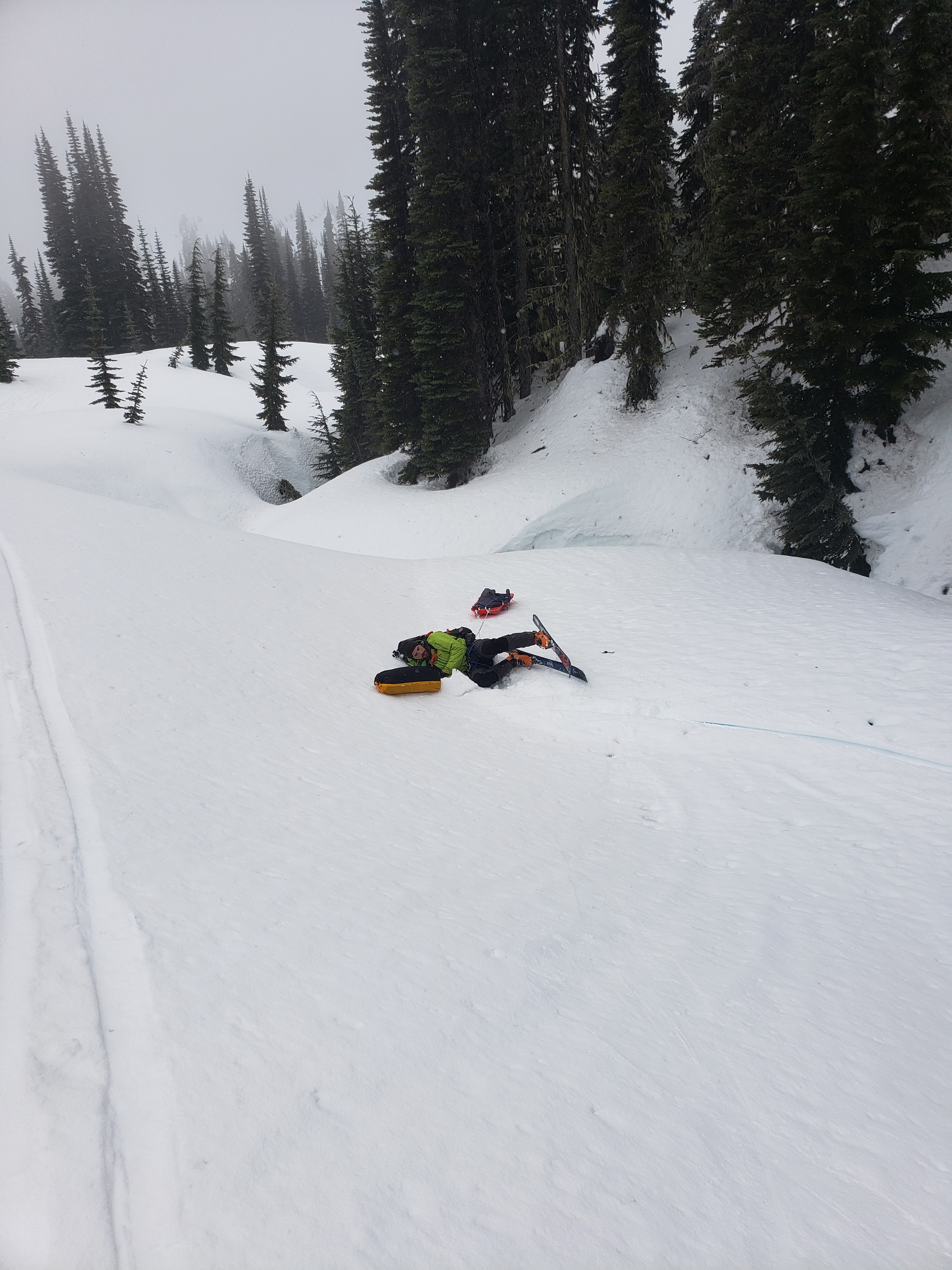
Or incapable of skiing more than 50ft?
1. You postholed hip deep/fell into a tree well for the 3758295th time 2. You are still. so. far. away. 3. Your bougie gifted chocolate-bar-on-a-stick is actually a block of hot chocolate powder encased in chocolate and not the delicious consolidated chocolate snack that you expected 4. You forgot a key piece of gear (crampons? skins? ski strap? water?) 5. The pass is snow and ice and driving sucks and you’re 15mi but somehow still 2hrs away from Taco Time
These are suspiciously similar to the list of reasons to laugh:
Yes we call this “backcountry skiing”
1. Your friend postholed hip deep/fell into a tree well for the 3758295th time 2. You’re so far away that it’s actually hilarious you ever thought this was possible 3. Your friend is in tears over their unexpected hot chocolate powder (not the pow we were hoping for, right?) 4. Your friend was a dumbass and didn’t bring skins or water 5. I’m sorry but Taco Time desperation is never funny. Get out.
If you have good friends, they’re going to do their best to interfere too. Sneaking rocks in your pack. Poking you while you try to do the rip-skin-without-removing-ski trick to knock you over. Telling you yeah you should totally ski that way only to watch you crash land off a surprise jump. Slowly undoing the straps on your pack. Seeing how long until you notice there’s a bonus branch hanging from your pack. Reminding you of your freshly ripped pants as you ski past the children sledding at Paradise and a mother gasps at your boldness.
What if we don’t even get to snow (spoiler: we didn’t)
And then there are the things folks don’t glorify on social media: The pine needles that cascade from your body when you finally get home and clog the shower. Starting at 1am. Sleeping in a Winco parking lot on the way back, or spooning their car tire next to the highway. The rainy days where you get soaked to the bone. The days where something spooks everyone (rockfall, avalanches, lizard brain protesting, ghost stories, fearless goats, aggressive mice). The days where someone (never me, no, never) fucked up navigation and you get off route and ran out of time, bonus points if other groups follow your tracks. Being told you totally have alpine cider at the tent so you stay mentally strong, only for your friend to confess at the tent that there is, in fact, no apple cider to be made. Sunburns. Disgusting clothing. Nosebleeds. Injuries. Mystery bruises. Blisters. Heat rashes. Dehydration. Resisting dropping that obnoxious guy in a crevasse and leaving him behind. Climbing hangovers!! I bet everyone who does this has been hungover because of dehydration on a Monday. Don’t ask me hard questions on Mondays, folks.
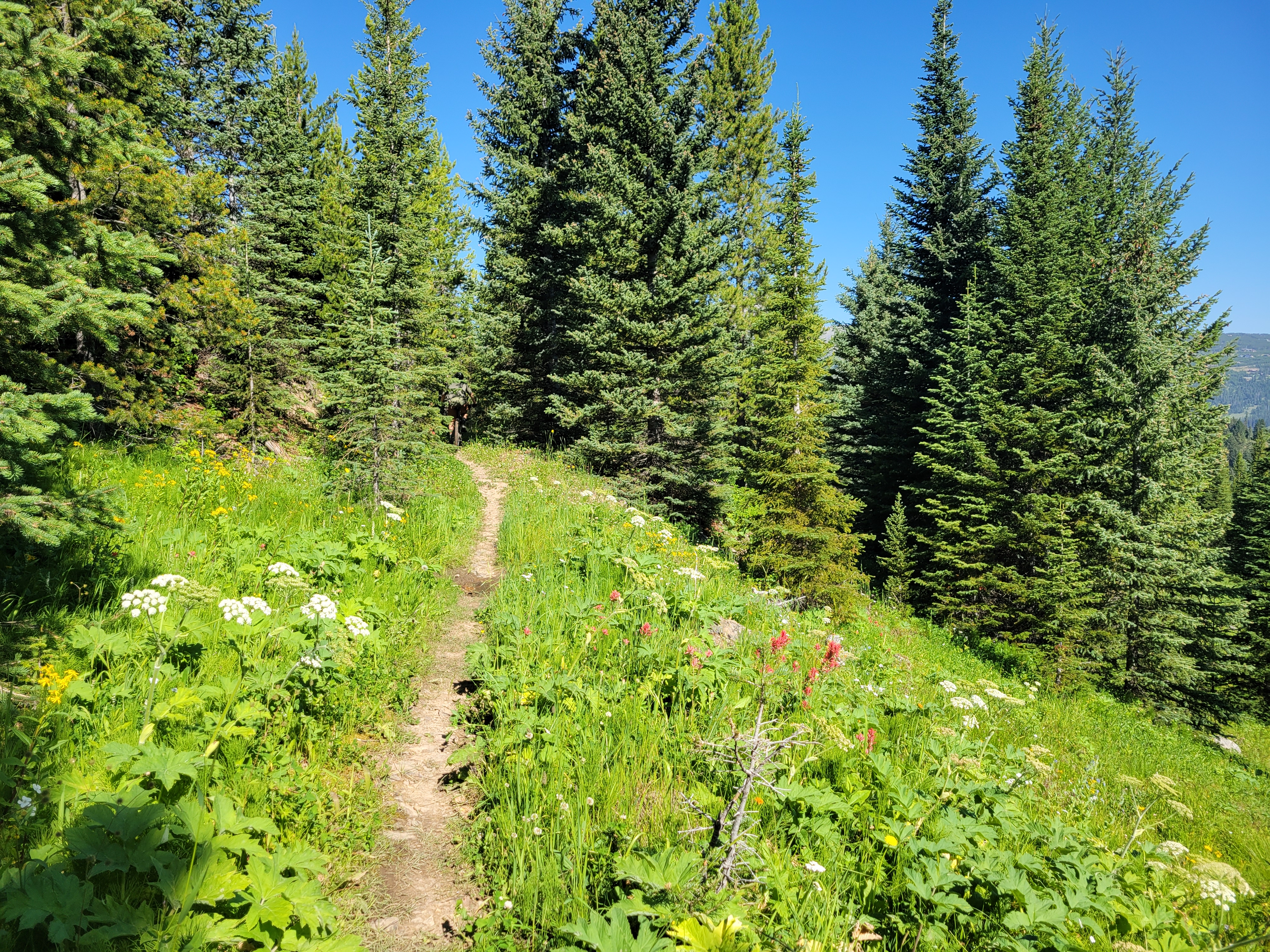
No green runs in the backcountry… even if it’s a green run
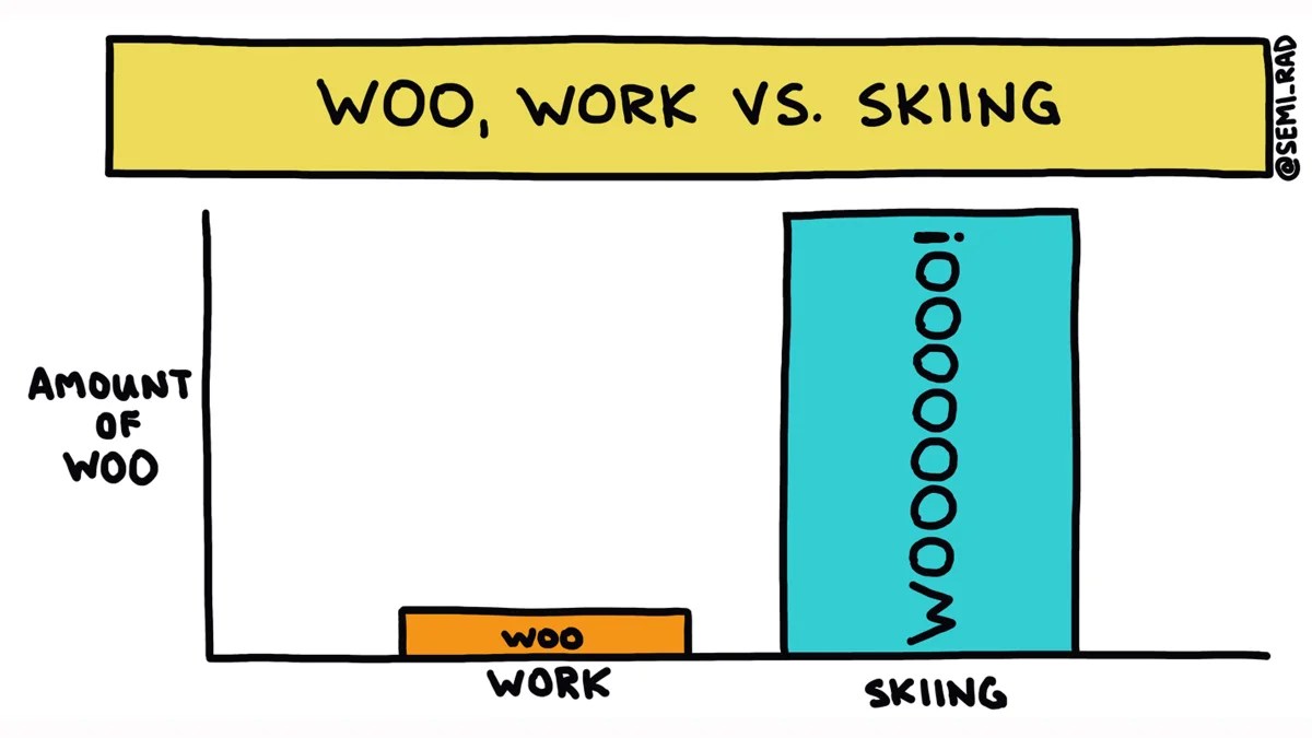
I mean they’re right, even on the worst days* (semi-rad)
Despite all of that, this helpful graphic from semi-rad keeps me motivated:
Amount of woo could be broken down further based on location, expectations, snowpack, number of people that I don’t want to hang out with taking all the lines, level of social starvation over the past 4 weeks, and whether my employer’s stock is doing anything interesting. But in general, skiing ice/scoured tree runs/luge tracks in the rain sure beats sitting at a desk, and usuallyl beats sitting at home wondering if you should have gone skiing, which, coincidentally, is what I’m doing right now. I hope it’s terrible out there.
Pow day if we had gotten high enough (we didn’t)
*I’m waiting until I’m senior enough at my job to have the balls to just set the semi-rad graph to my out-of-office auto response in outlook. I’m not there yet but someday. Mark my words.
It used to be a running joke that if you weren’t getting shut down 30% of the time in the Cascades you weren’t trying hard enough or chasing the right objectives. I realized a few years ago I never saw inversions anymore, and it’s probably because I didn’t attempt anything with a forecast of “partly sunny” aka socked in, but possible to get above the clouds (rare). The element of surprise is half of the reward of a trip. Surprise pow is always better than expected pow. Surprise views are always better than expected views. Surprise inversions are a freaking dream. You’ll never get them if you stop trying. Easy to say from the comfort of my couch.
At the end of the day, the suffering just makes those amazing days that much better. You pay your dues with some slogging in questionable conditions, rack up some karma, get really good at skiing crappy conditions, and eventually you really do land that waist deep powder day or that bluebird spring corn and raging endorphins oversaturate your vision and the views knock you over as soon as you crest the final ridge or the summit and then you get to giggle like kids the whole way down. And that’s what we’re chasing.
p.s. thank you to everyone who let me use pics of them wallowing and eating shit as part of this post. I am fortunate to have friends who still hang out with me despite me spending years saving up albums of wipeouts and misery and I expect nothing less in return.
Photos do not do justice to the density or vibrance of the flowers
Pretty river at the start
I know, it’s like I wrote one thing and now the floodgates are open and I can’t stop and maybe last summer wasn’t as much of a flop as I thought. Here’s another highlight of the year, a wild bike ride with barely any reviews on Trailforks that was easily, hands down, the best bike ride I’ve ever done and probably ever will do. I spent the few days before being SO anxious because I had never ridden anything of this caliber, especially after chickening out on some banked turns on a blue run the day prior. I’m happy to say I only walked like 10ft on the way down. Which probably means this should be a green trail if it weren’t for the distance and elevation gain but you know. Let me enjoy the moment okay?
Followed an old road bed for a while
Distance: 20mi for the whole lollipop loop
Elevation: ~4,000ft gain, ~9,500 highest point
Weather: 70’s and sunny
Commute from Seattle: Long, it’s outside of Big Sky MT
Did I Trip: Actually, genuinely, no
This loop is utterly spectacular. Ride it counterclockwise/backwards (climb 2nd yellow mule first, then go down 1st yellow mule). Go when the flowers are out. Bring a ton of water. Ok here we go.
Rich people watering hillsides improving views
It starts on a super popular hiking trail that’s basically paved. I was so worried about the distance and duration of this ride I went straight to the granny gear when we started climbing, ready to sandbag. In fact I titled my Strava record “bears hear my granny gear coming.” The trail cris-crosses some actual roads in the first few miles, reassuring me if I totally died (or, bears) there’d be an easy escape. Those soon disappeared though, and the trail started started feeling like true wilderness despite glimpses across valleys of construction for ski resorts and whatever the Yellowstone Club does with their land that us plebs will never see. And as usual my body started to perk up after the first mile or so.
CAUGHT WALKING HIS BIKE FOR THE FIRST TIME EVER
The climbing is pretty consistent on the way up (second yellow mule) but the views get better and better as you do. We stopped for a snack around an hour in, I was feeling great but Max not so much. I even caught him walking his bike, a sight never before seen to our usual biking crew. The trail was through sparse forests and mini meadows full of wildflowers, and as we got further out and higher up the trees gave way to more and more wildflowers.
Not the water you want to drink
I. Love. Wildflowers. Like, on par with prime larches and waist deep powder and smooth clean warm waves and a really good hand crack and a tickly 4-3 suspension in a song I’ve been enjoying. So the pace slows as the photos ramp up, which is good because suddenly Max is getting sick on the side of the trail.
Our experiences diverged as he trended towards miserable and I was in my personal heaven surrounded by rainbows and color and full of endorphins. We took a few breaks as he pushed through whatever was going on with his body, electrolytes/elevation/exhaustion we’ll never know. At this point it made more sense to get to the top ridge and bike the easier downhill rather than bike down what we had climbed up, so we carried on. And the meadows were getting more and more spectacular so not to sound like an unsympathetic sociopath or anything but I was flipping back and forth between being concerned and unadulterated bliss drinking in our surroundings. I will never complain about flopping down for a break in a meadow that looks like something out of a fantasy animation. I’m honestly not sure what I’d have done in his situation. I wouldn’t want to call SAR but not sure I’d have the guts to get through it either. You never know til you’re faced with it I guess, fortunately Max is a tough one. Suffering is a skill.
Let the bliss (and puking) begin
Back in the saddle
And we aren’t even at the ridiculous meadows yet
There are WAY worse places to be miserable
Looking back at Lost Peak which now has an 80 person gondola going to the summit which is insane
They’re STILL GOING THERE ARE STILL SO MANY FLOWERS
We haven’t even hit the lupine yet
We reached the ATV trail at the top of the ridge and took a break near a post (needed some landmark) where Max ran out of water. We hadn’t really passed any streams on the way up, and assumed there wouldn’t be any on the way down, and there certainly wasn’t any on the top of this massive mellow rolling ridge. I had already given him most of mine since I am a camel living in a perpetual state of dehydration, so at this point I grabbed both our camelbacks and took off cross country.
I figured there had to be some tiny snow patches lingering from winter on the northern slopes that would have some runoff at best or snow I could melt at worst. I apologized to every wildflower I trampled and suddenly came across our oasis, a 15×15′ snow patch with a tiny river trickling off its foot. I dug out a bit of a river and waited for the silt to settle and filled the bladders as best I could, jogging back up to Max through the disorienting featureless rolling grassy hills. Max is a crusher on the downhill sections so we knew as soon as we were done with the climbing he’d be fine getting back to the car and I’d be the one we had to worry about.
WE ARE SAVED
Water scouting mission successful, We hung out for a few minutes before biking the ridge to our turn off onto First Yellow Mule, where I immediately got off my bike and walked the first switchback downhill through a flood of “ah shit fun’s over” and “what have I gotten myself into” anxiety. I am not a strong downhill biker. I’m great at climbing, I got the endurance game down pat, but I’m a chicken going downhill especially after going OTB last year (did not inspire confidence). Max, on the other hand, was probably like “thank god” “fuck yeah” “fun’s just beginning.” Fortunately for both of us, the rest of the downhill was insane blissful cruising. Max had to wait but not THAT long since I was surprisingly comfortable on everything, probably because there were no drops or tight switchbacks. Again, maybe it’s a green trail if not for the distance and elevation. Shh.
crap, fun’s over, turns out I have to actually bike downhill
The main difficulty is that trail is extremely narrow and rutted, so it made sense to hop out of it and just bike raw ground for much of the descent. Which is terrible, there really should be some trail maintenance to prevent that, but the deep rut is nearly unbikeable. It’s extremely jarring trying to control a bike in a several-inch-deep single rut at speed. I will happily volunteer to help if someone tells me who to talk to. But ignoring that part, wow. Single track flowy downhill with barely any turns through ridiculous seas of wildflowers. I barely took photos because it was just too fast and fun. I have never biked anything like it and couldn’t believe it wasn’t more popular, but maybe Big Sky attracts more park type mountain bikers than cross country. I was legitimately disappointed when we got back to the intersection that would put us back on the popular/maintained hiker trail. I had lived a lifetime up on those mule trails and wasn’t ready for civilization yet.
No wait! I’m gonna be okay!
I still look back on this ride like it’s a dream I didn’t actually experience in real life. Did it really happen if you didn’t suffer at all? No type ii fun? And it didn’t even take us that long, under five hours so it was pretty much a half day trip given how quickly we were able to bike down despite all the breaks on the way up
. If it wasn’t for the pics I’d be thinking I glorified it in my head, I can’t believe there are barely any reviews on trailforks.. It was one of those trips where everything lines up too perfectly for a 10/10 experience. I know Max probably downgraded that to like 6/10 but I was on top of the world, ready to quit my job and just bike the wildflower-riddled west for a few weeks. Of course that didn’t happen, instead I worked from a dark hotel room all day the next day and had my recently re-discovered soul sucked back out of my body again immediately. But wow did that trip set the bar high for biking. And a huge thanks to Max for powering through the distress, I’m not sure I’d have been able to do that myself. Glad we were able to redeem some of the day on the way down!
“It’s just a backpacking trip” “we’re just camping at a lake” “it’ll be a piece of cake once we get to the ridge” “we’re not even climbing a peak how hard can it be?” Hard enough to shove your elitist climber attitude up your fat out of shape ass while you undulate along a beautiful stunning ridge for what feels like a decade of your life wondering if you actually died and are meant to meander this ridge for infinity. But if there was a twilight zone to be stuck in, this is probably up there in my top choices.
Distance: ~22 miles
Elevation gain: >10k (Brad: “I mean we might as well have just climbed Rainier”
Weather: 80’s and sunny
Commute from Seattle: 2.5hrs
Did I Trip: Briefly forgot how to walk and fell off the (forested) trail
goofballs in their natural habitat
I don’t remember much about this trip either, which is what you get for taking 6mo to write about it and not taking any notes during the trip. What I do remember:
I THINK we skipped Cinnabon at the pilot gas station, probably because Surafel cooked us breakfast like spoiled children. I do remember the hike to Bingley Gap taking what felt like ages, and thinking we’d break above treeline and it would mellow out after that. That’s false. Bingley Gap is very much still wooded and the elevation gain continues beyond it. “Mellows out” per WTA is a lie. You could argue it’s mellow relative to the switchbacks, but it’s very much up and down and not exactly running a high open ridge like you might hope. I had been saving this for a trail run someday, thank god I didn’t attempt that.
“Ridge trail” snaking below Sloan
Hardtack Lake and Glacier Peak peeking out
That said, Sloan and Bedal are STUNNERS. I have a hundred near duplicate photos of these two towering across the valley over meadows because they just continue to blow your mind every time you turn around. A group warned us that the last drinkable water was in about a quarter mile and there’d be nothing between there and the lakes, but we found that verifiably false; they must have higher standards for running water than we do.
Camp Lake with its ice float
Eventually you do gain the ridge, only to immediately drop down onto a long wandering bench (miles long) on the north side. The trail that drops down is like a mountain bike park trail where they fit in as many tight windy turns as possible into a small distance like a tapeworm of a trail so you get the biggest bang for your buck except I don’t want bang for my buck here I want efficiency. Finally it goes straight to the right, where you wrap around lose elevation and then gain elevation again and then lose it again and then gain it again until you’re cursing the OG trail builders for making this the way that it is.
You traverse above Hardtack Lake which looks like a great place to maybe be a tadpole, and then wrap around more shoulders and eventually arrive at Camp Lake, allegedly one of the coldest lakes in the Cascades, reinforced by the presence of icebergs. Never one to back down from a challenge, Brad starts getting ready to jump in, I can’t sit there doing nothing so I follow, and Surafel walks in up to his knees, shouts “I’m from AFRICA” and bails back to dry warm land while Brad and I see who gets brain freeze first. Like a whole new person, I pack up my stuff and climb the final elevation gain to “Little Siberia,” a stretch of beautiful subalpine with Glacier towering above you dwarfing all of the surrounding peaks. There were numbers spray painted on some of the rocks, never did figure out what they meant.
Leaving Little Siberia, Surafel standing out against Glacier Peak looking bare
Lake Byrne from above looking ABSURD
We got a great view of Lake Byrne below (omg it’s still that far away?!) and dropped down only to see the first campsite taken by people hiding in their tends to avoid the bugs. Very well we’ll take the second one. We dropped gear, jumped in the lake, Surafel started fishing but the fish were too smart and full of mosquitos (thank you fish). I found the remains of a pit toilet, RIP and thank you for your service. Brad and I hiked/schwacked to the pass on the southeast side of Lake Byrne to check out the Painted Traverse, which may legitimately have been easier than backtracking Lost Creek Ridge. I headed back to camp where I had a delicious dinner of cheesy pasta I assume and fell asleep at like 7, until Brad suddenly was like HEY GUYS GET UP SUNSET IS RIDIC and I clambered out of my tent to the most spectacular show of color on Glacier Peak I’ve ever seen. It was literally rainbow, I just about lost my mind. And then I went to bed and slept like a rock for the first time in probably months.
Worth getting out of bed for
We got moving early to beat the heat, knowing midday would be brutal and there weren’t really any lakes to jump in on the last half of the hike out (at least not without dropping a ton of elevation to Round Lake). I don’t remember much of the way back, so it probably was a sufferfest that wrecked my legs.
Oh wait no we did find a porcini that was past prime for eating, Sloan and Bedal were still amazing, Brad sat in the creek where we got water (this is why you filter your water folks), and then back in the forest proper I straight up slipped on some pine needles and fell like 15ft off trail. Surafel watched my leg swell up from a distance, I did a mini PAS on myself and decided nothing was broken so… let’s keep hiking I guess? With my new egg shin? Sucked so bad but functioned fine. I was quite happy to be back at the car and appreciate my brain dumping a few hours of suffering down switchbacks in a forest from my memory to make room for more fun things. And glad someone else drove so I didn’t have to.
For a total flop of a season in terms of my usual hobbies, this was a 10/10 trip and one of the highlights of my summer. It might have been the only overnight trip I did, actually. I can’t believe it didn’t get me back to writing immediately, but I do so much writing for my job I assume it just wasn’t feeling fun anymore, not to mention no free time. But the fact I remember more than a few bullet points obviously means it was GREAT.
Glacier Peak and the Painted Traverse from the pass Southeast of Lake Byrne. Not sure the lake has a name
Getting back into something is hard. I stopped writing, I stopped hiking biking climbing swimming surfing basically everything besides working this summer. Work had consumed my life, and not in a good way. So I think, to get back into writing, I’ll do the same as I did with every other hobby I have. I did some short pop culture hikes. I went on 2-3 mile runs. I sat on a surfboard for 90min and caught like two waves (I wasn’t sitting, I actually paddled a lot, I just ended up being every freaking wave). My first day back at the climbing gym I don’t think I tried anything harder than a 5.9. I couldn’t even do 15 push ups straight. But that was three months ago and now I’m running daily and climbing 5.10’s and the occasional 5.11 and can definitely do 15 push ups straight. And I’m on a new team at work! So time to get back to writing blog posts, starting with minimal words. The pictures are pretty, and they still say something about the trip. And eventually the rest of the words will come.
I can’t get enough wildflowers
Lookout Mountain Lookout, off Cascade River Road outside of Marblemount. This has been on my OG hikes list from moving here in 2014, except first I wanted to save it for an overnight, then I wanted to get up there in winter or early spring on skis, finally I gave up and Sarah was free and I convinced her to do this butt kicker of a hike even though neither of us were in the mental or physical shape to do it. She told me daily leading up to the hike that she might have to turn around. I’ve already turned around on this hike like three times for varying reasons (dog paw injury, friend’s knee, third time must have been my fault bc I’ve blocked it from memory) so a fourth bail wouldn’t be the end of the world.
Distance: 9.5mi round trip
Elevation gain: 4,500 gain (5,700 highest point)
Weather: 70’s and sunny, a bit smokey
Commute from Seattle: 2:30 without traffic
Did I Trip: I don’t remember, so I will assume yes, because I am a klutz
Tell me that’s not the biggest paintbrush you’ve ever seen
Here is what I remember:
It is steep
Sarah in her element. Avg page 0.25mph
We took like 800 pictures of a butterfly that was really hamming it up. Sarah was responsible for 793 of those. I took 7.
Sarah has an insane eye for color and lighting and notices things I’d never see myself but I think I’m getting better the more I hike with her
It was the longest 4.5mi to the top of any hike I’ve ever done
Definitely bring hiking poles, and lots of water. It’s 90% in the forest so sun was not a big problem. Sarah says that’s the only reason she had a shot at success.
Trail wrapping around a shoulder and taking the scenic route to the top
Finally!
There was paintbrush that was like traffic orange, I have never seen anything like it before. And I’ve seen a lot of paintbrush.
We made it to the lookout. 10/10, would return for overnight. Monogram Lake/Teebone Ridge better for skis.
10/10 would sleep
Sarah’s phone died, so I gave her mine for the way down because she was having artist withdrawals not being able to take pictures
Then she immediately took the best wildflower photo of the day, never mind my prior 230 attempts. Quality > quantity
We also spent probably 20min watching squirrels chase each other around a tree like we were in a Disney movie